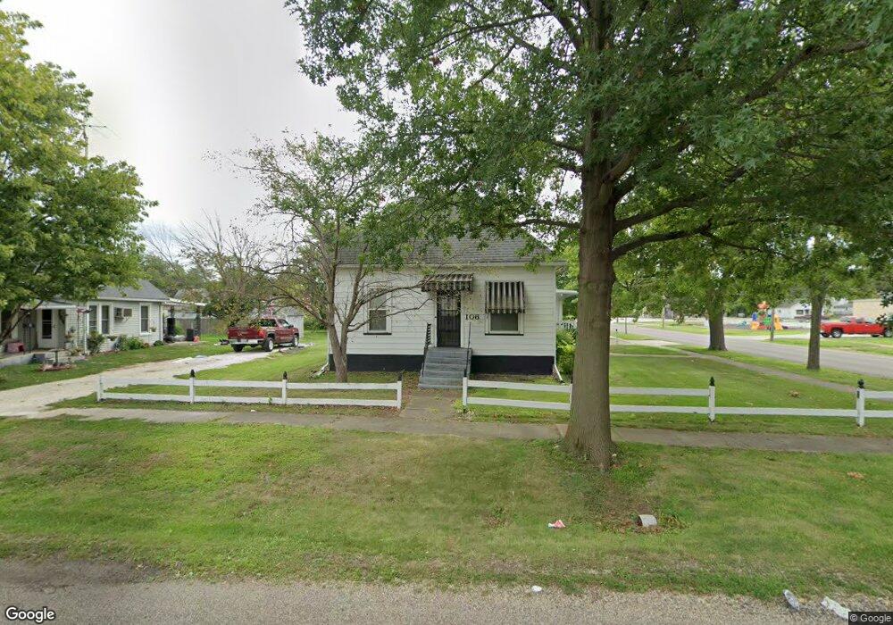
106 S Swarts Ave Abingdon, IL 61410
Estimated Value: $69,190 - $86,000
--
Bed
--
Bath
856
Sq Ft
$87/Sq Ft
Est. Value
About This Home
This home is located at 106 S Swarts Ave, Abingdon, IL 61410 and is currently estimated at $74,798, approximately $87 per square foot. 106 S Swarts Ave is a home located in Knox County with nearby schools including Hedding Grade School, Avon Elementary School, and Abingdon-Avon Middle School.
Ownership History
Date
Name
Owned For
Owner Type
Purchase Details
Closed on
Jun 30, 2017
Sold by
Penn Donald J
Bought by
Johnson Kevin F and Johnson Lucinda A
Current Estimated Value
Home Financials for this Owner
Home Financials are based on the most recent Mortgage that was taken out on this home.
Original Mortgage
$35,200
Outstanding Balance
$29,955
Interest Rate
4.81%
Mortgage Type
New Conventional
Estimated Equity
$44,843
Create a Home Valuation Report for This Property
The Home Valuation Report is an in-depth analysis detailing your home's value as well as a comparison with similar homes in the area
Home Values in the Area
Average Home Value in this Area
Purchase History
| Date | Buyer | Sale Price | Title Company |
|---|---|---|---|
| Johnson Kevin F | $46,000 | -- |
Source: Public Records
Mortgage History
| Date | Status | Borrower | Loan Amount |
|---|---|---|---|
| Open | Johnson Kevin F | $35,200 |
Source: Public Records
Tax History Compared to Growth
Tax History
| Year | Tax Paid | Tax Assessment Tax Assessment Total Assessment is a certain percentage of the fair market value that is determined by local assessors to be the total taxable value of land and additions on the property. | Land | Improvement |
|---|---|---|---|---|
| 2024 | $960 | $22,780 | $2,060 | $20,720 |
| 2023 | $960 | $20,560 | $1,860 | $18,700 |
| 2022 | $584 | $17,640 | $1,770 | $15,870 |
| 2021 | $984 | $16,960 | $1,700 | $15,260 |
| 2020 | $929 | $16,300 | $1,630 | $14,670 |
| 2019 | $949 | $16,130 | $1,610 | $14,520 |
| 2018 | $906 | $15,660 | $1,560 | $14,100 |
| 2017 | $1,375 | $14,500 | $1,530 | $12,970 |
| 2015 | -- | $14,220 | $1,500 | $12,720 |
| 2013 | -- | $14,080 | $1,490 | $12,590 |
Source: Public Records
Map
Nearby Homes
- 407 W Martin St
- 103 N Swarts St
- 108 W Jackson St
- 204 S Washington St
- 206 W Lower St
- 214 S Main St
- 500 N Monroe St
- 106 E Jackson St
- 211 S Froelich Ln
- 103 W Givens St
- 306 N Harshbarger St
- 204 E Adams St
- 704 N Cherry St
- 205 N Austin Ave
- 403 1/2 E Jared St
- 405 W Memorial Dr
- 369 Knox Highway 23
- 1196 160th St
- 1077 Knox Road 500 E
- 572 Knox Highway 26
- 104 S Swarts Ave
- 307 W Martin St
- 310 W Meek St
- 308 W Martin St
- 306 W Meek St
- 310 W Martin St
- 401 W Martin St
- 109 S Monroe St
- 400 W Martin St
- 103 S Western Ave
- 103 S Swarts Ave
- 101 S Swarts Ave
- 402 W Martin St
- 105 S Western Ave
- 303 W South St
- 305 W South St
- 404 W Martin St
- 104 S Ohio Ave
- 309 W Meek St
- 401 W South St