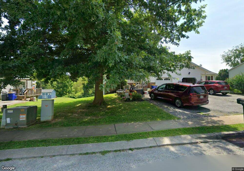
106 Shawnee Dr Stewartstown, PA 17363
Estimated Value: $235,000 - $340,000
3
Beds
2
Baths
1,748
Sq Ft
$168/Sq Ft
Est. Value
About This Home
This home is located at 106 Shawnee Dr, Stewartstown, PA 17363 and is currently estimated at $293,457, approximately $167 per square foot. 106 Shawnee Dr is a home located in York County with nearby schools including South Eastern Intermediate School, South Eastern Middle School, and Kennard-Dale High School.
Ownership History
Date
Name
Owned For
Owner Type
Purchase Details
Closed on
Mar 17, 2008
Sold by
Moore David M and Moore Trisha A
Bought by
Hart Robin L
Current Estimated Value
Home Financials for this Owner
Home Financials are based on the most recent Mortgage that was taken out on this home.
Original Mortgage
$35,000
Outstanding Balance
$22,360
Interest Rate
6.22%
Mortgage Type
Purchase Money Mortgage
Estimated Equity
$271,097
Purchase Details
Closed on
Jan 27, 2006
Sold by
Watkins Grace E
Bought by
Moor David M and Moore Trisha A
Home Financials for this Owner
Home Financials are based on the most recent Mortgage that was taken out on this home.
Original Mortgage
$127,920
Interest Rate
5.5%
Mortgage Type
Purchase Money Mortgage
Create a Home Valuation Report for This Property
The Home Valuation Report is an in-depth analysis detailing your home's value as well as a comparison with similar homes in the area
Home Values in the Area
Average Home Value in this Area
Purchase History
| Date | Buyer | Sale Price | Title Company |
|---|---|---|---|
| Hart Robin L | $180,000 | Lawyers Title Insurance Corp | |
| Moor David M | $159,900 | None Available |
Source: Public Records
Mortgage History
| Date | Status | Borrower | Loan Amount |
|---|---|---|---|
| Open | Hart Robin L | $35,000 | |
| Previous Owner | Moor David M | $127,920 |
Source: Public Records
Tax History Compared to Growth
Tax History
| Year | Tax Paid | Tax Assessment Tax Assessment Total Assessment is a certain percentage of the fair market value that is determined by local assessors to be the total taxable value of land and additions on the property. | Land | Improvement |
|---|---|---|---|---|
| 2025 | $3,943 | $123,230 | $30,000 | $93,230 |
| 2024 | $3,943 | $123,230 | $30,000 | $93,230 |
| 2023 | $3,943 | $123,230 | $30,000 | $93,230 |
| 2022 | $3,943 | $123,230 | $30,000 | $93,230 |
| 2021 | $3,820 | $123,230 | $30,000 | $93,230 |
| 2020 | $3,820 | $123,230 | $30,000 | $93,230 |
| 2019 | $3,808 | $123,230 | $30,000 | $93,230 |
| 2018 | $3,808 | $123,230 | $30,000 | $93,230 |
| 2017 | $3,808 | $123,230 | $30,000 | $93,230 |
| 2016 | $0 | $123,230 | $30,000 | $93,230 |
| 2015 | -- | $123,230 | $30,000 | $93,230 |
| 2014 | -- | $123,230 | $30,000 | $93,230 |
Source: Public Records
Map
Nearby Homes
- 9 W Pennsylvania Ave
- 2 S Main St
- 13 Baneberry St
- 94 Piston Ct
- 82 Piston Ct
- 231 Cool Spring Ln
- 4341 Forbes Dr
- 4303 Forbes Dr
- 17 Charles Ave
- 103 Hershey Cir
- 10 Black Oak Ct
- 150 Patterson Dr Unit 47
- 160 Patterson Dr Unit 48
- 180 Patterson Dr Unit 50
- 18007 Dave Anne Cir
- 18010 Dave Anne Cir
- 18183 Piedmont Rd
- 0 Bridgeview Rd Unit PAYK2080146
- 2 Dutton Rd
- 2430 Harris Mill Rd
- 108 Shawnee Dr
- 104 Shawnee Dr
- 102 Shawnee Dr
- 110 Shawnee Dr
- 112 Shawnee Dr
- 107 Shawnee Dr
- 105 Shawnee Dr
- 111 Shawnee Dr
- 109 Shawnee Dr
- 114 Shawnee Dr
- 103 Shawnee Dr
- 101 Shawnee Dr
- 115 Shawnee Dr
- 116 Shawnee Dr
- 113 Shawnee Dr
- 23 S George St
- 17 S George St
- 118 Shawnee Dr
- 13 S George St
- 38 W Pennsylvania Ave