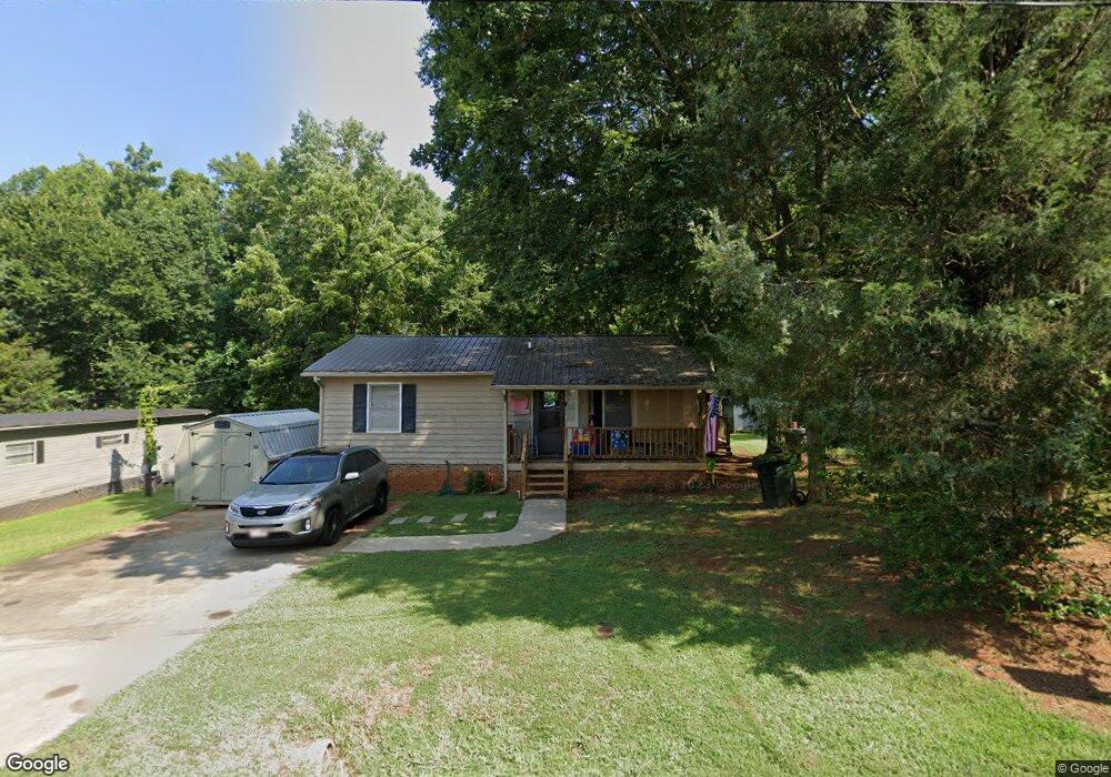
106 Sink Cir Lexington, NC 27292
Estimated Value: $100,000 - $153,000
2
Beds
1
Bath
1,000
Sq Ft
$128/Sq Ft
Est. Value
About This Home
This home is located at 106 Sink Cir, Lexington, NC 27292 and is currently estimated at $127,732, approximately $127 per square foot. 106 Sink Cir is a home located in Davidson County with nearby schools including South Lexington School, Lexington Middle School, and Lexington Senior High School.
Ownership History
Date
Name
Owned For
Owner Type
Purchase Details
Closed on
Oct 23, 1986
Current Estimated Value
Create a Home Valuation Report for This Property
The Home Valuation Report is an in-depth analysis detailing your home's value as well as a comparison with similar homes in the area
Home Values in the Area
Average Home Value in this Area
Purchase History
| Date | Buyer | Sale Price | Title Company |
|---|---|---|---|
| -- | -- | -- |
Source: Public Records
Tax History Compared to Growth
Tax History
| Year | Tax Paid | Tax Assessment Tax Assessment Total Assessment is a certain percentage of the fair market value that is determined by local assessors to be the total taxable value of land and additions on the property. | Land | Improvement |
|---|---|---|---|---|
| 2025 | $801 | $61,620 | $0 | $0 |
| 2024 | $801 | $61,620 | $0 | $0 |
| 2023 | $801 | $61,620 | $0 | $0 |
| 2022 | $801 | $61,620 | $0 | $0 |
| 2021 | $801 | $61,620 | $0 | $0 |
| 2020 | $668 | $51,790 | $0 | $0 |
| 2019 | $678 | $51,790 | $0 | $0 |
| 2018 | $678 | $51,790 | $0 | $0 |
| 2017 | $678 | $51,790 | $0 | $0 |
| 2016 | $678 | $51,790 | $0 | $0 |
| 2015 | $653 | $51,790 | $0 | $0 |
| 2014 | $725 | $57,500 | $0 | $0 |
Source: Public Records
Map
Nearby Homes
- 386 Harper Mill Cir
- 326 Owens Ridge Way
- 333 Owens Ridge Way
- 329 Owens Ridge Way
- 325 Owens Ridge Way
- 337 Owens Ridge Way
- 330 Owens Ridge Way
- 341 Owens Ridge Way
- 401 Owens Ridge Way
- 405 Owens Ridge Way
- 409 Owens Ridge Way
- TAYLOR Plan at Owens Ridge
- HAYDEN Plan at Owens Ridge
- ROBIE Plan at Owens Ridge
- PENWELL Plan at Owens Ridge
- CALI Plan at Owens Ridge
- BELHAVEN Plan at Owens Ridge
- 306 Pope St
- 26 Harrington Ave
- 503 Quail Ln