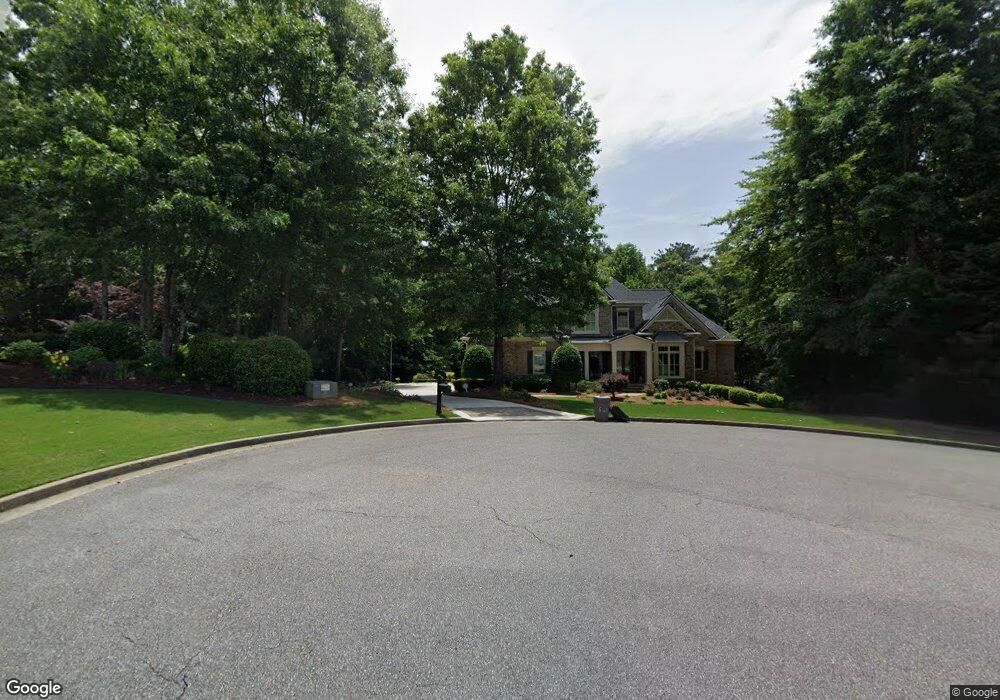
106 Sturbridge Pines Ln Canton, GA 30115
Union Hill NeighborhoodEstimated Value: $784,000 - $843,286
4
Beds
4
Baths
3,490
Sq Ft
$233/Sq Ft
Est. Value
About This Home
This home is located at 106 Sturbridge Pines Ln, Canton, GA 30115 and is currently estimated at $813,643, approximately $233 per square foot. 106 Sturbridge Pines Ln is a home located in Cherokee County with nearby schools including Avery Elementary School, Creekland Middle School, and Creekview High School.
Ownership History
Date
Name
Owned For
Owner Type
Purchase Details
Closed on
Jun 17, 2005
Sold by
John Wieland Homes & Neighborhoo
Bought by
Frigo John A and Frigo Judith
Current Estimated Value
Home Financials for this Owner
Home Financials are based on the most recent Mortgage that was taken out on this home.
Original Mortgage
$80,000
Interest Rate
5.51%
Mortgage Type
New Conventional
Create a Home Valuation Report for This Property
The Home Valuation Report is an in-depth analysis detailing your home's value as well as a comparison with similar homes in the area
Home Values in the Area
Average Home Value in this Area
Purchase History
| Date | Buyer | Sale Price | Title Company |
|---|---|---|---|
| Frigo John A | $560,000 | -- |
Source: Public Records
Mortgage History
| Date | Status | Borrower | Loan Amount |
|---|---|---|---|
| Previous Owner | Frigo John A | $80,000 |
Source: Public Records
Tax History Compared to Growth
Tax History
| Year | Tax Paid | Tax Assessment Tax Assessment Total Assessment is a certain percentage of the fair market value that is determined by local assessors to be the total taxable value of land and additions on the property. | Land | Improvement |
|---|---|---|---|---|
| 2024 | $3,660 | $296,760 | $88,000 | $208,760 |
| 2023 | $3,067 | $283,960 | $74,400 | $209,560 |
| 2022 | $2,755 | $232,000 | $68,000 | $164,000 |
| 2021 | $2,317 | $198,120 | $52,000 | $146,120 |
| 2020 | $1,669 | $173,680 | $52,000 | $121,680 |
| 2019 | $1,431 | $162,520 | $40,000 | $122,520 |
| 2018 | $2,184 | $185,880 | $40,000 | $145,880 |
| 2017 | $2,139 | $451,900 | $40,000 | $140,760 |
| 2016 | $2,304 | $460,800 | $40,000 | $144,320 |
| 2015 | $2,394 | $464,800 | $40,000 | $145,920 |
| 2014 | $2,089 | $434,400 | $38,800 | $134,960 |
Source: Public Records
Map
Nearby Homes
- 1200 Old Lathemtown Rd
- 1092 Old Lathemtown Rd
- 776 Old Lathemtown Rd
- 772 Old Lathemtown Rd
- 772 Old Lathemtown and 776 Rd
- 100 Hendrix Dr
- 390 Pat Rich Dr
- 348 Pat Rich Dr
- 340 Pat Rich Dr
- 348 A Pat Rich Dr
- 1724 Arbor Hill Rd
- 372 Pat Rich Dr
- 287 Red Gate Dr
- 139 Grandmar Chase
- 129 Rosebury Dr
- 135 Farm Valley Dr
- 635 Arbor Hill Rd
- 104 Sturbridge Pines Ln
- 107 Sturbridge Pines Ln
- 504 Abbey Crest Way
- 102 Sturbridge Pines Ln
- 505 Abbey Crest Way
- 105 Sturbridge Pines Ln
- 103 Sturbridge Pines Ln
- 0 Sturbridge Pines Ln Unit 8512957
- 0 Sturbridge Pines Ln Unit 8344671
- 0 Sturbridge Pines Ln
- 100 Sturbridge Pines Ln
- 1007 Windsor Green Dr
- 101 Sturbridge Pines Ln
- 1011 Windsor Green Dr
- 1015 Windsor Green Dr
- 2662 Arbor Hill Rd
- 2662 Arbor Hill Rd Unit TRACT 3
- 2662 Arbor Hill Rd Unit TRACT 1
- 0 Abbey Crest Way Unit 3126191
- 0 Abbey Crest Way Unit 7263672