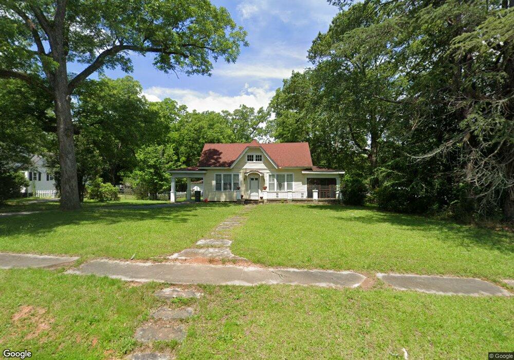
106 Thornton St Union Point, GA 30669
Estimated Value: $178,030 - $237,000
3
Beds
2
Baths
1,890
Sq Ft
$113/Sq Ft
Est. Value
About This Home
This home is located at 106 Thornton St, Union Point, GA 30669 and is currently estimated at $213,008, approximately $112 per square foot. 106 Thornton St is a home located in Greene County with nearby schools including Greene County High School.
Ownership History
Date
Name
Owned For
Owner Type
Purchase Details
Closed on
Jun 25, 2010
Sold by
Schrijver Nancy G
Bought by
Scott James M
Current Estimated Value
Purchase Details
Closed on
Dec 31, 2002
Sold by
Newsome Eva Stewart
Bought by
Schrijver Nancy G
Purchase Details
Closed on
Jan 1, 1988
Sold by
Newsome Norman and Newsome Eva
Bought by
Newsome Eva Stewart
Purchase Details
Closed on
Jan 1, 1985
Sold by
Anderson Cathy
Bought by
Newsome Norman and Newsome Eva
Purchase Details
Closed on
Jan 1, 1974
Sold by
English Etta Ray
Bought by
Newsome Norman
Purchase Details
Closed on
Jan 1, 1965
Bought by
English Etta Ray
Create a Home Valuation Report for This Property
The Home Valuation Report is an in-depth analysis detailing your home's value as well as a comparison with similar homes in the area
Home Values in the Area
Average Home Value in this Area
Purchase History
| Date | Buyer | Sale Price | Title Company |
|---|---|---|---|
| Scott James M | $65,000 | -- | |
| Schrijver Nancy G | $72,000 | -- | |
| Newsome Eva Stewart | -- | -- | |
| Newsome Norman | -- | -- | |
| Anderson Cathy | -- | -- | |
| Newsome Norman | -- | -- | |
| English Etta Ray | -- | -- |
Source: Public Records
Tax History Compared to Growth
Tax History
| Year | Tax Paid | Tax Assessment Tax Assessment Total Assessment is a certain percentage of the fair market value that is determined by local assessors to be the total taxable value of land and additions on the property. | Land | Improvement |
|---|---|---|---|---|
| 2025 | $1,452 | $55,520 | $5,800 | $49,720 |
| 2024 | $1,357 | $51,200 | $5,800 | $45,400 |
| 2023 | $976 | $49,160 | $5,800 | $43,360 |
| 2022 | $947 | $45,480 | $5,800 | $39,680 |
| 2021 | $917 | $41,240 | $5,800 | $35,440 |
| 2020 | $579 | $20,640 | $2,680 | $17,960 |
| 2019 | $598 | $20,640 | $2,680 | $17,960 |
| 2018 | $460 | $20,640 | $2,680 | $17,960 |
| 2017 | $540 | $20,668 | $2,700 | $17,968 |
| 2016 | $568 | $21,694 | $2,700 | $18,994 |
| 2015 | $534 | $21,694 | $2,700 | $18,994 |
| 2014 | $508 | $19,822 | $2,700 | $17,122 |
Source: Public Records
Map
Nearby Homes
- 202 Veazey St
- 324 N Rhodes St
- 215 Hunter St
- 0 Woodland Ct Unit 10543600
- 0 S Rhodes St Unit 10618488
- 112 Hendry St
- 1041 Hillcrest Dr
- 1241 Old Siloam Rd
- 0 Washington Hwy Unit 7276060
- 1860 Washington Hwy
- 1581 Highway 77 S Hwy
- 1581 Highway 77 S
- 5401 Union Point Hwy
- 1201 Buffalo Lick Rd
- 0 Buffalo Lick Rd Unit 10551234
- 0 Buffalo Lick Rd Unit 10551325
- 1251 Adams Rd
- 0 Old Union Point Rd Unit 1 10557753
- 1251 Brick House Rd
- 1251 Brickhouse Rd
- 104 Thornton St
- 108 Thornton St
- 702 Hart Ave
- 701 Thornton St
- 200 Thornton St
- 705 Carlton Ave
- 704 Hart Ave
- 707 Carlton Ave
- 105 Thornton St
- 201 Thornton St
- 607 Carlton Ave
- 203 Thornton St
- 715 Carlton Ave
- 715 Carlton Ave Unit Lot 36
- 1144 Farm Rd
- 605 Hart Ave
- 104 Veazey St
- 102 Veazey St
- 210 Thornton St
- 108 Veazey St