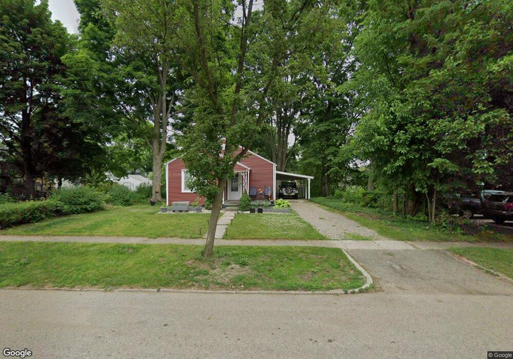
106 W Grant St Plainwell, MI 49080
Estimated Value: $182,000 - $211,000
3
Beds
1
Bath
1,020
Sq Ft
$190/Sq Ft
Est. Value
About This Home
This home is located at 106 W Grant St, Plainwell, MI 49080 and is currently estimated at $194,032, approximately $190 per square foot. 106 W Grant St is a home located in Allegan County with nearby schools including Plainwell High School and Otsego Christian Academy.
Ownership History
Date
Name
Owned For
Owner Type
Purchase Details
Closed on
May 21, 2021
Sold by
Meszaros Mark and Meszaros Lisa
Bought by
Bridge Street West Llc
Current Estimated Value
Purchase Details
Closed on
Aug 10, 2020
Sold by
Warnement Evon D
Bought by
Meszaros Mark and Meszaros Lisa
Purchase Details
Closed on
Sep 14, 2007
Sold by
Walling John and Walling Kathy
Bought by
Landstra Amanda K
Home Financials for this Owner
Home Financials are based on the most recent Mortgage that was taken out on this home.
Original Mortgage
$65,250
Interest Rate
6.63%
Mortgage Type
Purchase Money Mortgage
Purchase Details
Closed on
Aug 15, 2005
Sold by
Howrigon Marshall and Howigon Margaret Ann
Bought by
Walling John and Walling Kathy
Create a Home Valuation Report for This Property
The Home Valuation Report is an in-depth analysis detailing your home's value as well as a comparison with similar homes in the area
Home Values in the Area
Average Home Value in this Area
Purchase History
| Date | Buyer | Sale Price | Title Company |
|---|---|---|---|
| Bridge Street West Llc | -- | None Available | |
| Meszaros Mark | $45,000 | Lighthouse Ttl Agcy Thornapp | |
| Landstra Amanda K | $87,000 | Chicago Title | |
| Walling John | $68,000 | Chicago Title |
Source: Public Records
Mortgage History
| Date | Status | Borrower | Loan Amount |
|---|---|---|---|
| Previous Owner | Landstra Amanda K | $65,250 | |
| Previous Owner | Landstra Amanda K | $21,750 |
Source: Public Records
Tax History Compared to Growth
Tax History
| Year | Tax Paid | Tax Assessment Tax Assessment Total Assessment is a certain percentage of the fair market value that is determined by local assessors to be the total taxable value of land and additions on the property. | Land | Improvement |
|---|---|---|---|---|
| 2025 | $1,888 | $76,000 | $20,900 | $55,100 |
| 2024 | $1,701 | $69,600 | $18,600 | $51,000 |
| 2023 | $1,703 | $59,000 | $16,500 | $42,500 |
| 2022 | $1,701 | $52,000 | $13,900 | $38,100 |
| 2021 | $1,635 | $47,800 | $12,600 | $35,200 |
| 2020 | $1,614 | $44,200 | $10,900 | $33,300 |
| 2019 | $1,466 | $39,700 | $9,600 | $30,100 |
| 2018 | $0 | $39,800 | $10,800 | $29,000 |
| 2017 | $0 | $39,200 | $9,800 | $29,400 |
| 2016 | $0 | $36,400 | $8,300 | $28,100 |
| 2015 | -- | $36,400 | $8,300 | $28,100 |
| 2014 | -- | $31,200 | $8,100 | $23,100 |
| 2013 | -- | $30,400 | $8,100 | $22,300 |
Source: Public Records
Map
Nearby Homes
- 317 E Chart St
- 426 W Bridge St
- 204 N Sherwood Ave
- 551 W Bridge St
- 140 W 1st Ave
- 1056 Elmwood St
- 623 Glenview Cir
- 771 N Main St
- 721 E Bridge St
- V/L 11th St
- 455 N 10th St
- 355 12th St
- 390 12th St
- 518 Foxmoor Dr Unit 39
- 965 Miller Rd
- 830 Miller Rd Unit 9.86 Acres
- 830 Miller Rd Unit 26.94 Acres
- 830 Miller Rd Unit 15 Acres
- 1036 Sir Knight Rd
- 1081 Sir Knight Rd