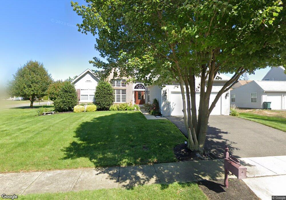
106 Weathervane Dr Mount Royal, NJ 08061
East Greenwich Township NeighborhoodEstimated Value: $437,449 - $503,000
--
Bed
--
Bath
1,898
Sq Ft
$250/Sq Ft
Est. Value
About This Home
This home is located at 106 Weathervane Dr, Mount Royal, NJ 08061 and is currently estimated at $474,612, approximately $250 per square foot. 106 Weathervane Dr is a home located in Gloucester County with nearby schools including Jeffrey Clark School, Samuel Mickle School, and Kingsway Regional Middle School.
Ownership History
Date
Name
Owned For
Owner Type
Purchase Details
Closed on
Sep 18, 2001
Sold by
Kolok Joseph and Kolok Yvonne
Bought by
Kolok Joseph and Kolok Yvonne
Current Estimated Value
Home Financials for this Owner
Home Financials are based on the most recent Mortgage that was taken out on this home.
Original Mortgage
$226,800
Outstanding Balance
$87,795
Interest Rate
6.89%
Mortgage Type
Purchase Money Mortgage
Estimated Equity
$386,817
Purchase Details
Closed on
Oct 22, 1999
Sold by
Weathervane Farms Llc
Bought by
Kolok Joseph and Aliganga Yvonne
Home Financials for this Owner
Home Financials are based on the most recent Mortgage that was taken out on this home.
Original Mortgage
$157,720
Interest Rate
7.73%
Mortgage Type
FHA
Create a Home Valuation Report for This Property
The Home Valuation Report is an in-depth analysis detailing your home's value as well as a comparison with similar homes in the area
Home Values in the Area
Average Home Value in this Area
Purchase History
| Date | Buyer | Sale Price | Title Company |
|---|---|---|---|
| Kolok Joseph | -- | -- | |
| Kolok Joseph | $176,517 | First American Title Ins Co |
Source: Public Records
Mortgage History
| Date | Status | Borrower | Loan Amount |
|---|---|---|---|
| Open | Kolok Joseph | $226,800 | |
| Closed | Kolok Joseph | $157,720 |
Source: Public Records
Tax History Compared to Growth
Tax History
| Year | Tax Paid | Tax Assessment Tax Assessment Total Assessment is a certain percentage of the fair market value that is determined by local assessors to be the total taxable value of land and additions on the property. | Land | Improvement |
|---|---|---|---|---|
| 2025 | $9,041 | $284,400 | $72,200 | $212,200 |
| 2024 | $8,754 | $284,400 | $72,200 | $212,200 |
| 2023 | $8,754 | $284,400 | $72,200 | $212,200 |
| 2022 | $7,875 | $263,300 | $72,200 | $191,100 |
| 2021 | $7,928 | $263,300 | $72,200 | $191,100 |
| 2020 | $7,965 | $263,300 | $72,200 | $191,100 |
| 2019 | $7,883 | $263,300 | $72,200 | $191,100 |
| 2018 | $8,200 | $248,700 | $77,200 | $171,500 |
| 2017 | $8,093 | $248,700 | $77,200 | $171,500 |
| 2016 | $7,998 | $248,700 | $77,200 | $171,500 |
| 2015 | $7,665 | $248,700 | $77,200 | $171,500 |
| 2014 | $7,192 | $248,700 | $77,200 | $171,500 |
Source: Public Records
Map
Nearby Homes
- 127 Acorn Dr
- 126 Foxwood Terrace
- 121 Weathervane Dr
- 106 Eagleview Terrace
- 149 Tradewinds Dr
- 380 Concetta Dr
- 232 Fawn Meadow Dr
- 127 Bell Ave
- 276-280 County House Rd
- 212 Fawn Meadow Dr
- 153 Kings Hwy
- 0 Jessups Mill Rd
- 16 Berkley Rd
- 296 Ogden Station Rd
- 17 Higginsville Ln
- 9 Weatherby Ave
- 1054 Kings Hwy
- 27 Kristen Ln
- 465 Berkley Rd
- 26 E Cohawkin Rd
- 108 Weathervane Dr
- 107 Sunset Dr
- 109 Sunset Dr
- 107 Weathervane Dr
- 109 Weathervane Dr
- 102 Weathervane Dr
- 110 Weathervane Dr
- 105 Weathervane Dr
- 103 Sunset Dr
- 111 Sunset Dr
- 111 Weathervane Dr
- 103 Weathervane Dr
- 112 Weathervane Dr
- 104 Windward Dr
- 100 Weathervane Dr
- 106 Sunset Dr
- 106 Windward Dr
- 113 Sunset Dr
- 113 Weathervane Dr
- 102 Windward Dr