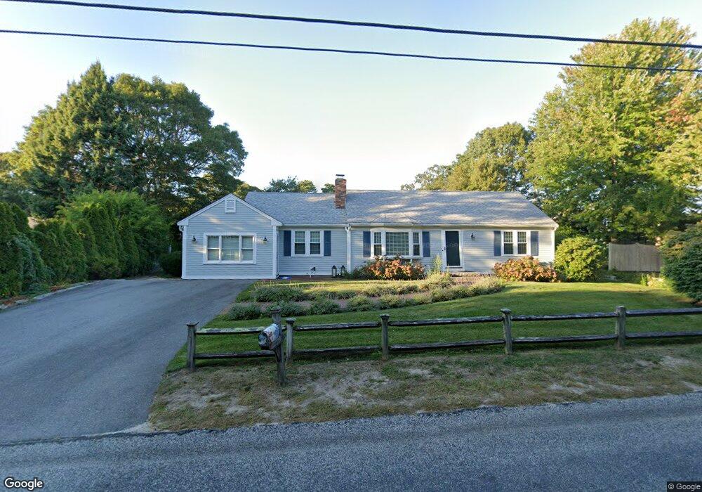
106 White Rock Rd Yarmouth Port, MA 02675
Yarmouth Port NeighborhoodEstimated Value: $627,000 - $719,000
2
Beds
2
Baths
1,644
Sq Ft
$403/Sq Ft
Est. Value
About This Home
This home is located at 106 White Rock Rd, Yarmouth Port, MA 02675 and is currently estimated at $662,733, approximately $403 per square foot. 106 White Rock Rd is a home located in Barnstable County with nearby schools including Dennis-Yarmouth Regional High School, St. Pius X. School, and Trinity Christian Academy of Cape Cod.
Ownership History
Date
Name
Owned For
Owner Type
Purchase Details
Closed on
Oct 20, 2025
Sold by
Marie C Polcari 2016 Ret and Polcari
Bought by
Tupper Richard S
Current Estimated Value
Purchase Details
Closed on
Aug 2, 2019
Sold by
Polcari Marie C
Bought by
Marie C Polcri 2018 Ret and Polcari
Purchase Details
Closed on
Dec 12, 2001
Sold by
Hair George F and Hair Ann M
Bought by
Polcari Marie C
Purchase Details
Closed on
Oct 17, 1989
Sold by
Nelson John C
Bought by
Hair George F
Create a Home Valuation Report for This Property
The Home Valuation Report is an in-depth analysis detailing your home's value as well as a comparison with similar homes in the area
Home Values in the Area
Average Home Value in this Area
Purchase History
| Date | Buyer | Sale Price | Title Company |
|---|---|---|---|
| Tupper Richard S | $550,000 | -- | |
| Marie C Polcri 2018 Ret | -- | None Available | |
| Polcari Marie C | $199,500 | -- | |
| Hair George F | $125,000 | -- | |
| Hair George F | $125,000 | -- |
Source: Public Records
Mortgage History
| Date | Status | Borrower | Loan Amount |
|---|---|---|---|
| Previous Owner | Hair George F | $50,000 | |
| Previous Owner | Hair George F | $15,000 |
Source: Public Records
Tax History Compared to Growth
Tax History
| Year | Tax Paid | Tax Assessment Tax Assessment Total Assessment is a certain percentage of the fair market value that is determined by local assessors to be the total taxable value of land and additions on the property. | Land | Improvement |
|---|---|---|---|---|
| 2025 | $4,281 | $604,600 | $189,700 | $414,900 |
| 2024 | $3,901 | $528,600 | $147,800 | $380,800 |
| 2023 | $3,796 | $468,100 | $130,400 | $337,700 |
| 2022 | $3,548 | $386,500 | $118,600 | $267,900 |
| 2021 | $3,355 | $350,900 | $124,500 | $226,400 |
| 2020 | $3,333 | $333,300 | $131,800 | $201,500 |
| 2019 | $3,064 | $303,400 | $131,800 | $171,600 |
| 2018 | $2,896 | $281,400 | $109,800 | $171,600 |
| 2017 | $2,820 | $281,400 | $109,800 | $171,600 |
| 2016 | $2,721 | $272,600 | $101,000 | $171,600 |
| 2015 | $2,696 | $268,500 | $90,500 | $178,000 |
Source: Public Records
Map
Nearby Homes
- 882 W Yarmouth Rd
- 933-935 W Yarmouth Rd
- 209 Union St
- 32 Deveau Ln
- 10 Balsam Way
- 50 Cottonwood St
- 24 Minnetuxet Way
- 371 Route 6a
- 8 Rowley Ln
- 23 Dauphine Dr
- 1 Barnacle Rd
- 607 W Yarmouth Rd
- 16 Warren Rd Unit 16
- 16 Warren Rd
- 17 Trowbridge Path
- 105 Old Hyannis Rd
- 186 Route 6a
- 560 W Yarmouth Rd
- 162 Route 6a
- 86 Pompano Rd
- 33 Early Red Berry Ln
- 33 Early Redberry Ln
- 102 White Rock Rd
- 110 White Rock Rd
- 27 Early Red Berry Ln
- 39 Early Redberry Ln
- 39 Early Red Berry Ln
- 27 Early Redberry Ln
- 96 White Rock Rd
- 32 Early Red Berry Ln
- 105 White Rock Rd
- 45 Early Red Berry Ln
- 45 Early Redberry Ln
- 32 Early Redberry Ln
- 38 Early Red Berry Ln
- 38 Early Redberry Ln
- 22 Early Red Berry Ln
- 22 Early Redberry Ln
- 42 Early Redberry Ln
- 10 Linnell Ln