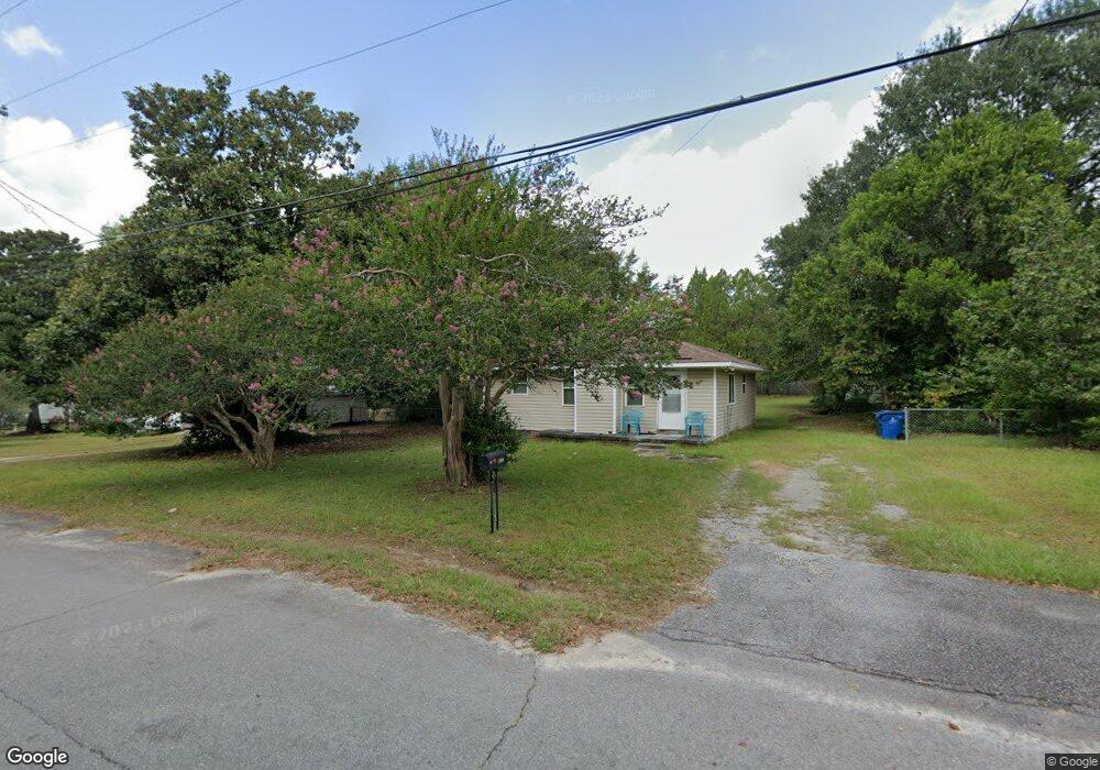
106 Whiteside Cir West Columbia, SC 29169
Estimated Value: $116,000 - $179,000
3
Beds
2
Baths
930
Sq Ft
$160/Sq Ft
Est. Value
About This Home
This home is located at 106 Whiteside Cir, West Columbia, SC 29169 and is currently estimated at $148,885, approximately $160 per square foot. 106 Whiteside Cir is a home located in Lexington County with nearby schools including Cayce Elementary, Cyril B. Busbee Creative Arts Academy, and Brookland-Cayce High School.
Ownership History
Date
Name
Owned For
Owner Type
Purchase Details
Closed on
Feb 26, 2013
Sold by
Freschcoat One Llc
Bought by
Seabrook Derrick A
Current Estimated Value
Home Financials for this Owner
Home Financials are based on the most recent Mortgage that was taken out on this home.
Original Mortgage
$68,799
Outstanding Balance
$48,240
Interest Rate
3.4%
Mortgage Type
VA
Estimated Equity
$100,645
Purchase Details
Closed on
Aug 31, 2012
Sold by
Federal Home Loan Mortgage Corporation
Bought by
Freshcoat One Llc
Purchase Details
Closed on
Apr 24, 2012
Sold by
Fulmer Sarah M
Bought by
Federal Home Loan Mortgage Corporation
Purchase Details
Closed on
Oct 24, 2002
Sold by
Morton Berry N
Bought by
Fulmer Sarah M
Purchase Details
Closed on
Sep 24, 2002
Sold by
Household Fin Corp Ii
Bought by
Ballinger Debbie
Create a Home Valuation Report for This Property
The Home Valuation Report is an in-depth analysis detailing your home's value as well as a comparison with similar homes in the area
Home Values in the Area
Average Home Value in this Area
Purchase History
| Date | Buyer | Sale Price | Title Company |
|---|---|---|---|
| Seabrook Derrick A | $75,500 | -- | |
| Freshcoat One Llc | $8,900 | -- | |
| Federal Home Loan Mortgage Corporation | $44,925 | -- | |
| Fulmer Sarah M | $68,800 | -- | |
| Ballinger Debbie | $31,000 | -- |
Source: Public Records
Mortgage History
| Date | Status | Borrower | Loan Amount |
|---|---|---|---|
| Open | Seabrook Derrick A | $68,799 |
Source: Public Records
Tax History Compared to Growth
Tax History
| Year | Tax Paid | Tax Assessment Tax Assessment Total Assessment is a certain percentage of the fair market value that is determined by local assessors to be the total taxable value of land and additions on the property. | Land | Improvement |
|---|---|---|---|---|
| 2024 | $687 | $3,240 | $640 | $2,600 |
| 2023 | $619 | $3,240 | $640 | $2,600 |
| 2022 | $625 | $3,240 | $640 | $2,600 |
| 2020 | $600 | $3,240 | $640 | $2,600 |
| 2019 | $569 | $3,014 | $640 | $2,374 |
| 2018 | $575 | $3,014 | $640 | $2,374 |
| 2017 | $552 | $3,014 | $640 | $2,374 |
| 2016 | $567 | $3,014 | $640 | $2,374 |
| 2014 | $430 | $2,999 | $720 | $2,279 |
| 2013 | -- | $4,100 | $1,080 | $3,020 |
Source: Public Records
Map
Nearby Homes
- 135 Silver Run Place
- 116 Silver Run Place
- 309 Hammond Ave
- 339 Gum Swamp Trail
- 349 Gum Swamp Trail
- 706 Westside Dr
- 212 Alexandria St
- 725 Brooks Ave
- 2312 Rainbow Dr
- 2405 Rainbow Dr
- 2024 Platt Springs Rd
- 1802 D Ave
- 153 Cavendish Dr
- 151 Cavendish Dr
- 157 Cavendish Dr
- 615 Dawn Dr
- 826 Jefferson St
- 215 Sandel Ln
- 207 Woodhaven Dr
- 1608 Crapps Ave
- 104 Whiteside Cir
- 108 Whiteside Cir
- 108 Bonnie St
- 110 Whiteside Cir
- 107 Whiteside Cir
- 112 Bonnie St
- 109 Whiteside Cir
- 111 Whiteside Cir
- 105 Whiteside Cir
- 113 Bonnie St
- 102 Whiteside Cir
- 113 Whiteside Cir
- 112 Whiteside Cir
- 115 Whiteside Cir
- 604 Brooks Ave
- 116 Bonnie St
- 2341 Thornton Ave
- 117 Bonnie St
- 117 Whiteside Cir
- 2337 Thornton Ave