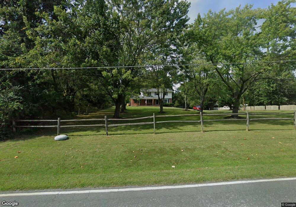
1060 Carrs Wharf Rd Edgewater, MD 21037
Estimated Value: $551,855 - $727,000
--
Bed
2
Baths
2,015
Sq Ft
$317/Sq Ft
Est. Value
About This Home
This home is located at 1060 Carrs Wharf Rd, Edgewater, MD 21037 and is currently estimated at $639,214, approximately $317 per square foot. 1060 Carrs Wharf Rd is a home located in Anne Arundel County with nearby schools including Mayo Elementary School, Central Middle School, and South River High School.
Ownership History
Date
Name
Owned For
Owner Type
Purchase Details
Closed on
Oct 7, 2004
Sold by
Howard Richard J
Bought by
Dean Catherine A and Dean Hillory
Current Estimated Value
Purchase Details
Closed on
Jun 20, 1990
Sold by
Keshishian Harold M
Bought by
Howard 2Nd Richard J
Home Financials for this Owner
Home Financials are based on the most recent Mortgage that was taken out on this home.
Original Mortgage
$240,000
Interest Rate
10.12%
Create a Home Valuation Report for This Property
The Home Valuation Report is an in-depth analysis detailing your home's value as well as a comparison with similar homes in the area
Home Values in the Area
Average Home Value in this Area
Purchase History
| Date | Buyer | Sale Price | Title Company |
|---|---|---|---|
| Dean Catherine A | $340,000 | -- | |
| Howard 2Nd Richard J | $175,000 | -- |
Source: Public Records
Mortgage History
| Date | Status | Borrower | Loan Amount |
|---|---|---|---|
| Previous Owner | Howard 2Nd Richard J | $240,000 | |
| Closed | Dean Catherine A | -- |
Source: Public Records
Tax History Compared to Growth
Tax History
| Year | Tax Paid | Tax Assessment Tax Assessment Total Assessment is a certain percentage of the fair market value that is determined by local assessors to be the total taxable value of land and additions on the property. | Land | Improvement |
|---|---|---|---|---|
| 2025 | $3,987 | $469,500 | -- | -- |
| 2024 | $3,987 | $450,100 | $0 | $0 |
| 2023 | $3,870 | $430,700 | $215,300 | $215,400 |
| 2022 | $3,631 | $429,467 | $0 | $0 |
| 2021 | $7,152 | $428,233 | $0 | $0 |
| 2020 | $3,482 | $427,000 | $215,300 | $211,700 |
| 2019 | $3,398 | $394,833 | $0 | $0 |
| 2018 | $3,677 | $362,667 | $0 | $0 |
| 2017 | $3,148 | $330,500 | $0 | $0 |
| 2016 | -- | $322,700 | $0 | $0 |
| 2015 | -- | $314,900 | $0 | $0 |
| 2014 | -- | $307,100 | $0 | $0 |
Source: Public Records
Map
Nearby Homes
- 3887 Cotter Dr
- 3820 Outrigger Dr
- 0 Mayo Rd Unit MDAA2113152
- 1261 Mayo Ridge Rd
- 1410 Central Ave E
- 3831 Twin Oaks Dr
- 3829 Twin Oaks Dr
- 3820 Holly Dr
- 509 Overhill Dr
- 0 Beverley Ave Unit MDAA2048610
- 1027 Old Turkey Point Rd
- 1218 Pine Ave
- 1207 Bay View Ct
- 1663 Cliff Dr
- 133 Valley View Ave
- 3925 River Club Dr
- 1305 Dark Horse Ct
- 3718 4th Ave
- 4180 Shoreham Beach Rd
- 901 Ct
- 1070 Carrs Wharf Rd
- 1072 Carrs Wharf Rd
- 1074 Carrs Wharf Rd
- 1063 Carrs Wharf Rd
- 1076 Carrs Wharf Rd
- 1065 Carrs Wharf Rd
- 1053 Carrs Wharf Rd
- 1051 Carrs Wharf Rd
- 3928 Calawasse Rd
- 3930 Calawasse Rd
- 3926 Calawasse Rd
- 1073 Carrs Wharf Rd
- 3924 Calawasse Rd
- 3985 Germantown Rd
- 1042 Carrs Wharf Rd
- 3992 Germantown Rd
- 4150 Carrs Ridge Rd
- 3990 Germantown Rd
- 1067 Carrs Wharf Rd
- 4154 Carrs Ridge Rd