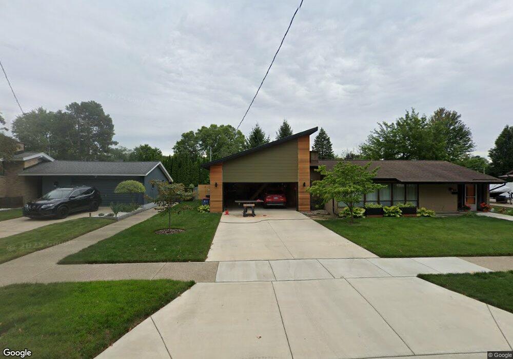
1060 Drexel Dr NE Grand Rapids, MI 49505
Creston NeighborhoodEstimated Value: $297,983 - $313,000
2
Beds
1
Bath
1,150
Sq Ft
$263/Sq Ft
Est. Value
About This Home
This home is located at 1060 Drexel Dr NE, Grand Rapids, MI 49505 and is currently estimated at $302,996, approximately $263 per square foot. 1060 Drexel Dr NE is a home located in Kent County with nearby schools including Kent Hills School, Riverside Middle School, and Union High School.
Ownership History
Date
Name
Owned For
Owner Type
Purchase Details
Closed on
May 19, 2025
Sold by
Farrell Michael J
Bought by
Michael Farrell And Laura Wahamaki Revocable and Farrell
Current Estimated Value
Purchase Details
Closed on
Apr 14, 2008
Sold by
Independent Mortgage Co West Michigan
Bought by
Federal National Mortgage Association
Purchase Details
Closed on
Jul 11, 2007
Sold by
Robbins Debra
Bought by
Independent Mortgage Co West Michigan
Purchase Details
Closed on
Dec 30, 2004
Sold by
Hilbrand Stephanie M and Hilbrand Kamor Stephanie M
Bought by
Robbins Debra L
Home Financials for this Owner
Home Financials are based on the most recent Mortgage that was taken out on this home.
Original Mortgage
$89,900
Interest Rate
5.78%
Mortgage Type
Purchase Money Mortgage
Create a Home Valuation Report for This Property
The Home Valuation Report is an in-depth analysis detailing your home's value as well as a comparison with similar homes in the area
Home Values in the Area
Average Home Value in this Area
Purchase History
| Date | Buyer | Sale Price | Title Company |
|---|---|---|---|
| Michael Farrell And Laura Wahamaki Revocable | -- | None Listed On Document | |
| Federal National Mortgage Association | -- | None Available | |
| Independent Mortgage Co West Michigan | $91,459 | None Available | |
| Robbins Debra L | $90,400 | Metropolitan Title Company |
Source: Public Records
Mortgage History
| Date | Status | Borrower | Loan Amount |
|---|---|---|---|
| Previous Owner | Robbins Debra L | $89,900 |
Source: Public Records
Tax History Compared to Growth
Tax History
| Year | Tax Paid | Tax Assessment Tax Assessment Total Assessment is a certain percentage of the fair market value that is determined by local assessors to be the total taxable value of land and additions on the property. | Land | Improvement |
|---|---|---|---|---|
| 2025 | $2,301 | $148,700 | $0 | $0 |
| 2024 | $2,301 | $135,700 | $0 | $0 |
| 2023 | $1,761 | $98,900 | $0 | $0 |
| 2022 | $1,700 | $86,600 | $0 | $0 |
| 2021 | $1,662 | $78,900 | $0 | $0 |
| 2020 | $1,589 | $72,300 | $0 | $0 |
| 2019 | $1,664 | $63,300 | $0 | $0 |
| 2018 | $1,607 | $58,600 | $0 | $0 |
| 2017 | $1,564 | $54,000 | $0 | $0 |
| 2016 | $1,583 | $48,900 | $0 | $0 |
| 2015 | $1,472 | $48,900 | $0 | $0 |
| 2013 | -- | $43,300 | $0 | $0 |
Source: Public Records
Map
Nearby Homes
- 1119 Kentwood Dr NE
- 1824 Herrick Ave NE
- 1237 Dale Ct NE
- 1848 Emerald Ave NE
- 1119 Spencer St NE
- 1757 Westlane Dr NE
- 1825 Meadowfield Dr NE
- 1339 Fuller Ave NE
- 1452 Carlton Ave NE
- 1444 Sweet St NE
- 1256 Diamond Ave NE
- 1335 Knapp St NE
- 1228 Spring Ave NE
- 2027 Joan Ave NE
- 2100 Dawson Ave NE
- 1518 Mayfield Ave NE
- 1524 Sweet St NE
- 1233 Emerald Ave NE
- 1060 Leonard St NE
- 1150 Diamond Ave NE
- 1050 Drexel Dr NE
- 1064 Drexel Dr NE
- 1647 Diamond Ct NE
- 1649 Diamond Ct NE
- 1643 Diamond Ct NE
- 1040 Drexel Dr NE
- 1639 Diamond Ct NE
- 1651 Diamond Ct NE
- 1063 Drexel Dr NE
- 1637 Diamond Ct NE
- 0 Drexel Dr NE
- 953955 Drexel Dr NE
- 1078 Drexel Dr NE
- 1633 Diamond Ct NE
- 1034 Drexel Dr NE
- 1657 Diamond Ct NE
- 1055 Drexel Dr NE
- 1049 Drexel Dr NE
- 1707 Burke Ave NE
- 1045 Drexel Dr NE