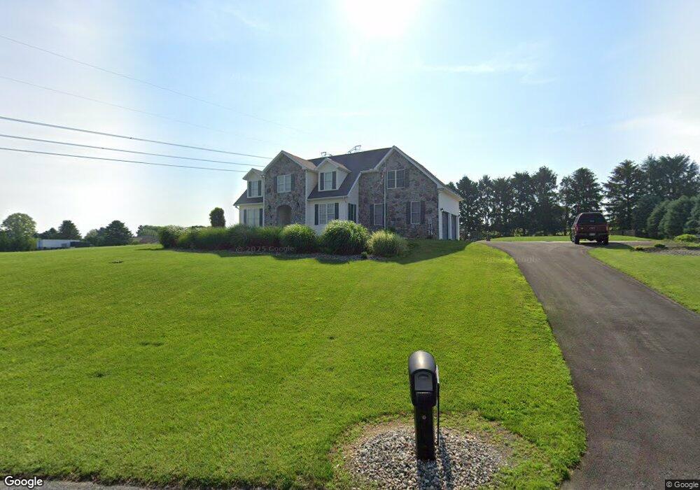
1060 Heritage Ave Shippensburg, PA 17257
Estimated Value: $400,000 - $487,519
--
Bed
1
Bath
2,190
Sq Ft
$203/Sq Ft
Est. Value
About This Home
This home is located at 1060 Heritage Ave, Shippensburg, PA 17257 and is currently estimated at $443,880, approximately $202 per square foot. 1060 Heritage Ave is a home located in Franklin County with nearby schools including Shippensburg Area Senior High School, Mt. Rock Parochial School, and Anchor Christian School.
Ownership History
Date
Name
Owned For
Owner Type
Purchase Details
Closed on
Oct 17, 2005
Sold by
Pittman Jeffrey J and Pittman Stephanie L
Bought by
Rampulla Joel J and Rampulla Debra K
Current Estimated Value
Home Financials for this Owner
Home Financials are based on the most recent Mortgage that was taken out on this home.
Original Mortgage
$220,000
Outstanding Balance
$117,457
Interest Rate
5.72%
Mortgage Type
New Conventional
Estimated Equity
$326,423
Create a Home Valuation Report for This Property
The Home Valuation Report is an in-depth analysis detailing your home's value as well as a comparison with similar homes in the area
Home Values in the Area
Average Home Value in this Area
Purchase History
| Date | Buyer | Sale Price | Title Company |
|---|---|---|---|
| Rampulla Joel J | $250,000 | None Available |
Source: Public Records
Mortgage History
| Date | Status | Borrower | Loan Amount |
|---|---|---|---|
| Open | Rampulla Joel J | $220,000 |
Source: Public Records
Tax History Compared to Growth
Tax History
| Year | Tax Paid | Tax Assessment Tax Assessment Total Assessment is a certain percentage of the fair market value that is determined by local assessors to be the total taxable value of land and additions on the property. | Land | Improvement |
|---|---|---|---|---|
| 2025 | $4,645 | $31,380 | $2,090 | $29,290 |
| 2024 | $4,065 | $31,380 | $2,090 | $29,290 |
| 2023 | $3,983 | $31,380 | $2,090 | $29,290 |
| 2022 | $3,955 | $31,380 | $2,090 | $29,290 |
| 2021 | $3,839 | $31,380 | $2,090 | $29,290 |
| 2020 | $4,032 | $31,380 | $2,090 | $29,290 |
| 2019 | $3,996 | $31,380 | $2,090 | $29,290 |
| 2018 | $4,070 | $31,380 | $2,090 | $29,290 |
| 2017 | $4,102 | $31,380 | $2,090 | $29,290 |
| 2016 | $874 | $31,220 | $2,090 | $29,130 |
| 2015 | $813 | $31,220 | $2,090 | $29,130 |
| 2014 | $806 | $30,930 | $2,090 | $28,840 |
Source: Public Records
Map
Nearby Homes
- 0 Mount Rock Rd
- 8256 Olde Scotland Rd
- 8640 Possum Hollow Rd
- 23 Lenwood Park
- 8029 Molly Pitcher Hwy
- 127 Stony Point Ave
- 642 Eric Dr
- 423 Bradley Ln
- 3035 Stillhouse Hollow Rd
- 476 Beech Tree St
- 25 Lippizan Dr
- 9807 Possum Hollow Rd
- 0 Means Hollow Rd Unit PAFL2029114
- 0 Means Hollow Rd Unit 25178950
- 700 Remington Dr
- 6062 Molly Pitcher Hwy
- 10050 Mccreary Rd
- 108 Baker and Russell Dr
- 184 Park Heights Ave
- 201 Baker & Russell Dr
- 1064 Heritage Ave
- 1065 Heritage Ave
- 1065 Heritage Ave
- 7039 Olde Scotland Rd
- 7025 Olde Scotland Rd
- 1052 Heritage Ave
- 1066 Heritage Ave
- 7051 Olde Scotland Rd
- 7013 Olde Scotland Rd
- 6852 Olde Scotland Rd
- 1038 Heritage Ave
- 1070 Heritage Ave
- 1036 Heritage Ave
- 7063 Olde Scotland Rd
- 6842 Olde Scotland Rd
- 7052 Olde Scotland Rd
- 7001 Olde Scotland Rd
- 7064 Olde Scotland Rd
- 7075 Olde Scotland Rd
- 1049 Heritage Ave