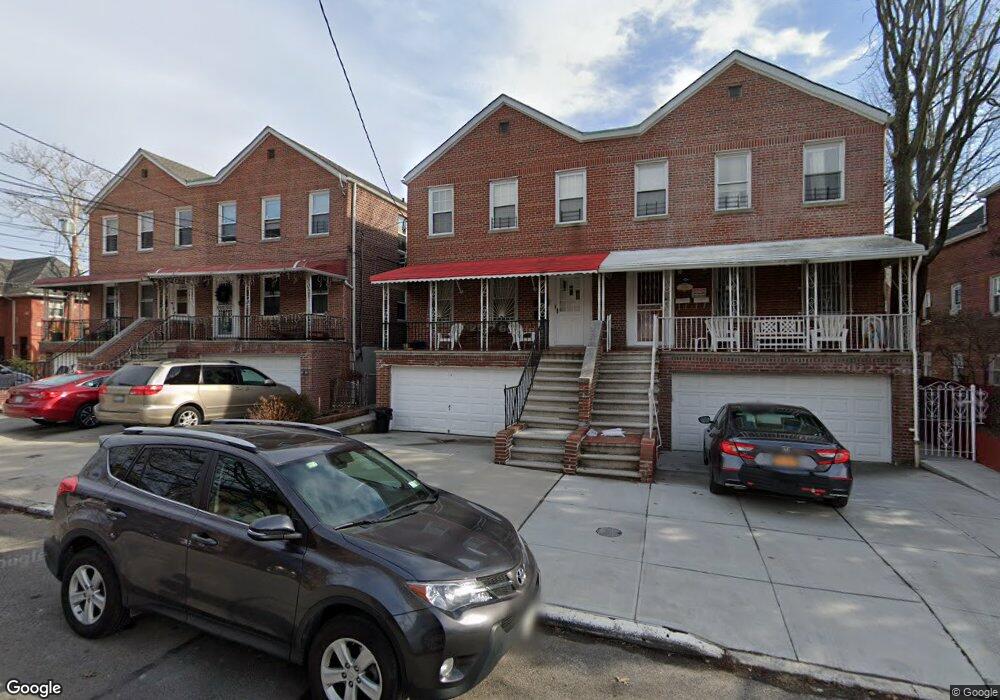
1060 Lydig Ave Bronx, NY 10461
Morris Park NeighborhoodEstimated Value: $923,000 - $1,147,000
Studio
--
Bath
2,849
Sq Ft
$359/Sq Ft
Est. Value
About This Home
This home is located at 1060 Lydig Ave, Bronx, NY 10461 and is currently estimated at $1,023,963, approximately $359 per square foot. 1060 Lydig Ave is a home located in Bronx County with nearby schools including P.S. 083 The Donald Hertz School, St. Clare of Assisi School, and Our Saviour Lutheran School.
Ownership History
Date
Name
Owned For
Owner Type
Purchase Details
Closed on
Aug 1, 2014
Sold by
Frances Smaldone As Settlor
Bought by
Chung Michael and Chung Heang Sok
Current Estimated Value
Purchase Details
Closed on
Jul 19, 2011
Sold by
Smaldone Frances
Bought by
Laurie Smaldone Alsup Trustee and Smaldone Family 2011 Irrevocable Trust
Purchase Details
Closed on
Jun 7, 1990
Sold by
Carcaterra Carmela / Estate Of
Bought by
Smaldone Frances
Create a Home Valuation Report for This Property
The Home Valuation Report is an in-depth analysis detailing your home's value as well as a comparison with similar homes in the area
Home Values in the Area
Average Home Value in this Area
Purchase History
| Date | Buyer | Sale Price | Title Company |
|---|---|---|---|
| Chung Michael | $520,000 | -- | |
| Laurie Smaldone Alsup Trustee | -- | -- | |
| Smaldone Frances | -- | -- |
Source: Public Records
Tax History
| Year | Tax Paid | Tax Assessment Tax Assessment Total Assessment is a certain percentage of the fair market value that is determined by local assessors to be the total taxable value of land and additions on the property. | Land | Improvement |
|---|---|---|---|---|
| 2025 | $8,574 | $45,446 | $8,924 | $36,522 |
| 2024 | $8,574 | $44,089 | $8,114 | $35,975 |
| 2023 | $8,163 | $41,594 | $7,721 | $33,873 |
| 2022 | $7,546 | $52,380 | $10,380 | $42,000 |
| 2021 | $7,667 | $42,540 | $10,380 | $32,160 |
| 2020 | $7,720 | $45,120 | $10,380 | $34,740 |
| 2019 | $7,350 | $38,700 | $10,380 | $28,320 |
| 2018 | $6,768 | $34,662 | $8,678 | $25,984 |
| 2017 | $6,359 | $32,700 | $10,380 | $22,320 |
| 2016 | $5,688 | $31,560 | $10,380 | $21,180 |
| 2015 | $3,676 | $31,860 | $11,520 | $20,340 |
| 2014 | $3,676 | $30,660 | $11,520 | $19,140 |
Source: Public Records
Map
Nearby Homes
- 1054 Lydig Ave
- 1059 Neill Ave
- 1100 Neill Ave
- 2019 Colden Ave
- 2118 Bogart Ave
- 2116 Bogart Ave
- 2037 Radcliff Ave
- - Lydig Ave
- 1942 Haight Ave
- 1917 Haight Ave
- 2004 Bogart Ave
- 2129 Muliner Ave
- 1912 Haight Ave
- 2080 Matthews Ave
- 1925 Radcliff Ave
- 1116 Rhinelander Ave
- 1850 Hone Ave
- 2165 Mathews Ave Unit 5H
- 2165 Matthews Ave Unit 4A
- 2165 Matthews Ave Unit 4F
- 1060 Lydig Ave Unit 2
- 1062 Lydig Ave
- 1058 Lydig Ave
- 1064 Lydig Ave
- 2033 Lurting Ave
- 2031 Lurting Ave
- 2031 Lurting Ave Unit 2
- 2027 Lurting Ave
- 2036 Hone Ave
- 1050 Lydig Ave
- 2101 Lurting Ave
- 2025 Lurting Ave
- 2034 Hone Ave
- 2032 Lurting Ave
- 2032-2036 Lurting Ave
- 2023 Lurting Ave
- 2023 Lurting Ave
- 2030 Hone Ave
- 2105 Lurting Ave
- 1059 Lydig Ave
Your Personal Tour Guide
Ask me questions while you tour the home.