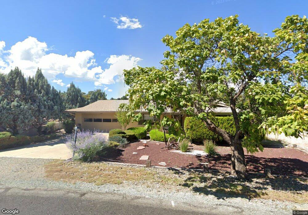
1060 N Stirrup High Dr W Dewey, AZ 86327
Prescott Golf & Country Club NeighborhoodEstimated Value: $383,357 - $443,000
2
Beds
2
Baths
1,600
Sq Ft
$256/Sq Ft
Est. Value
About This Home
This home is located at 1060 N Stirrup High Dr W, Dewey, AZ 86327 and is currently estimated at $410,089, approximately $256 per square foot. 1060 N Stirrup High Dr W is a home located in Yavapai County with nearby schools including Lake Valley Elementary School, Glassford Hill Middle School, and Bradshaw Mountain High School.
Ownership History
Date
Name
Owned For
Owner Type
Purchase Details
Closed on
Jan 20, 2016
Sold by
Foulds Scott D and Foulds Karen D
Bought by
Shurtz Gary D
Current Estimated Value
Home Financials for this Owner
Home Financials are based on the most recent Mortgage that was taken out on this home.
Original Mortgage
$92,500
Outstanding Balance
$73,519
Interest Rate
3.94%
Mortgage Type
New Conventional
Estimated Equity
$336,570
Purchase Details
Closed on
Jul 27, 2005
Sold by
Neville Jane A and The Passerotti Family Revocabl
Bought by
Foulds D Scott and Foulds Karen D
Home Financials for this Owner
Home Financials are based on the most recent Mortgage that was taken out on this home.
Original Mortgage
$112,500
Interest Rate
5.46%
Mortgage Type
New Conventional
Purchase Details
Closed on
Feb 2, 1998
Sold by
Passerotti John E and Passerotti Betty J
Bought by
Passerotti John E and Passerotti Betty J
Create a Home Valuation Report for This Property
The Home Valuation Report is an in-depth analysis detailing your home's value as well as a comparison with similar homes in the area
Home Values in the Area
Average Home Value in this Area
Purchase History
| Date | Buyer | Sale Price | Title Company |
|---|---|---|---|
| Shurtz Gary D | $192,500 | Yavapai Title | |
| Foulds D Scott | $225,000 | Capital Title Agency | |
| Passerotti John E | -- | -- |
Source: Public Records
Mortgage History
| Date | Status | Borrower | Loan Amount |
|---|---|---|---|
| Open | Shurtz Gary D | $92,500 | |
| Previous Owner | Foulds D Scott | $112,500 |
Source: Public Records
Tax History Compared to Growth
Tax History
| Year | Tax Paid | Tax Assessment Tax Assessment Total Assessment is a certain percentage of the fair market value that is determined by local assessors to be the total taxable value of land and additions on the property. | Land | Improvement |
|---|---|---|---|---|
| 2026 | $1,556 | $28,173 | -- | -- |
| 2024 | $1,403 | $29,481 | -- | -- |
| 2023 | $1,426 | $24,651 | $4,642 | $20,009 |
| 2022 | $1,403 | $20,166 | $4,061 | $16,105 |
| 2021 | $1,466 | $18,533 | $4,074 | $14,459 |
| 2020 | $1,409 | $0 | $0 | $0 |
| 2019 | $1,391 | $0 | $0 | $0 |
| 2018 | $1,323 | $0 | $0 | $0 |
| 2017 | $1,297 | $0 | $0 | $0 |
| 2016 | $1,253 | $0 | $0 | $0 |
| 2015 | -- | $0 | $0 | $0 |
| 2014 | -- | $0 | $0 | $0 |
Source: Public Records
Map
Nearby Homes
- 1140 N Latigo Ln
- 11613 E Silver Spur
- 1131 N Tapadero Dr Unit 4
- 11516 E Wingfoot Ct
- 942 Latigo Ln
- 11640 E Manzanita Trail
- 11640 E Manzanita Trail
- 1017 N Fairway Dr
- 11847 E Stirrup High Dr E
- 11820 E Stirrup High Dr E
- 819 N Winchester Way
- 12070 E Pepper Tree Way
- 11430 E Manzanita Trail
- 11452 E Turquoise Cir Unit 4
- 776 N Maverick Trail
- 11493 E Turquoise Cir
- 12140 E Peppertree Way
- 707 N Apache Dr
- 1107 N Buena Vista E
- 1178 N Buena Vista E Unit E
- 1060 Stirrup High Dr E
- 1064 N Stirrup High Dr W
- 1056 Stirrup High Dr E
- 1056 N Stirrup High Dr W
- 11697 E Appaloosa Ln
- 11687 E Appaloosa Ln
- 1059 N Stirrup High Dr W
- 1099 N Latigo Ln
- 1052 N Stirrup High Dr W Unit W
- 1052 N Stirrup High Dr W
- 1070 N Stirrup High Dr W
- 1052 W Stirrup High Dr
- 1070 Stirrup High Dr E
- 1107 N Latigo Ln
- 1107 N Latigo Ln Unit 1
- 1053 N Stirrup High Dr W
- 1053 Stirrup High Dr E
- 1065 N Stirrup High Dr W
- 11698 E Appaloosa Ln
- 1065 Stirrup High Dr E