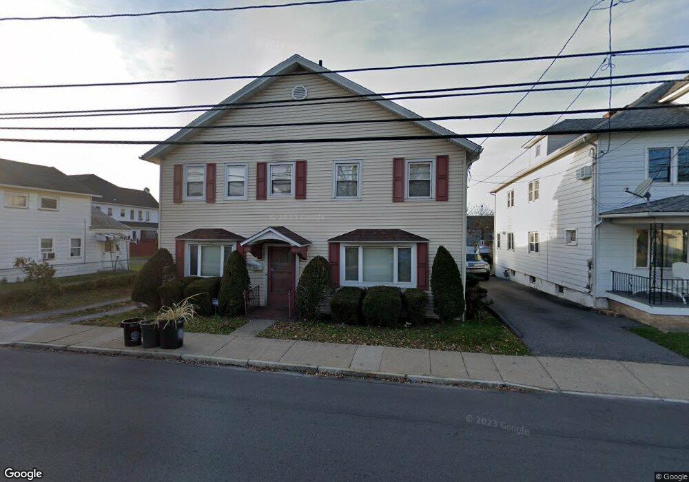
1060 Scott St Wilkes Barre, PA 18705
Estimated Value: $208,000 - $251,000
6
Beds
3
Baths
2,000
Sq Ft
$113/Sq Ft
Est. Value
About This Home
This home is located at 1060 Scott St, Wilkes Barre, PA 18705 and is currently estimated at $225,411, approximately $112 per square foot. 1060 Scott St is a home located in Luzerne County with nearby schools including Leo E. Solomon-Plains Elementary School, Cradock Middle School, and Solomon/Plains Junior High School.
Ownership History
Date
Name
Owned For
Owner Type
Purchase Details
Closed on
May 11, 2013
Sold by
Chirinko Bruce
Bought by
Jiang Qingzhong and Zheng Yuanqin
Current Estimated Value
Purchase Details
Closed on
Apr 20, 2013
Sold by
Forrence Stanley and Forrence Stanley M
Bought by
Jiang Qingzhong and Zheng Yuanqin
Purchase Details
Closed on
Sep 11, 1998
Sold by
Forrence Theodore C and Forrence Ellen J
Bought by
Forrence Theodore and Murphy Jane
Create a Home Valuation Report for This Property
The Home Valuation Report is an in-depth analysis detailing your home's value as well as a comparison with similar homes in the area
Home Values in the Area
Average Home Value in this Area
Purchase History
| Date | Buyer | Sale Price | Title Company |
|---|---|---|---|
| Jiang Qingzhong | -- | None Available | |
| Jiang Qingzhong | $85,000 | None Available | |
| Forrence Theodore | -- | None Available |
Source: Public Records
Tax History Compared to Growth
Tax History
| Year | Tax Paid | Tax Assessment Tax Assessment Total Assessment is a certain percentage of the fair market value that is determined by local assessors to be the total taxable value of land and additions on the property. | Land | Improvement |
|---|---|---|---|---|
| 2025 | $18,672 | $112,400 | $19,300 | $93,100 |
| 2024 | $18,672 | $112,400 | $19,300 | $93,100 |
| 2023 | $18,672 | $112,400 | $19,300 | $93,100 |
| 2022 | $18,651 | $112,400 | $19,300 | $93,100 |
| 2021 | $18,651 | $112,400 | $19,300 | $93,100 |
| 2020 | $18,651 | $112,400 | $19,300 | $93,100 |
| 2019 | $18,584 | $112,400 | $19,300 | $93,100 |
| 2018 | $18,518 | $112,400 | $19,300 | $93,100 |
| 2017 | $18,451 | $112,400 | $19,300 | $93,100 |
| 2016 | -- | $112,400 | $19,300 | $93,100 |
| 2015 | -- | $112,400 | $19,300 | $93,100 |
| 2014 | -- | $112,400 | $19,300 | $93,100 |
Source: Public Records
Map
Nearby Homes
- 239 Matson Ave
- 245 Matson Ave
- 24 Oliver St
- 133 Govier St
- 180 Gardner Ave
- 178 Gardner Ave
- 19 Virginia Dr
- 52 Mill St
- 35 Kado St
- 31 Harriet St
- 76 Brader Dr
- 18 Samantha Dr
- 14 Knight St
- 1326 N Washington St Unit PORTFOLIO 3 BUILDING
- 221 E Thomas St
- 330 E Thomas St
- 12 Mayock St
- 11 Mayock St
- 9 Mayock St
- 13 Mayock St
- 278-280 George Ave
- 1066 Scott St
- 1068 Scott St
- 1054 Scott St
- 251 Matson Ave
- 278 George Ave
- 288 George Ave
- 280 George Ave
- 280 George Ave Unit 1
- 280 George Ave
- 387 Matson Ave
- 256-258 George Ave
- 1075 Scott St
- 262 George Ave
- 256 Matson Ave
- 237 Matson Ave
- 287 Matson Ave
- 254 Matson Ave
- 235 Matson Ave
- 1034 Scott St