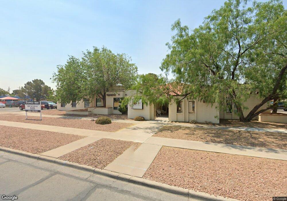
10600 Montwood Dr El Paso, TX 79935
Vista Del Sol Neighborhood
--
Bed
--
Bath
9,792
Sq Ft
1.03
Acres
About This Home
This home is located at 10600 Montwood Dr, El Paso, TX 79935. 10600 Montwood Dr is a home located in El Paso County with nearby schools including Eastwood Heights Elementary School, Eastwood Middle School, and Eastwood High School.
Ownership History
Date
Name
Owned For
Owner Type
Purchase Details
Closed on
May 14, 2018
Sold by
Barreras Jason
Bought by
10600 Montwood Llc
Purchase Details
Closed on
Dec 23, 2013
Sold by
Barreras Jason and Barreras Joanna
Bought by
10600 Montwood Llc
Purchase Details
Closed on
Nov 13, 2012
Sold by
Prewitt Barbara J
Bought by
Severo Hughston Llc
Home Financials for this Owner
Home Financials are based on the most recent Mortgage that was taken out on this home.
Original Mortgage
$512,000
Interest Rate
3.37%
Mortgage Type
Stand Alone Second
Purchase Details
Closed on
Sep 4, 2012
Sold by
Moran Gabriel
Bought by
Prewitt Barbara J and Estate Of Ted C Prewitt
Purchase Details
Closed on
Mar 20, 2008
Sold by
Prewitt Ted C and Prewitt Barbara J
Bought by
Moran Gabriel
Home Financials for this Owner
Home Financials are based on the most recent Mortgage that was taken out on this home.
Original Mortgage
$575,000
Interest Rate
5.72%
Mortgage Type
Seller Take Back
Create a Home Valuation Report for This Property
The Home Valuation Report is an in-depth analysis detailing your home's value as well as a comparison with similar homes in the area
Home Values in the Area
Average Home Value in this Area
Purchase History
| Date | Buyer | Sale Price | Title Company |
|---|---|---|---|
| 10600 Montwood Llc | -- | None Available | |
| 10600 Montwood Llc | -- | None Available | |
| Severo Hughston Llc | -- | None Available | |
| Prewitt Barbara J | $425,000 | None Available | |
| Moran Gabriel | -- | None Available |
Source: Public Records
Mortgage History
| Date | Status | Borrower | Loan Amount |
|---|---|---|---|
| Previous Owner | Severo Hughston Llc | $512,000 | |
| Previous Owner | Moran Gabriel | $575,000 |
Source: Public Records
Tax History Compared to Growth
Tax History
| Year | Tax Paid | Tax Assessment Tax Assessment Total Assessment is a certain percentage of the fair market value that is determined by local assessors to be the total taxable value of land and additions on the property. | Land | Improvement |
|---|---|---|---|---|
| 2025 | $19,764 | $805,000 | $423,554 | $381,446 |
| 2024 | $19,764 | $835,580 | $423,554 | $412,026 |
| 2023 | $17,453 | $599,659 | $423,554 | $176,105 |
| 2022 | $18,622 | $599,659 | $423,554 | $176,105 |
| 2021 | $16,736 | $514,859 | $423,554 | $91,305 |
| 2020 | $20,087 | $635,950 | $423,554 | $212,396 |
| 2018 | $16,170 | $520,000 | $423,554 | $96,446 |
| 2017 | $15,895 | $520,000 | $423,554 | $96,446 |
| 2016 | $15,895 | $520,000 | $423,554 | $96,446 |
| 2015 | $14,879 | $520,000 | $423,554 | $96,446 |
| 2014 | $14,879 | $520,000 | $423,554 | $96,446 |
Source: Public Records
Map
Nearby Homes
- 2105 Pacheco Dr
- 2224 Escarpa Dr
- 2109 Febrero Dr
- 1909 Crow Dr
- 10512 Album Ave
- 10309 Woodruff Ct
- 1955 Trawood Dr Unit 12
- 10304 Woodruff Ct
- 10313 Byway Dr
- 2412 Penwood Dr
- 2705 Fierro Dr
- 2701 Brady Place
- 10233 Byway Dr
- 2000 Solano Dr
- 2801 Brady Place
- 2313 Frank Beard Dr
- 2153 Trawood Dr
- 1730 Bara Dr
- 2201 Trawood Dr
- 2912 Chaswood St
- 10609 Brian Mooney Ave
- 10609 Brian Mooney Ave Unit 38
- 10613 Brian Mooney Ave
- 10605 Brian Mooney Ave
- 10617 Brian Mooney Ave
- 10601 Brian Mooney Ave
- 2100 Escarpa Dr
- 2101 Villa Plata Dr
- 10621 Brian Mooney Ave
- 10541 Brian Mooney Ave
- 10608 Brian Mooney Ave
- 10604 Brian Mooney Ave
- 2101 Escarpa Dr
- 10612 Brian Mooney Ave
- 2104 Escarpa Dr
- 2105 Villa Plata Dr
- 10600 Brian Mooney Ave
- 10536 Montwood Dr Unit D
- 10536 Montwood Dr Unit B
- 10536 Montwood Dr