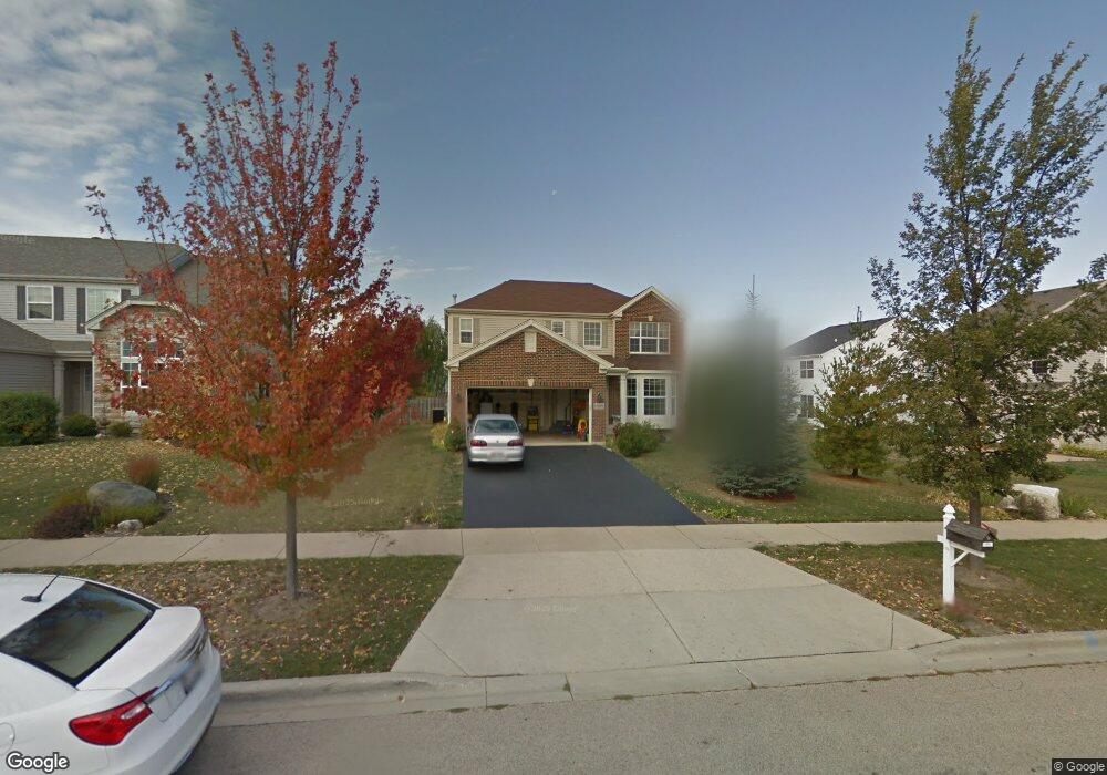
10601 Nantucket Ln Huntley, IL 60142
Estimated Value: $452,000 - $467,000
3
Beds
3
Baths
2,266
Sq Ft
$203/Sq Ft
Est. Value
About This Home
This home is located at 10601 Nantucket Ln, Huntley, IL 60142 and is currently estimated at $459,225, approximately $202 per square foot. 10601 Nantucket Ln is a home located in McHenry County with nearby schools including Martin Elementary School, Chesak Elementary School, and Heineman Middle School.
Ownership History
Date
Name
Owned For
Owner Type
Purchase Details
Closed on
Oct 23, 2024
Sold by
Norman Marian
Bought by
Norman Alicia
Current Estimated Value
Home Financials for this Owner
Home Financials are based on the most recent Mortgage that was taken out on this home.
Original Mortgage
$427,121
Outstanding Balance
$422,864
Interest Rate
6.63%
Mortgage Type
FHA
Estimated Equity
$36,362
Purchase Details
Closed on
Oct 11, 2004
Sold by
Wing Pointe North L L C
Bought by
Norman Alphonso and Norman Marian
Home Financials for this Owner
Home Financials are based on the most recent Mortgage that was taken out on this home.
Original Mortgage
$265,760
Interest Rate
7.25%
Mortgage Type
Purchase Money Mortgage
Create a Home Valuation Report for This Property
The Home Valuation Report is an in-depth analysis detailing your home's value as well as a comparison with similar homes in the area
Home Values in the Area
Average Home Value in this Area
Purchase History
| Date | Buyer | Sale Price | Title Company |
|---|---|---|---|
| Norman Alicia | $435,000 | Fidelity National Title | |
| Norman Alicia | $435,000 | Fidelity National Title | |
| Norman Alphonso | $295,694 | First American Title Ins Co |
Source: Public Records
Mortgage History
| Date | Status | Borrower | Loan Amount |
|---|---|---|---|
| Open | Norman Alicia | $427,121 | |
| Closed | Norman Alicia | $427,121 | |
| Previous Owner | Norman Alphonso | $265,760 |
Source: Public Records
Tax History Compared to Growth
Tax History
| Year | Tax Paid | Tax Assessment Tax Assessment Total Assessment is a certain percentage of the fair market value that is determined by local assessors to be the total taxable value of land and additions on the property. | Land | Improvement |
|---|---|---|---|---|
| 2024 | $8,272 | $124,487 | $11,644 | $112,843 |
| 2023 | $8,037 | $111,828 | $10,460 | $101,368 |
| 2022 | $7,669 | $101,829 | $9,525 | $92,304 |
| 2021 | $7,435 | $95,903 | $8,971 | $86,932 |
| 2020 | $7,310 | $93,346 | $8,732 | $84,614 |
| 2019 | $7,138 | $90,963 | $8,509 | $82,454 |
| 2018 | $6,774 | $85,594 | $9,575 | $76,019 |
| 2017 | $6,635 | $80,666 | $9,024 | $71,642 |
| 2016 | $6,694 | $76,694 | $8,580 | $68,114 |
| 2013 | $3,048 | $60,941 | $14,022 | $46,919 |
Source: Public Records
Map
Nearby Homes
- 10880 Potomac Dr
- 10592 Capitol Ln
- 10804 Concord Ln
- 10631 Oregon Trail
- 0 Ruth Rd Unit MRD12258953
- 2.54 Ruth Rd
- 10392 Hunter Trail
- 10826 Timer Dr W Unit 2
- 10846 Timer Dr W Unit 2
- 11314 Algonquin Rd Unit C
- 10419 Evendale Rd
- 10783 Chadsey Rd
- 10794 Saxony St
- 10784 Saxony St
- 10774 Saxony St
- 10764 Saxony St
- 10702 Chadsey Rd
- 10754 Saxony St
- 10795 Saxony St
- 10020 Berkshire Ln
- 10605 Nantucket Ln
- 10847 Potomac Dr
- 10861 Potomac Dr
- 10617 Nantucket Ln
- 10630 Golden Gate Ave
- 10820 Oregon Trail
- 10875 Potomac Dr
- 10624 Golden Gate Ave
- 10823 Potomac Dr
- 10631 Nantucket Ln
- 10889 Potomac Dr
- 10636 Golden Gate Ave
- 10806 Oregon Trail
- 10809 Potomac Dr
- 10819 Oregon Trail
- 10643 Nantucket Ln
- 10852 Potomac Dr
- 10905 Potomac Dr
- 10618 Golden Gate Ave
- 10840 Potomac Dr