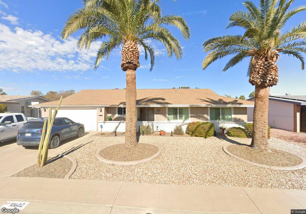
10602 W Caron Dr Sun City, AZ 85351
Estimated Value: $311,000 - $406,000
--
Bed
2
Baths
2,563
Sq Ft
$137/Sq Ft
Est. Value
About This Home
This home is located at 10602 W Caron Dr, Sun City, AZ 85351 and is currently estimated at $350,237, approximately $136 per square foot. 10602 W Caron Dr is a home located in Maricopa County with nearby schools including Ombudsman - Northwest Charter and Peoria Accelerated High School.
Ownership History
Date
Name
Owned For
Owner Type
Purchase Details
Closed on
Jun 30, 2021
Sold by
Trimble Thomas W and Trimble Janet L
Bought by
Trimble Thomas W and Trimble Janet L
Current Estimated Value
Purchase Details
Closed on
Jul 13, 2004
Sold by
Zeckser Norman A
Bought by
Trimble Thomas W and Trimble Janet L
Home Financials for this Owner
Home Financials are based on the most recent Mortgage that was taken out on this home.
Original Mortgage
$88,000
Outstanding Balance
$44,107
Interest Rate
6.27%
Mortgage Type
New Conventional
Estimated Equity
$306,130
Create a Home Valuation Report for This Property
The Home Valuation Report is an in-depth analysis detailing your home's value as well as a comparison with similar homes in the area
Home Values in the Area
Average Home Value in this Area
Purchase History
| Date | Buyer | Sale Price | Title Company |
|---|---|---|---|
| Trimble Thomas W | -- | None Available | |
| Trimble Thomas W | $110,000 | Capital Title Agency Inc |
Source: Public Records
Mortgage History
| Date | Status | Borrower | Loan Amount |
|---|---|---|---|
| Open | Trimble Thomas W | $88,000 |
Source: Public Records
Tax History Compared to Growth
Tax History
| Year | Tax Paid | Tax Assessment Tax Assessment Total Assessment is a certain percentage of the fair market value that is determined by local assessors to be the total taxable value of land and additions on the property. | Land | Improvement |
|---|---|---|---|---|
| 2025 | $1,681 | $20,781 | -- | -- |
| 2024 | $1,511 | $19,791 | -- | -- |
| 2023 | $1,511 | $31,770 | $6,350 | $25,420 |
| 2022 | $1,424 | $25,380 | $5,070 | $20,310 |
| 2021 | $1,470 | $24,330 | $4,860 | $19,470 |
| 2020 | $1,430 | $22,120 | $4,420 | $17,700 |
| 2019 | $1,404 | $21,010 | $4,200 | $16,810 |
| 2018 | $1,352 | $19,520 | $3,900 | $15,620 |
| 2017 | $1,306 | $18,010 | $3,600 | $14,410 |
| 2016 | $691 | $17,350 | $3,470 | $13,880 |
| 2015 | $1,163 | $15,380 | $3,070 | $12,310 |
Source: Public Records
Map
Nearby Homes
- 10707 W Mission Ln
- 9202 N 107th Ave Unit 8
- 10726 W Kelso Dr Unit 172
- 10731 W Mission Ln Unit 200
- 10726 W Denham Dr Unit 16
- 10732 W Denham Dr Unit 17
- 10825 W Caron Dr
- 8803 N 105th Dr
- 10326 W Caron Dr
- 8800 N 107th Ave Unit 17
- 8800 N 107th Ave Unit 19
- 8800 N 107th Ave Unit 52
- 10512 W Ruth Ave
- 10816 W Venturi Dr
- 10801 W Mountain View Rd
- 10603 W Ruth Ave
- 9802 N 107th Ave
- 9815 N 103rd Ave
- 10788 W Cinnebar Ave
- 10316 W Salem Dr Unit 6D
- 10548 W Caron Dr
- 10612 W Caron Dr
- 10603 W Kelso Dr
- 10609 W Kelso Dr
- 10549 W Kelso Dr
- 10542 W Caron Dr
- 10605 W Caron Dr
- 10618 W Caron Dr
- 10541 W Caron Dr
- 10617 W Kelso Dr
- 10627 W Kelso Dr
- 10534 W Caron Dr
- 10624 W Caron Dr
- 10537 W Caron Dr
- 10531 W Kelso Dr
- 10604 W Kelso Dr
- 10550 W Kelso Dr Unit 7
- 10633 W Kelso Dr Unit 7
- 10610 W Kelso Dr
- 10528 W Caron Dr