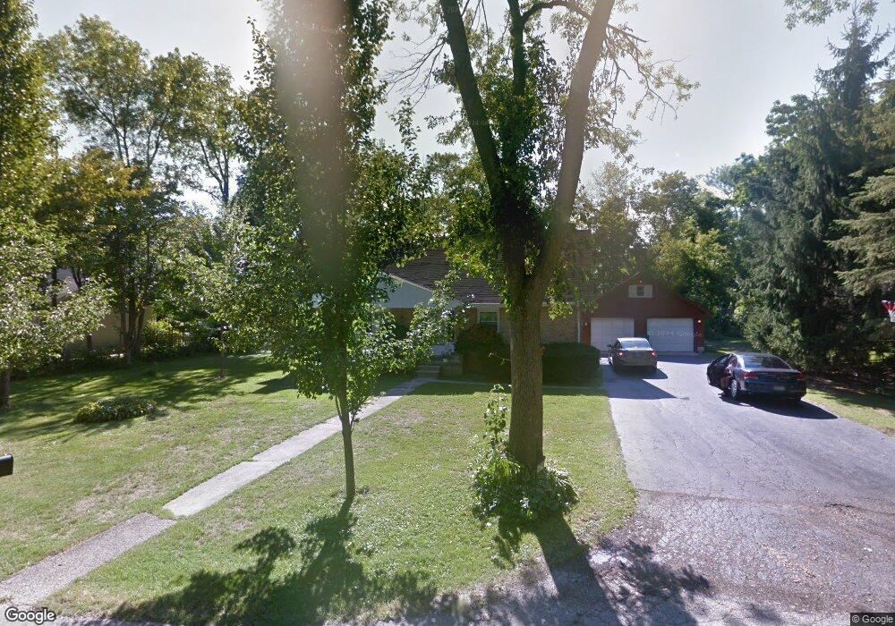
10603 W Circle Dr Beach Park, IL 60099
Estimated Value: $263,000 - $319,000
3
Beds
2
Baths
1,650
Sq Ft
$175/Sq Ft
Est. Value
About This Home
This home is located at 10603 W Circle Dr, Beach Park, IL 60099 and is currently estimated at $289,034, approximately $175 per square foot. 10603 W Circle Dr is a home located in Lake County with nearby schools including Oak Crest School, Beach Park Middle School, and Zion-Benton Township High School.
Ownership History
Date
Name
Owned For
Owner Type
Purchase Details
Closed on
Jul 23, 2021
Sold by
North Shore Trust And Savings
Bought by
Drinka Donna J
Current Estimated Value
Purchase Details
Closed on
Jun 25, 2018
Sold by
Benson Louise
Bought by
Drinka Donna
Home Financials for this Owner
Home Financials are based on the most recent Mortgage that was taken out on this home.
Original Mortgage
$140,650
Interest Rate
4.5%
Mortgage Type
New Conventional
Create a Home Valuation Report for This Property
The Home Valuation Report is an in-depth analysis detailing your home's value as well as a comparison with similar homes in the area
Home Values in the Area
Average Home Value in this Area
Purchase History
| Date | Buyer | Sale Price | Title Company |
|---|---|---|---|
| Drinka Donna J | -- | None Available | |
| Drinka Donna | $145,000 | First American Title |
Source: Public Records
Mortgage History
| Date | Status | Borrower | Loan Amount |
|---|---|---|---|
| Previous Owner | Drinka Donna | $140,650 |
Source: Public Records
Tax History
| Year | Tax Paid | Tax Assessment Tax Assessment Total Assessment is a certain percentage of the fair market value that is determined by local assessors to be the total taxable value of land and additions on the property. | Land | Improvement |
|---|---|---|---|---|
| 2024 | $5,777 | $70,923 | $10,452 | $60,471 |
| 2023 | $5,812 | $62,179 | $10,090 | $52,089 |
| 2022 | $5,812 | $59,751 | $9,882 | $49,869 |
| 2021 | $5,985 | $58,232 | $9,631 | $48,601 |
| 2020 | $5,857 | $55,570 | $9,191 | $46,379 |
| 2019 | $5,825 | $52,723 | $8,720 | $44,003 |
| 2018 | $4,035 | $51,113 | $10,577 | $40,536 |
| 2017 | $4,245 | $48,084 | $9,950 | $38,134 |
| 2016 | $4,364 | $45,777 | $9,473 | $36,304 |
| 2015 | $4,662 | $41,982 | $8,688 | $33,294 |
| 2014 | $4,377 | $48,625 | $8,957 | $39,668 |
| 2012 | $3,990 | $50,530 | $9,308 | $41,222 |
Source: Public Records
Map
Nearby Homes
- 3249 Gilead Ave
- 3224 Gilboa Ave
- 3220 Eshcol Ave
- 3104 Bethel Blvd
- 3020 Ezekiel Ave
- 3022 Gabriel Ave
- 10435 W Chaplin Ave
- 3029 Gilboa Ave
- 3017 Gabriel Ave
- 3113 Galilee Ave
- 1136 10 Pin Ln
- 2923 Ezra Ave
- 2631 Carmel Blvd
- 1215 Carmel Blvd
- 3002 Gilead Ave
- 38842-60 Sheridan Rd
- 2903 Gideon Ave
- 38633 N Cedar Ave
- 3805 Bertrand Ln
- 2903 Gilead Ave
- 10623 W Circle Dr
- 10639 W Circle Dr
- 39257 N Gabriel Ave
- 10610 W Circle Dr
- 39241 N Gabriel Ave
- 10665 W Circle Dr
- 10604 W Circle Dr
- 3408 W Circle Dr
- 10606 W Circle Dr
- 10644 W Wadsworth Rd
- 3408 Circle Dr
- 39203 N Gabriel Ave
- 10638 W Circle Dr
- 10676 W Circle Dr
- 39246 N Gabriel Ave
- 3343 Sharon Place
- 39250 N Gabriel Ave
- 39242 N Gabriel Ave
- 10676 W Wadsworth Rd
- 39254 N Gabriel Ave
Your Personal Tour Guide
Ask me questions while you tour the home.