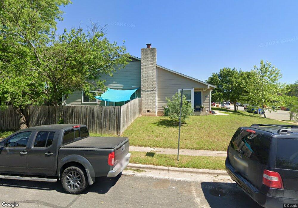
10604 Topperwein Dr Unit B Austin, TX 78758
North Austin NeighborhoodEstimated Value: $434,000 - $475,000
2
Beds
1
Bath
2,042
Sq Ft
$225/Sq Ft
Est. Value
About This Home
This home is located at 10604 Topperwein Dr Unit B, Austin, TX 78758 and is currently estimated at $459,841, approximately $225 per square foot. 10604 Topperwein Dr Unit B is a home located in Travis County with nearby schools including Cook Elementary School, Burnet Middle School, and Navarro Early College High School.
Ownership History
Date
Name
Owned For
Owner Type
Purchase Details
Closed on
Jun 16, 2014
Sold by
Horton Walter L
Bought by
Allibhoy Zuber
Current Estimated Value
Home Financials for this Owner
Home Financials are based on the most recent Mortgage that was taken out on this home.
Original Mortgage
$183,612
Outstanding Balance
$139,922
Interest Rate
4.25%
Mortgage Type
FHA
Estimated Equity
$319,919
Purchase Details
Closed on
May 30, 1997
Sold by
Mccarrick Timothy P and Bressette Kevin R
Bought by
Horton Walter L
Home Financials for this Owner
Home Financials are based on the most recent Mortgage that was taken out on this home.
Original Mortgage
$90,250
Interest Rate
8.17%
Create a Home Valuation Report for This Property
The Home Valuation Report is an in-depth analysis detailing your home's value as well as a comparison with similar homes in the area
Home Values in the Area
Average Home Value in this Area
Purchase History
| Date | Buyer | Sale Price | Title Company |
|---|---|---|---|
| Allibhoy Zuber | -- | None Available | |
| Horton Walter L | -- | Alamo Title Company |
Source: Public Records
Mortgage History
| Date | Status | Borrower | Loan Amount |
|---|---|---|---|
| Open | Allibhoy Zuber | $183,612 | |
| Previous Owner | Horton Walter L | $90,250 |
Source: Public Records
Tax History Compared to Growth
Tax History
| Year | Tax Paid | Tax Assessment Tax Assessment Total Assessment is a certain percentage of the fair market value that is determined by local assessors to be the total taxable value of land and additions on the property. | Land | Improvement |
|---|---|---|---|---|
| 2025 | $9,731 | $442,551 | $212,618 | $229,933 |
| 2023 | $9,679 | $534,982 | $275,000 | $259,982 |
| 2022 | $11,085 | $561,291 | $275,000 | $286,291 |
| 2021 | $8,141 | $374,004 | $125,000 | $249,004 |
| 2020 | $6,815 | $317,713 | $125,000 | $192,713 |
| 2018 | $5,827 | $263,209 | $125,000 | $179,648 |
| 2017 | $5,336 | $239,281 | $75,000 | $164,281 |
| 2016 | $4,444 | $199,266 | $60,000 | $139,266 |
| 2015 | $3,491 | $187,160 | $21,000 | $166,160 |
| 2014 | $3,491 | $146,713 | $21,000 | $125,713 |
Source: Public Records
Map
Nearby Homes
- 10606 Lanshire Dr Unit A&B
- 1712 Pine Knoll Dr
- 1810 Mearns Meadow Blvd
- 10407 Robinwood Cir
- 10424 Quail Ridge Dr
- 10410 Little Pebble Dr
- 10414 Quail Ridge Dr
- 10813 Hermosillo Dr Unit 1005
- 10721 Desert Trail
- 10219 W Rutland Village
- 10700 MacMora Rd Unit 116
- 10828 Desert Trail
- 10823 Desert Trail
- 10212 W Rutland Village
- 10814 Hermosillo Dr
- 10103 Oak Hollow Cir
- 10302 Button Quail Cove
- 10005 Quail Hutch Dr
- 10206 Cripple Creek Cove
- 1301 S Meadows Dr
- 10604 Topperwein Dr Unit A
- 10604 Topperwein Dr
- 10606 Topperwein Dr Unit B
- 10606 Topperwein Dr Unit a
- 10606 Topperwein Dr
- 10613 Lanshire Dr
- 10606 Topperwein Unit A Dr Unit A
- 10608 Topperwein Dr
- 10615 Lanshire Dr
- 10600 Lanshire Dr
- 10602 Lanshire Dr
- 10617 Lanshire Dr
- 10604 Lanshire Dr Unit B
- 10604 Lanshire Dr Unit A
- 10604 Lanshire Dr
- 10603 Topperwein Dr
- 10610 Topperwein Dr
- 10610 Topperwein Dr Unit B
- 10610 Topperwein Dr Unit A
- 10605 Topperwein Dr