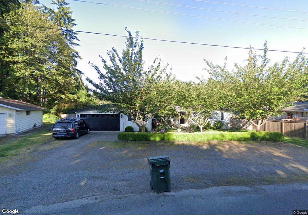
10606 Sierra Dr E Puyallup, WA 98374
Estimated Value: $486,000 - $604,000
3
Beds
2
Baths
2,116
Sq Ft
$264/Sq Ft
Est. Value
About This Home
This home is located at 10606 Sierra Dr E, Puyallup, WA 98374 and is currently estimated at $559,416, approximately $264 per square foot. 10606 Sierra Dr E is a home located in Pierce County with nearby schools including Sunrise Elementary School, Ferrucci Junior High School, and Emerald Ridge High School.
Ownership History
Date
Name
Owned For
Owner Type
Purchase Details
Closed on
Jul 26, 2011
Sold by
Us Bank National Association
Bought by
Jagosh David A
Current Estimated Value
Home Financials for this Owner
Home Financials are based on the most recent Mortgage that was taken out on this home.
Original Mortgage
$154,003
Outstanding Balance
$107,520
Interest Rate
4.75%
Mortgage Type
FHA
Estimated Equity
$451,896
Purchase Details
Closed on
Jul 14, 2010
Sold by
Jones Robert
Bought by
U S Bank National Association
Purchase Details
Closed on
Feb 28, 1996
Sold by
Keller Kelly C and Keller Kristina J
Bought by
Jones Robert T
Home Financials for this Owner
Home Financials are based on the most recent Mortgage that was taken out on this home.
Original Mortgage
$128,250
Interest Rate
7.04%
Create a Home Valuation Report for This Property
The Home Valuation Report is an in-depth analysis detailing your home's value as well as a comparison with similar homes in the area
Home Values in the Area
Average Home Value in this Area
Purchase History
| Date | Buyer | Sale Price | Title Company |
|---|---|---|---|
| Jagosh David A | $144,000 | Fidelity Natl Title Ins Co | |
| U S Bank National Association | $306,955 | None Available | |
| Jones Robert T | $135,000 | Transamerica Title Insurance |
Source: Public Records
Mortgage History
| Date | Status | Borrower | Loan Amount |
|---|---|---|---|
| Open | Jagosh David A | $154,003 | |
| Previous Owner | Jones Robert T | $128,250 |
Source: Public Records
Tax History Compared to Growth
Tax History
| Year | Tax Paid | Tax Assessment Tax Assessment Total Assessment is a certain percentage of the fair market value that is determined by local assessors to be the total taxable value of land and additions on the property. | Land | Improvement |
|---|---|---|---|---|
| 2025 | $5,065 | $527,600 | $211,700 | $315,900 |
| 2024 | $5,065 | $509,900 | $206,900 | $303,000 |
| 2023 | $5,065 | $477,600 | $196,200 | $281,400 |
| 2022 | $5,026 | $502,000 | $192,700 | $309,300 |
| 2021 | $4,638 | $357,000 | $121,900 | $235,100 |
| 2019 | $4,073 | $333,600 | $104,900 | $228,700 |
| 2018 | $4,112 | $311,800 | $96,400 | $215,400 |
| 2017 | $3,792 | $281,400 | $82,200 | $199,200 |
| 2016 | $3,373 | $221,700 | $65,800 | $155,900 |
| 2014 | $3,050 | $208,400 | $57,700 | $150,700 |
| 2013 | $3,050 | $187,500 | $50,500 | $137,000 |
Source: Public Records
Map
Nearby Homes
- 3501 27th St SE
- 2617 35th Ave SE
- 2927 Forest Rim Ct S
- 2921 Forest Rim Ct S
- 2622 31st Street Ct SE
- 2810 Cherokee Blvd
- 11312 134th Avenue Ct E
- 2303 Cherokee Blvd
- 11421 133rd Ave E
- 2331 40th Ave SE
- 2804 25th Avenue Ct SE
- 2202 28th Ave SE
- 11505 134th Avenue Ct E
- 2611 26th Ave SE
- 3719 27th Ave SE
- 3610 21st St SE
- 2503 25th St SE
- 4013 23rd St SE
- 4305 25th St SE
- 13208 116th Street Ct E
- 10612 Sierra Dr E
- 10602 Sierra Dr E
- 13022 107th St E
- 13021 107th St E
- 10702 Rampart Dr E
- 10603 Sierra Dr E
- 13019 107th St E
- 18417 107th St E Unit 500
- 13020 107th St E
- 10609 Sierra Dr E
- 10710 Rampart Dr E
- 2911 33rd Ave SE
- 3248 30th St SE
- 10714 Rampart Dr E
- 13016 107th St E
- 10619 Sierra Dr E
- 13013 107th St E
- 3240 30th St SE
- 10718 Rampart Dr E