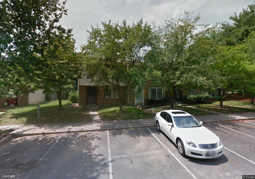
10606 Whiterock Ct Laurel, MD 20723
Estimated Value: $380,000 - $400,000
--
Bed
2
Baths
1,280
Sq Ft
$306/Sq Ft
Est. Value
About This Home
This home is located at 10606 Whiterock Ct, Laurel, MD 20723 and is currently estimated at $391,135, approximately $305 per square foot. 10606 Whiterock Ct is a home located in Howard County with nearby schools including Hammond Elementary School, Hammond Middle School, and Atholton High School.
Ownership History
Date
Name
Owned For
Owner Type
Purchase Details
Closed on
Aug 6, 1999
Sold by
Alan Mckinney Jeffrey
Bought by
Essex Rhonda S
Current Estimated Value
Purchase Details
Closed on
Mar 22, 1988
Sold by
Flynn Robert Lee
Bought by
Chick William F
Home Financials for this Owner
Home Financials are based on the most recent Mortgage that was taken out on this home.
Original Mortgage
$87,503
Interest Rate
9.92%
Create a Home Valuation Report for This Property
The Home Valuation Report is an in-depth analysis detailing your home's value as well as a comparison with similar homes in the area
Home Values in the Area
Average Home Value in this Area
Purchase History
| Date | Buyer | Sale Price | Title Company |
|---|---|---|---|
| Essex Rhonda S | $98,000 | -- | |
| Chick William F | $85,500 | -- |
Source: Public Records
Mortgage History
| Date | Status | Borrower | Loan Amount |
|---|---|---|---|
| Previous Owner | Chick William F | $87,503 | |
| Closed | Essex Rhonda S | -- |
Source: Public Records
Tax History Compared to Growth
Tax History
| Year | Tax Paid | Tax Assessment Tax Assessment Total Assessment is a certain percentage of the fair market value that is determined by local assessors to be the total taxable value of land and additions on the property. | Land | Improvement |
|---|---|---|---|---|
| 2025 | $4,318 | $286,100 | $155,000 | $131,100 |
| 2024 | $4,318 | $272,433 | $0 | $0 |
| 2023 | $4,081 | $258,767 | $0 | $0 |
| 2022 | $3,862 | $245,100 | $130,000 | $115,100 |
| 2021 | $3,708 | $239,733 | $0 | $0 |
| 2020 | $3,708 | $234,367 | $0 | $0 |
| 2019 | $3,630 | $229,000 | $80,000 | $149,000 |
| 2018 | $3,279 | $224,300 | $0 | $0 |
| 2017 | $3,135 | $229,000 | $0 | $0 |
| 2016 | -- | $214,900 | $0 | $0 |
| 2015 | -- | $211,000 | $0 | $0 |
| 2014 | -- | $207,100 | $0 | $0 |
Source: Public Records
Map
Nearby Homes
- 10665 Glen Hannah Dr
- 10687 Glen Hannah Dr
- 10633 Delfield Ct
- 10781 Scaggsville Rd
- 10520 Scaggsville Rd
- 10571 Scaggsville Rd
- 10417 Leslie Dr
- 8200 Splashing Brook Ct
- 7688 Blackbriar Way
- 7302 Isabella Rd
- 7323 Isabella Rd
- 10948 Scaggsville Rd
- 7700 Cultivator Rd
- 7840 Blackbriar Way
- 8208 Sandy Stream Rd
- 7858 Blackbriar Way
- 7862 Blackbriar Way
- 10681 Old Bond Mill Rd
- 7866 Blackbriar Way
- 7870 Blackbriar Way
- 10604 Whiterock Ct
- 10608 Whiterock Ct
- 10602 Whiterock Ct
- 10612 Whiterock Ct
- 10614 Whiterock Ct
- 10611 Glen Hannah Dr
- 10616 Whiterock Ct
- 10613 Glen Hannah Dr
- 10618 Whiterock Ct
- 10607 Glen Hannah Dr
- 10605 Glen Hannah Dr
- 10615 Glen Hannah Dr
- 10603 Glen Hannah Dr
- 10601 Glen Hannah Dr
- 10617 Glen Hannah Dr
- 10622 Whiterock Ct
- 10607 Whiterock Ct
- 10605 Whiterock Ct
- 10603 Whiterock Ct
- 10601 Whiterock Ct