Estimated Value: $157,193 - $167,000
2
Beds
1
Bath
1,100
Sq Ft
$147/Sq Ft
Est. Value
About This Home
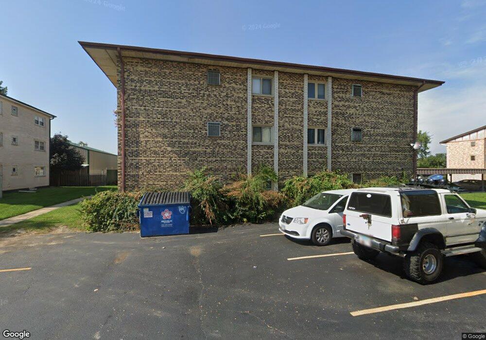
This home is located at 10607 Southwest Hwy Unit 2D, Worth, IL 60482 and is currently estimated at $162,048, approximately $147 per square foot. 10607 Southwest Hwy Unit 2D is a home located in Cook County with nearby schools including Worthwoods Elementary School, Worth Jr High School, and A B Shepard High School.
Ownership History
Date
Name
Owned For
Owner Type
Purchase Details
Closed on
Apr 4, 2003
Sold by
Lipka Cynthia M
Bought by
Lipka Michael and Lipka Cynthia M
Current Estimated Value
Home Financials for this Owner
Home Financials are based on the most recent Mortgage that was taken out on this home.
Original Mortgage
$81,500
Outstanding Balance
$35,320
Interest Rate
5.87%
Mortgage Type
Purchase Money Mortgage
Estimated Equity
$126,728
Purchase Details
Closed on
Jan 21, 1998
Sold by
Harn Michelle
Bought by
Smyth Laura E
Home Financials for this Owner
Home Financials are based on the most recent Mortgage that was taken out on this home.
Original Mortgage
$73,600
Interest Rate
7.24%
Create a Home Valuation Report for This Property
The Home Valuation Report is an in-depth analysis detailing your home's value as well as a comparison with similar homes in the area
Home Values in the Area
Average Home Value in this Area
Purchase History
| Date | Buyer | Sale Price | Title Company |
|---|---|---|---|
| Lipka Michael | -- | Cti | |
| Lipka Michael | -- | Cti | |
| Smyth Laura E | $77,500 | -- |
Source: Public Records
Mortgage History
| Date | Status | Borrower | Loan Amount |
|---|---|---|---|
| Open | Lipka Michael | $81,500 | |
| Closed | Lipka Michael | $81,500 | |
| Closed | Smyth Laura E | $73,600 |
Source: Public Records
Tax History Compared to Growth
Tax History
| Year | Tax Paid | Tax Assessment Tax Assessment Total Assessment is a certain percentage of the fair market value that is determined by local assessors to be the total taxable value of land and additions on the property. | Land | Improvement |
|---|---|---|---|---|
| 2024 | $3,785 | $13,889 | $824 | $13,065 |
| 2023 | $1,146 | $13,889 | $824 | $13,065 |
| 2022 | $1,146 | $6,136 | $1,146 | $4,990 |
| 2021 | $1,139 | $6,136 | $1,146 | $4,990 |
| 2020 | $1,204 | $6,136 | $1,146 | $4,990 |
| 2019 | $2,146 | $8,542 | $1,038 | $7,504 |
| 2018 | $2,911 | $10,399 | $1,038 | $9,361 |
| 2017 | $4,020 | $12,999 | $1,038 | $11,961 |
| 2016 | $1,828 | $6,583 | $859 | $5,724 |
| 2015 | $1,740 | $6,583 | $859 | $5,724 |
| 2014 | $1,729 | $6,583 | $859 | $5,724 |
| 2013 | $2,586 | $9,294 | $859 | $8,435 |
Source: Public Records
Map
Nearby Homes
- 7110 W 107th St Unit 16
- 10600 S Highland Ave
- 10718 S Worth Ave
- 10738 S Worth Ave
- 10512 Ridge Cove Dr Unit 11C
- 10516 Ridge Cove Dr Unit 36C
- 10738 S New England Ave
- 10840 S Harlem Ave
- 10630 Oak Park Ave
- 6806 W Lode Dr Unit 1B
- 10940 S Worth Ave Unit 1094011
- 10817 S Oak Park Ave
- 6708 W 107th St Unit 3C
- 7201 W 110th St
- 10900 S Rutherford Ave
- 10735 S Lloyd Dr
- 10440 Natoma Ave Unit 11
- 6856 W Crandall Ave
- 10701 S Nashville Ave
- 10288 Southwest Hwy Unit 3D
- 10607 Southwest Hwy Unit 3D
- 10607 Southwest Hwy Unit 1D
- 10607 Southwest Hwy Unit 1C
- 10607 Southwest Hwy Unit 2C
- 10607 Southwest Hwy Unit 1A
- 10607 Southwest Hwy Unit 2A
- 10607 Southwest Hwy Unit 3A
- 10607 Southwest Hwy Unit 1B
- 10607 Southwest Hwy Unit 3C
- 10607 Southwest Hwy Unit 3B
- 10609 Southwest Hwy Unit 1D
- 10609 Southwest Hwy Unit 2D
- 10609 Southwest Hwy Unit 3B
- 10609 Southwest Hwy Unit 3A
- 10609 Southwest Hwy Unit 1A
- 10609 Southwest Hwy Unit 3C
- 10609 Southwest Hwy Unit 1C
- 10609 Southwest Hwy Unit 2B
- 10609 Southwest Hwy Unit 2C
- 10609 Southwest Hwy Unit 1B