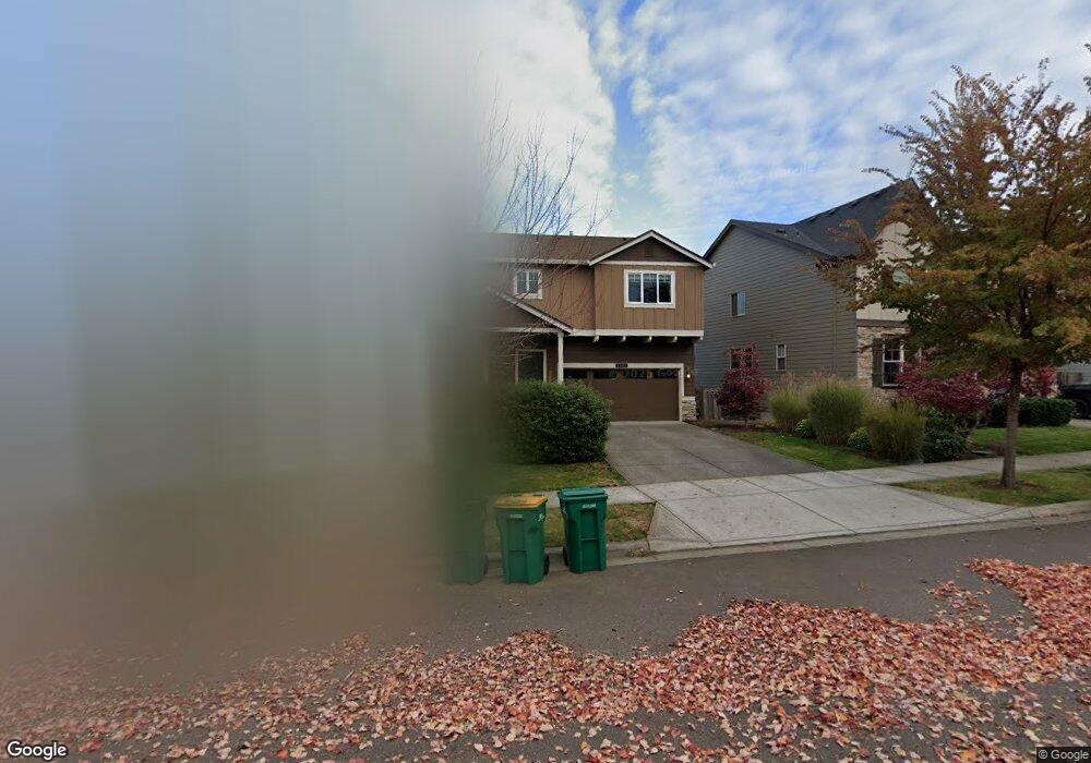
1061 Goff Rd Forest Grove, OR 97116
Estimated Value: $664,471 - $737,000
5
Beds
4
Baths
2,284
Sq Ft
$302/Sq Ft
Est. Value
About This Home
This home is located at 1061 Goff Rd, Forest Grove, OR 97116 and is currently estimated at $688,868, approximately $301 per square foot. 1061 Goff Rd is a home with nearby schools including Dilley Elementary School, Tom McCall Upper Elementary School, and Neil Armstrong Middle School.
Ownership History
Date
Name
Owned For
Owner Type
Purchase Details
Closed on
Jul 26, 2023
Sold by
Miller Michael J
Bought by
Miller Michael J and Hulen Elizabeth Catherine
Current Estimated Value
Purchase Details
Closed on
Aug 13, 2014
Sold by
D R Horton Inc Portland
Bought by
Miller Michael J
Home Financials for this Owner
Home Financials are based on the most recent Mortgage that was taken out on this home.
Original Mortgage
$248,995
Interest Rate
4.11%
Mortgage Type
New Conventional
Create a Home Valuation Report for This Property
The Home Valuation Report is an in-depth analysis detailing your home's value as well as a comparison with similar homes in the area
Home Values in the Area
Average Home Value in this Area
Purchase History
| Date | Buyer | Sale Price | Title Company |
|---|---|---|---|
| Miller Michael J | -- | None Listed On Document | |
| Miller Michael J | $348,995 | First American |
Source: Public Records
Mortgage History
| Date | Status | Borrower | Loan Amount |
|---|---|---|---|
| Previous Owner | Miller Michael J | $248,995 |
Source: Public Records
Tax History Compared to Growth
Tax History
| Year | Tax Paid | Tax Assessment Tax Assessment Total Assessment is a certain percentage of the fair market value that is determined by local assessors to be the total taxable value of land and additions on the property. | Land | Improvement |
|---|---|---|---|---|
| 2026 | $7,127 | $400,220 | -- | -- |
| 2025 | $7,127 | $388,570 | -- | -- |
| 2024 | $6,876 | $377,260 | -- | -- |
| 2023 | $6,876 | $366,280 | $0 | $0 |
| 2022 | $6,012 | $366,280 | $0 | $0 |
| 2021 | $5,934 | $345,270 | $0 | $0 |
| 2020 | $5,902 | $335,220 | $0 | $0 |
| 2019 | $5,771 | $325,460 | $0 | $0 |
| 2018 | $5,594 | $315,990 | $0 | $0 |
| 2017 | $5,421 | $306,790 | $0 | $0 |
| 2016 | $5,268 | $297,860 | $0 | $0 |
| 2015 | $5,113 | $291,890 | $0 | $0 |
| 2014 | $1,401 | $79,600 | $0 | $0 |
Source: Public Records
Map
Nearby Homes
- 2517 Sweetwood Ct
- 2440 Heather Way
- 1078 Vista Oaks Dr
- 1222 Brookside Ave
- 1104 Magnolia Way
- 1315 Begonia Ave
- 1609 Camino Dr
- 2819 Buxton St
- 1611 Camino Dr
- 1425 Willamina Ave
- 918 Rosebud Ct
- 922 Rosebud Ct
- 1316 19th Place
- 1224 Alyssum Ave
- 911 Rosebud Ct
- 920 Rosebud Ct
- 924 Rosebud Ct
- 1294 19th Ave
- 2108 D St
- 507-FH Plan at Parkview Terrace
- 1055 Goff Rd
- 1067 Goff Rd
- 1049 Goff Rd
- 1070 Stonewall Ave
- 1076 Stonewall Ave
- 1064 Stonewall Ave
- 1079 Goff Rd
- 1082 Stonewall Ave
- 2439 Sablewood Ct
- 1111 Goff Rd
- 1106 Stonewall Ave
- 1037 Goff Rd
- 1081 Andy Ave
- 1052 Stonewall Ave
- 2440 Sablewood Ct
- 2433 Sablewood Ct
- 1112 Stonewall Ave
- 1117 Goff Rd
- 1075 Andy Ave
- 1031 Goff Rd