
Seller's Agent in 2025
Richard Lunetta
Laer Realty
(978) 375-9717
3 in this area
4 Total Sales
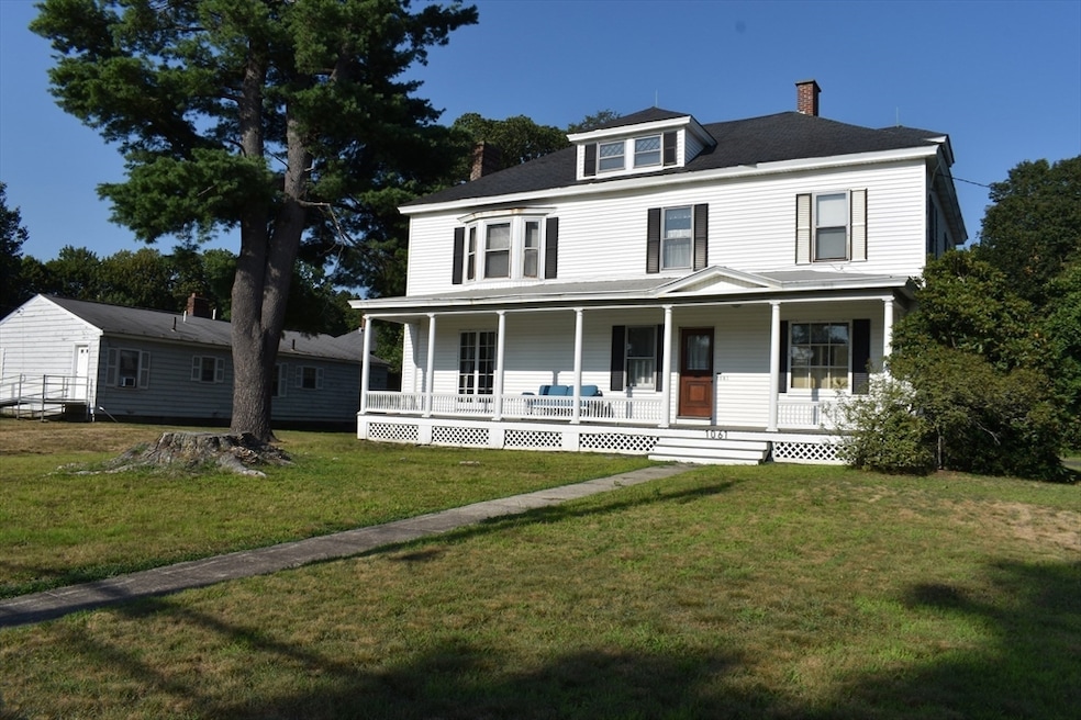
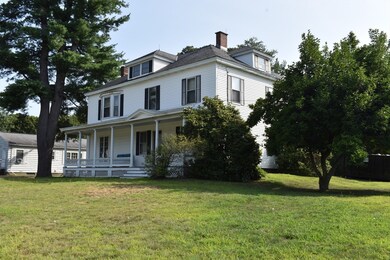
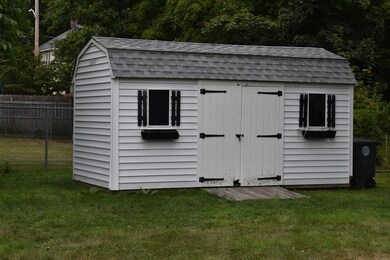
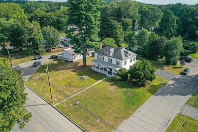
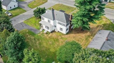
North Leominster vintage colonial in Johnny Appleseed school district that sits on a level corner lot of a dead end street. This home provides a beautiful foundation for someone looking to put their own touch on a property while also providing historic charm throughout. Elements including multiple stained glass windows, traditional column radiators, classic woodwork and a spacious foyer that is adorned with a bifurcated staircase. Large main bedroom on 2nd floor with access to a versatile three season porch which has numerous windows that allow for continuous sunlight throughout the day. The flat lot provides for a possible accessory dwelling unit (ADU). Minutes to both Route 2 and the commuter rail. All appliances convey .Safe in basement will convey.
Last Buyer's Agent
Sandra Skerrett
Keller Williams Pinnacle Central
| Date | Type | Sale Price | Title Company |
|---|---|---|---|
| Quit Claim Deed | $480,000 | -- | |
| Deed | -- | -- | |
| Deed | -- | -- | |
| Deed | $375,000 | -- | |
| Deed | -- | -- |
| Date | Status | Loan Amount | Loan Type |
|---|---|---|---|
| Open | $471,306 | FHA | |
| Previous Owner | $375,000 | Purchase Money Mortgage |
| Date | Event | Price | List to Sale | Price per Sq Ft |
|---|---|---|---|---|
| 10/03/2025 10/03/25 | Sold | $480,000 | 0.0% | $198 / Sq Ft |
| 08/25/2025 08/25/25 | Pending | -- | -- | -- |
| 08/15/2025 08/15/25 | For Sale | $479,900 | -- | $197 / Sq Ft |
| Year | Tax Paid | Tax Assessment Tax Assessment Total Assessment is a certain percentage of the fair market value that is determined by local assessors to be the total taxable value of land and additions on the property. | Land | Improvement |
|---|---|---|---|---|
| 2025 | $6,496 | $463,000 | $131,600 | $331,400 |
| 2024 | $6,290 | $433,500 | $125,300 | $308,200 |
| 2023 | $6,082 | $391,400 | $109,000 | $282,400 |
| 2022 | $5,851 | $353,300 | $94,800 | $258,500 |
| 2021 | $6,226 | $343,400 | $73,800 | $269,600 |
| 2020 | $6,092 | $338,800 | $73,800 | $265,000 |
| 2019 | $5,827 | $314,300 | $70,200 | $244,100 |
| 2018 | $5,184 | $268,200 | $68,200 | $200,000 |
| 2017 | $5,067 | $256,800 | $63,700 | $193,100 |
| 2016 | $4,709 | $240,500 | $63,700 | $176,800 |
| 2015 | $4,495 | $231,200 | $63,700 | $167,500 |
| 2014 | $4,086 | $216,300 | $70,400 | $145,900 |
Seller's Agent in 2025
Richard Lunetta
Laer Realty
(978) 375-9717
3 in this area
4 Total Sales
S
Buyer's Agent in 2025
Sandra Skerrett
Keller Williams Pinnacle Central
Source: MLS Property Information Network (MLS PIN)
MLS Number: 73417762
APN: LEOM-000276-000004
Disclaimer: Certain information contained herein is derived from information provided by parties other than Homes.com. All information provided is deemed reliable, but is not guaranteed to be accurate and should be independently verified.
![]() The property listing data and information, or the Images, set forth herein were provided to MLS Property Information Network, Inc. from third party sources, including sellers, lessors and public records, and were compiled by MLS Property Information Network, Inc. The property listing data and information, and the Images, are for the personal, non-commercial use of consumers having a good faith interest in purchasing or leasing listed properties of the type displayed to them and may not be used for any purpose other than to identify prospective properties which such consumers may have a good faith interest in purchasing or leasing. MLS Property Information Network, Inc. and its subscribers disclaim any and all representations and warranties as to the accuracy of the property listing data and information, or as to the accuracy of any of the Images, set forth herein.
The property listing data and information, or the Images, set forth herein were provided to MLS Property Information Network, Inc. from third party sources, including sellers, lessors and public records, and were compiled by MLS Property Information Network, Inc. The property listing data and information, and the Images, are for the personal, non-commercial use of consumers having a good faith interest in purchasing or leasing listed properties of the type displayed to them and may not be used for any purpose other than to identify prospective properties which such consumers may have a good faith interest in purchasing or leasing. MLS Property Information Network, Inc. and its subscribers disclaim any and all representations and warranties as to the accuracy of the property listing data and information, or as to the accuracy of any of the Images, set forth herein.
Ask me questions while you tour the home.