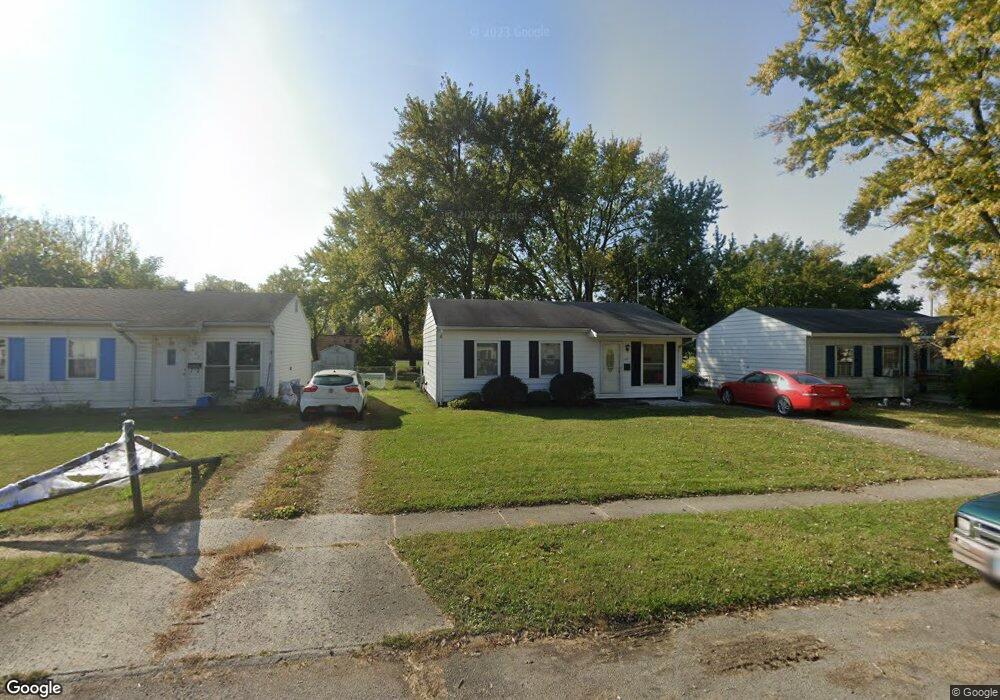
1061 National Dr Marion, OH 43302
Estimated Value: $91,003 - $124,000
3
Beds
1
Bath
800
Sq Ft
$129/Sq Ft
Est. Value
About This Home
This home is located at 1061 National Dr, Marion, OH 43302 and is currently estimated at $103,501, approximately $129 per square foot. 1061 National Dr is a home located in Marion County with nearby schools including James A. Garfield Elementary School, Ulysses S. Grant Middle School, and Harding High School.
Ownership History
Date
Name
Owned For
Owner Type
Purchase Details
Closed on
Mar 17, 1998
Bought by
Lewis Denver
Current Estimated Value
Purchase Details
Closed on
Apr 20, 1995
Bought by
Lewis Denver
Create a Home Valuation Report for This Property
The Home Valuation Report is an in-depth analysis detailing your home's value as well as a comparison with similar homes in the area
Home Values in the Area
Average Home Value in this Area
Purchase History
| Date | Buyer | Sale Price | Title Company |
|---|---|---|---|
| Lewis Denver | $15,000 | -- | |
| Lewis Denver | -- | -- |
Source: Public Records
Tax History Compared to Growth
Tax History
| Year | Tax Paid | Tax Assessment Tax Assessment Total Assessment is a certain percentage of the fair market value that is determined by local assessors to be the total taxable value of land and additions on the property. | Land | Improvement |
|---|---|---|---|---|
| 2024 | $679 | $18,090 | $2,250 | $15,840 |
| 2023 | $679 | $18,090 | $2,250 | $15,840 |
| 2022 | $629 | $18,090 | $2,250 | $15,840 |
| 2021 | $547 | $14,140 | $1,960 | $12,180 |
| 2020 | $547 | $14,140 | $1,960 | $12,180 |
| 2019 | $546 | $14,140 | $1,960 | $12,180 |
| 2018 | $454 | $11,740 | $1,960 | $9,780 |
| 2017 | $459 | $11,740 | $1,960 | $9,780 |
| 2016 | $469 | $11,740 | $1,960 | $9,780 |
| 2015 | $463 | $11,340 | $1,750 | $9,590 |
| 2014 | $465 | $11,340 | $1,750 | $9,590 |
| 2012 | $462 | $11,230 | $1,770 | $9,460 |
Source: Public Records
Map
Nearby Homes
- 472 Clinton St
- 950 Oak Grove Ave
- 625 Rochelle Dr
- 889 Oak Grove Ave
- 407 Latourette St
- 824 Oak Grove Ave
- 383 Brentwood Dr
- 796 Woodrow Ave
- 668 Uncapher Ave
- 579 Henry St
- 645 Henry St
- 716 Uncapher Ave
- 403 Uncapher Ave
- 512 Henry St
- 720 Woodrow Ave
- 681 Davids St
- 786 Sheridan Rd
- 757 Merkle Ave
- 772 Sheridan Rd
- 0 Bellefontaine Ave
- 1067 National Dr
- 1055 National Dr
- 1073 National Dr
- 1049 National Dr
- 1062 National Dr
- 1043 National Dr
- 574 Clinton St
- 1076 National Dr
- 537 Swiss Dr
- 1037 National Dr
- 1040 National Dr
- 1031 National Dr
- 531 Swiss Dr
- 536 Swiss Dr
- 542 Clinton St
- 530 Swiss Dr
- 1025 National Dr
- 525 Swiss Dr
- 571 Clinton St
- 1030 National Dr