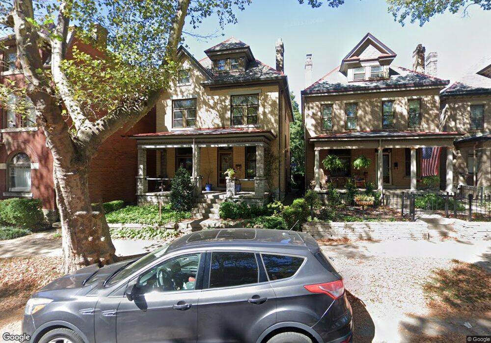
1061 Neil Ave Columbus, OH 43201
Victorian Village NeighborhoodEstimated Value: $556,000 - $627,000
4
Beds
3
Baths
1,800
Sq Ft
$324/Sq Ft
Est. Value
About This Home
This home is located at 1061 Neil Ave, Columbus, OH 43201 and is currently estimated at $583,595, approximately $324 per square foot. 1061 Neil Ave is a home located in Franklin County with nearby schools including Hubbard Elementary School, Dominion Middle School, and Whetstone High School.
Ownership History
Date
Name
Owned For
Owner Type
Purchase Details
Closed on
Apr 22, 2020
Sold by
Anderson Peter M and Anderson Kathleen M
Bought by
Anderson Nora and Sandman Anderson Irrevocable H
Current Estimated Value
Purchase Details
Closed on
Aug 8, 1989
Bought by
Anderson Peter M
Create a Home Valuation Report for This Property
The Home Valuation Report is an in-depth analysis detailing your home's value as well as a comparison with similar homes in the area
Home Values in the Area
Average Home Value in this Area
Purchase History
| Date | Buyer | Sale Price | Title Company |
|---|---|---|---|
| Anderson Nora | -- | None Available | |
| Anderson Peter M | $112,000 | -- |
Source: Public Records
Tax History Compared to Growth
Tax History
| Year | Tax Paid | Tax Assessment Tax Assessment Total Assessment is a certain percentage of the fair market value that is determined by local assessors to be the total taxable value of land and additions on the property. | Land | Improvement |
|---|---|---|---|---|
| 2024 | $7,954 | $177,240 | $77,000 | $100,240 |
| 2023 | $7,853 | $177,240 | $77,000 | $100,240 |
| 2022 | $8,372 | $161,420 | $32,900 | $128,520 |
| 2021 | $8,387 | $161,420 | $32,900 | $128,520 |
| 2020 | $8,398 | $161,420 | $32,900 | $128,520 |
| 2019 | $8,134 | $134,090 | $27,410 | $106,680 |
| 2018 | $7,670 | $132,270 | $27,410 | $104,860 |
| 2017 | $8,019 | $132,270 | $27,410 | $104,860 |
| 2016 | $8,078 | $121,940 | $26,530 | $95,410 |
| 2015 | $7,333 | $121,940 | $26,530 | $95,410 |
| 2014 | $7,351 | $121,940 | $26,530 | $95,410 |
| 2013 | $3,296 | $110,845 | $24,115 | $86,730 |
Source: Public Records
Map
Nearby Homes
- 337 Tappan St
- 1042 Neil Ave
- 319 W 2nd Ave Unit 319
- 1018 Neil Ave
- 1016 Neil Ave
- 994 Harrison Ave
- 1025 Hunter Ave
- 986 Highland St
- 1003 Pennsylvania Ave Unit 5
- 969 Hunter Ave
- 313 W 1st Ave
- 998 Ewing Alley Unit 998
- 162 E 2nd Ave
- 475 W 2nd Ave
- 1001 Dennison Ave
- 1245 Pennsylvania Ave
- 938 Hunter Ave
- 884 Neil Ave
- 1025 Oregon Ave
- 867-871 Delaware Ave
- 1065 Neil Ave
- 294 Tappan St
- 292 Tappan St
- 298 Tappan St
- 296 Tappan St
- 1069 Neil Ave Unit 73
- 288 Tappan St
- 304 Tappan St
- 302 Tappan St
- 1055 Neil Ave
- 1057 Neil Ave
- 1055 Neil Ave Unit B
- 1055 Neil Ave Unit E
- 1055 Neil Ave Unit D
- 1055 Neil Ave Unit C
- 1077 Neil Ave
- 310 Tappan St
- 295 Tappan St
- 314 Tappan St
- 1043 Neil Ave Unit 45