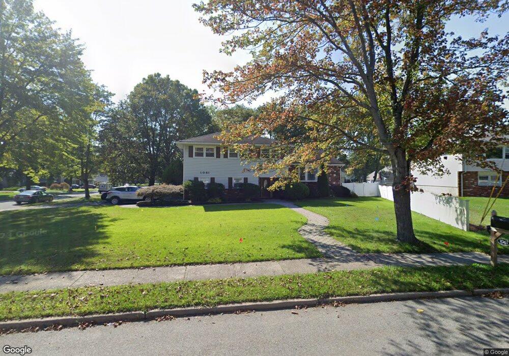
1061 Vail Rd Parsippany, NJ 07054
Estimated Value: $650,792 - $759,000
Studio
--
Bath
2,106
Sq Ft
$337/Sq Ft
Est. Value
About This Home
This home is located at 1061 Vail Rd, Parsippany, NJ 07054 and is currently estimated at $709,198, approximately $336 per square foot. 1061 Vail Rd is a home located in Morris County with nearby schools including Rockaway Meadow School, Central Middle School, and Parsippany High School.
Ownership History
Date
Name
Owned For
Owner Type
Purchase Details
Closed on
May 30, 2003
Sold by
Bhavaraju Murty
Bought by
Thomas Cliff and Thomas Joyce
Current Estimated Value
Home Financials for this Owner
Home Financials are based on the most recent Mortgage that was taken out on this home.
Original Mortgage
$360,000
Outstanding Balance
$156,896
Interest Rate
5.71%
Estimated Equity
$552,302
Purchase Details
Closed on
Nov 14, 2000
Sold by
Bhavaraju Murty and Bhavaraju Bharati
Bought by
Bhavaraju Bharati
Create a Home Valuation Report for This Property
The Home Valuation Report is an in-depth analysis detailing your home's value as well as a comparison with similar homes in the area
Home Values in the Area
Average Home Value in this Area
Purchase History
| Date | Buyer | Sale Price | Title Company |
|---|---|---|---|
| Thomas Cliff | $420,000 | -- | |
| Bhavaraju Bharati | -- | -- |
Source: Public Records
Mortgage History
| Date | Status | Borrower | Loan Amount |
|---|---|---|---|
| Open | Thomas Cliff | $360,000 |
Source: Public Records
Tax History
| Year | Tax Paid | Tax Assessment Tax Assessment Total Assessment is a certain percentage of the fair market value that is determined by local assessors to be the total taxable value of land and additions on the property. | Land | Improvement |
|---|---|---|---|---|
| 2025 | $11,347 | $321,800 | $144,700 | $177,100 |
| 2024 | $11,134 | $321,800 | $144,700 | $177,100 |
Source: Public Records
Map
Nearby Homes
- 15 Ridge Rd
- 52 Gordon Cir Unit 52
- 7 Carlson Place
- 32 Lake Shore Dr
- 14 Crescent Dr
- 90 Crown Point Rd
- 25 Wenonah Ave
- 28 Lincoln Gardens
- 18 Mohawk Ave
- 47 Nokomis Ave
- 60 White Oak Rd
- 49 Navajo Ave
- 13 Iroquois Ave
- 8 New England Dr
- 263 Lake Shore Dr
- 255 Knoll Rd
- 5 Vincent Dr
- 11 Merlin Place
- 20 Druid Hill Dr
- 171 Old Bloomfield Ave
Your Personal Tour Guide
Ask me questions while you tour the home.