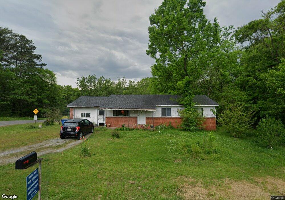
1061 Wilson Rd Rossville, GA 30741
Estimated Value: $153,170 - $193,000
--
Bed
1
Bath
1,075
Sq Ft
$157/Sq Ft
Est. Value
About This Home
This home is located at 1061 Wilson Rd, Rossville, GA 30741 and is currently estimated at $169,293, approximately $157 per square foot. 1061 Wilson Rd is a home located in Walker County with nearby schools including Rossville Elementary School, Rossville Middle School, and Ridgeland High School.
Ownership History
Date
Name
Owned For
Owner Type
Purchase Details
Closed on
Dec 16, 1991
Sold by
Brown Mildred Grace and Brown
Bought by
Clark Carmella Starr
Current Estimated Value
Purchase Details
Closed on
Apr 4, 1986
Sold by
Brown Mildred Grace
Bought by
Brown Mildred Grace and Brown
Purchase Details
Closed on
Dec 28, 1978
Sold by
Mcjunkin Grace
Bought by
Brown Mildred Grace
Purchase Details
Closed on
Jan 1, 1972
Sold by
Mcjunkin J Ray
Bought by
Mcjunkin Grace
Create a Home Valuation Report for This Property
The Home Valuation Report is an in-depth analysis detailing your home's value as well as a comparison with similar homes in the area
Home Values in the Area
Average Home Value in this Area
Purchase History
| Date | Buyer | Sale Price | Title Company |
|---|---|---|---|
| Clark Carmella Starr | -- | -- | |
| Brown Mildred Grace | -- | -- | |
| Brown Mildred Grace | -- | -- | |
| Mcjunkin Grace | -- | -- | |
| Mcjunkin J Ray | -- | -- |
Source: Public Records
Tax History Compared to Growth
Tax History
| Year | Tax Paid | Tax Assessment Tax Assessment Total Assessment is a certain percentage of the fair market value that is determined by local assessors to be the total taxable value of land and additions on the property. | Land | Improvement |
|---|---|---|---|---|
| 2024 | $1,080 | $47,741 | $2,712 | $45,029 |
| 2023 | $1,093 | $45,472 | $2,712 | $42,760 |
| 2022 | $922 | $35,043 | $1,356 | $33,687 |
| 2021 | $708 | $23,319 | $1,356 | $21,963 |
| 2020 | $643 | $20,055 | $1,356 | $18,699 |
| 2019 | $653 | $20,055 | $1,356 | $18,699 |
| 2018 | $531 | $20,055 | $1,356 | $18,699 |
| 2017 | $708 | $20,055 | $1,356 | $18,699 |
| 2016 | $621 | $20,055 | $1,356 | $18,699 |
| 2015 | $372 | $9,308 | $1,500 | $7,808 |
| 2014 | $300 | $9,308 | $1,500 | $7,808 |
| 2013 | -- | $21,982 | $1,500 | $20,482 |
Source: Public Records
Map
Nearby Homes
- 53 Charlsie Trail Unit 12
- 1014 Wilson Rd
- 635 N Sherry Dr
- 715 W James St
- 717 W James St
- 601 James St
- 5220 Fagan St
- 5343 Usher Dr
- 816 Indian Ave
- 724 Shelly Ln
- 5342 Slayton Ave
- 527 W Gordon Ave
- 1014 Lee Ave
- Lots 7 & 5 Slayton Ave
- 5413 Lee Ave
- 610 Union Ave
- 0 Slayton Ave Unit 1504633
- 126 S Liner St
- 509 W Gordon Ave
- 200 W Oak St
- 711 Luwana Dr
- 1111 Wilson Rd
- 1107 Wilson Rd
- 1048 Wilson Rd
- 1042 Wilson Rd
- 609 Mohawk St
- 1031 Wilson Rd
- 615 Mohawk St
- 1001 Escalon Dr
- 725 Luwana Dr
- 1036 Wilson Rd
- 610 Mohawk St
- 727 Luwana Dr
- 1102 Wilson Rd
- 1102 Wilson Rd
- 1102 Wilson Rd
- 1104 Glentana Rd
- 13 Charlsie Trail Unit 8
- 13 Charlsie Trail Unit 8
- 1030 Wilson Rd