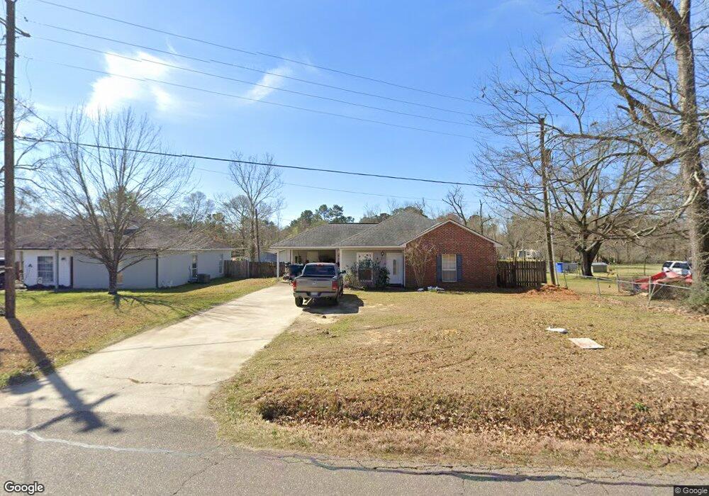
10610 Brown Rd Denham Springs, LA 70726
Estimated Value: $192,000 - $307,000
3
Beds
2
Baths
1,143
Sq Ft
$215/Sq Ft
Est. Value
About This Home
This home is located at 10610 Brown Rd, Denham Springs, LA 70726 and is currently estimated at $245,805, approximately $215 per square foot. 10610 Brown Rd is a home located in Livingston Parish with nearby schools including Juban Parc Elementary School, Juban Parc Junior High School, and Denham Springs Freshman High School.
Ownership History
Date
Name
Owned For
Owner Type
Purchase Details
Closed on
Apr 23, 2024
Sold by
Parish Of Livingston and Bank Of St Francisville
Bought by
Tdp Group Llc and Beeland Properties Llc
Current Estimated Value
Purchase Details
Closed on
May 18, 2007
Sold by
Erfurt Bryan Scott
Bought by
Mccain Clair H and Mccain Holly B
Home Financials for this Owner
Home Financials are based on the most recent Mortgage that was taken out on this home.
Original Mortgage
$109,800
Interest Rate
7.85%
Mortgage Type
Adjustable Rate Mortgage/ARM
Create a Home Valuation Report for This Property
The Home Valuation Report is an in-depth analysis detailing your home's value as well as a comparison with similar homes in the area
Home Values in the Area
Average Home Value in this Area
Purchase History
| Date | Buyer | Sale Price | Title Company |
|---|---|---|---|
| Tdp Group Llc | -- | None Listed On Document | |
| Mccain Clair H | $122,000 | Milestone Title Inc |
Source: Public Records
Mortgage History
| Date | Status | Borrower | Loan Amount |
|---|---|---|---|
| Previous Owner | Mccain Clair H | $120,531 | |
| Previous Owner | Mccain Clair H | $109,800 |
Source: Public Records
Tax History Compared to Growth
Tax History
| Year | Tax Paid | Tax Assessment Tax Assessment Total Assessment is a certain percentage of the fair market value that is determined by local assessors to be the total taxable value of land and additions on the property. | Land | Improvement |
|---|---|---|---|---|
| 2024 | $1,626 | $15,335 | $3,730 | $11,605 |
| 2023 | $1,307 | $11,080 | $2,910 | $8,170 |
| 2022 | $1,317 | $11,080 | $2,910 | $8,170 |
| 2021 | $1,321 | $11,080 | $2,910 | $8,170 |
| 2020 | $1,305 | $11,080 | $2,910 | $8,170 |
| 2019 | $1,082 | $9,140 | $2,240 | $6,900 |
| 2018 | $1,097 | $9,140 | $2,240 | $6,900 |
| 2017 | $1,052 | $8,800 | $2,240 | $6,560 |
| 2015 | $145 | $8,710 | $1,940 | $6,770 |
| 2014 | $148 | $8,710 | $1,940 | $6,770 |
Source: Public Records
Map
Nearby Homes
- 10509 Brown Rd
- 25547 Juban Rd
- 25411 Juban Rd
- 25286 Juban Rd
- 10373 Carter Hills Ave
- 2.06 acres Woodridge St
- 10296 Carter Hills Ave
- 26222 Avoyelles Ave
- 26267 Avoyelles Ave
- 26264 Avoyelles Ave
- 26270 Avoyelles Ave
- 26288 Avoyelles Ave
- 10119 Serene Rd
- 10486 Sherrie Ln
- 26351 Avoyelles Ave
- 25717 Tarver Dr
- 10735 Sherrie Ln
- 11257 Abbey Ln
- 26072 Purdy Ave
- 25717 Tarver St
- 10620 Brown Rd
- 24662 Spillers Ranch Rd
- 10630 Brown Rd
- 10590 Brown Rd
- 10595 Brown Rd
- 10625 Brown Rd
- 10662 Brown Rd
- 10555 Brown Rd
- 10696 Brown Rd
- 24684 Spillers Ranch Rd
- 25522 Ashland Bend Dr
- 10533 Brown Rd
- 24714 Spillers Ranch Rd
- 10655 Brown Rd
- 10520 Brown Rd
- 25531 Ashland Bend Dr
- 10734 Brown Rd
- 10680 Brown Rd
- 25532 Ashland Bend Dr
- 25545 Ashland Bend Dr