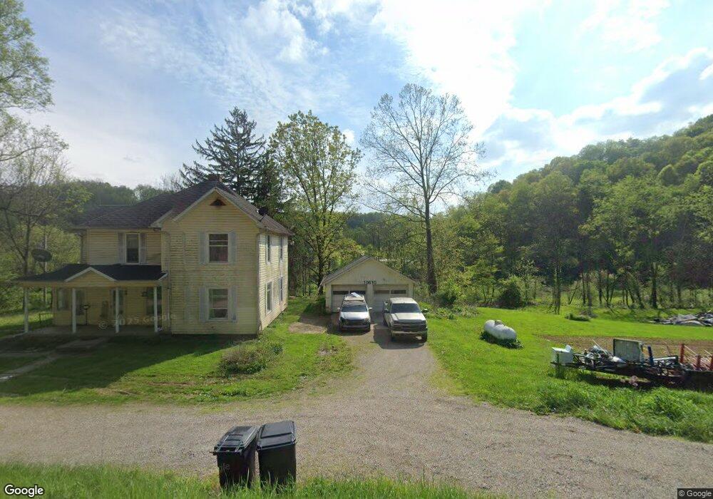
10610 Coshocton Rd New Concord, OH 43762
Estimated Value: $196,000 - $365,000
4
Beds
2
Baths
2,036
Sq Ft
$141/Sq Ft
Est. Value
About This Home
This home is located at 10610 Coshocton Rd, New Concord, OH 43762 and is currently estimated at $287,973, approximately $141 per square foot. 10610 Coshocton Rd is a home located in Muskingum County with nearby schools including New Concord Elementary School, East Muskingum Middle School, and Larry Miller Intermediate Elementary School.
Ownership History
Date
Name
Owned For
Owner Type
Purchase Details
Closed on
Oct 15, 2012
Sold by
Hammond Chad and Hammond Chad Earl
Bought by
Shields Todd R
Current Estimated Value
Purchase Details
Closed on
Feb 4, 2008
Sold by
Davis Rodney L and Davis Timothy L
Bought by
Hammond Chad and Hammond Chad Earl
Home Financials for this Owner
Home Financials are based on the most recent Mortgage that was taken out on this home.
Original Mortgage
$76,101
Interest Rate
6.22%
Mortgage Type
VA
Create a Home Valuation Report for This Property
The Home Valuation Report is an in-depth analysis detailing your home's value as well as a comparison with similar homes in the area
Home Values in the Area
Average Home Value in this Area
Purchase History
| Date | Buyer | Sale Price | Title Company |
|---|---|---|---|
| Shields Todd R | $32,000 | None Available | |
| Hammond Chad | $74,500 | Attorney |
Source: Public Records
Mortgage History
| Date | Status | Borrower | Loan Amount |
|---|---|---|---|
| Previous Owner | Hammond Chad | $76,101 |
Source: Public Records
Tax History Compared to Growth
Tax History
| Year | Tax Paid | Tax Assessment Tax Assessment Total Assessment is a certain percentage of the fair market value that is determined by local assessors to be the total taxable value of land and additions on the property. | Land | Improvement |
|---|---|---|---|---|
| 2024 | $1,827 | $53,900 | $4,620 | $49,280 |
| 2023 | $1,150 | $31,710 | $2,310 | $29,400 |
| 2022 | $1,129 | $31,710 | $2,310 | $29,400 |
| 2021 | $1,116 | $31,710 | $2,310 | $29,400 |
| 2020 | $1,045 | $28,875 | $2,100 | $26,775 |
| 2019 | $1,040 | $28,875 | $2,100 | $26,775 |
| 2018 | $1,063 | $28,875 | $2,100 | $26,775 |
| 2017 | $928 | $24,465 | $1,960 | $22,505 |
| 2016 | $924 | $24,330 | $1,960 | $22,370 |
| 2015 | $947 | $24,330 | $1,960 | $22,370 |
| 2013 | $989 | $24,330 | $1,960 | $22,370 |
Source: Public Records
Map
Nearby Homes
- 14240 Cr 410 Lot# 58
- 16286 Ohio 93
- 6825 Barr Rd
- 2250 Indian Camp Run Rd
- 16386 Township Road 118
- 5580 Friendship Dr
- 68477 Geese Rd
- 16842 Township Road 118
- 67655 Geese Rd
- 0 Geese Rd
- 49694 Township Road 146
- 3688 Indian Camp Run Rd
- 203 Main St
- 7255 Mitchell Ln
- 17567 Township Road 278
- 0 Norfield Unit 5124761
- 17418 Tr 118
- 7855 East St
- 15713 State Route 16
- 64895 Lovers Lane Rd
- 10535 Coshocton Rd
- 10660 Coshocton Rd
- 10655 Coshocton Rd
- 10730 Coshocton Rd
- 10450 Coshocton Rd
- 10740 Coshocton Rd
- 10435 Wolfe Ln
- 10870 Coshocton Rd
- 10355 Wolfe Ln
- 10745 Wolfe Ln
- 10380 Wolfe Ln
- 10935 Coshocton Rd
- 10945 Coshocton Rd
- 10945 Coshocton Rd
- 10800 Wolfe Ln
- 10940 Coshocton Rd
- 10995 Coshocton Rd
- 10269 Castor Rd
- 11000 Coshocton Rd
- 10275 Castor Rd