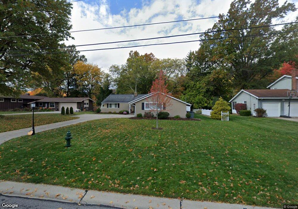
10612 King Coe Ln Strongsville, OH 44149
Estimated Value: $328,562 - $352,000
3
Beds
3
Baths
1,793
Sq Ft
$192/Sq Ft
Est. Value
About This Home
This home is located at 10612 King Coe Ln, Strongsville, OH 44149 and is currently estimated at $344,141, approximately $191 per square foot. 10612 King Coe Ln is a home located in Cuyahoga County with nearby schools including Strongsville High School and Sts Joseph & John Interparochial School.
Ownership History
Date
Name
Owned For
Owner Type
Purchase Details
Closed on
Jun 19, 2002
Sold by
Turk Francis J and Turk Francis Jerome
Bought by
Rush Michael D and Rush Debra A
Current Estimated Value
Home Financials for this Owner
Home Financials are based on the most recent Mortgage that was taken out on this home.
Original Mortgage
$124,000
Interest Rate
6.32%
Purchase Details
Closed on
May 21, 1998
Sold by
Estate Of Patricia F Turk
Bought by
Turk Francis Jerome
Purchase Details
Closed on
Sep 26, 1979
Sold by
Textoris John L
Bought by
Turk Francis J and Turk Patricia F
Purchase Details
Closed on
Oct 17, 1978
Sold by
Mcmurray Wm E and Mcmurray Anne
Bought by
Textoris John L
Purchase Details
Closed on
Jan 1, 1975
Bought by
Mcmurray Wm E and Mcmurray Anne
Create a Home Valuation Report for This Property
The Home Valuation Report is an in-depth analysis detailing your home's value as well as a comparison with similar homes in the area
Home Values in the Area
Average Home Value in this Area
Purchase History
| Date | Buyer | Sale Price | Title Company |
|---|---|---|---|
| Rush Michael D | $155,000 | -- | |
| Turk Francis Jerome | -- | -- | |
| Turk Francis J | $90,000 | -- | |
| Textoris John L | $89,000 | -- | |
| Mcmurray Wm E | -- | -- |
Source: Public Records
Mortgage History
| Date | Status | Borrower | Loan Amount |
|---|---|---|---|
| Previous Owner | Rush Michael D | $124,000 |
Source: Public Records
Tax History Compared to Growth
Tax History
| Year | Tax Paid | Tax Assessment Tax Assessment Total Assessment is a certain percentage of the fair market value that is determined by local assessors to be the total taxable value of land and additions on the property. | Land | Improvement |
|---|---|---|---|---|
| 2024 | $4,667 | $99,400 | $21,560 | $77,840 |
| 2023 | $4,517 | $72,140 | $18,450 | $53,690 |
| 2022 | $4,484 | $72,140 | $18,450 | $53,690 |
| 2021 | $4,449 | $72,140 | $18,450 | $53,690 |
| 2020 | $4,411 | $63,280 | $16,170 | $47,110 |
| 2019 | $4,282 | $180,800 | $46,200 | $134,600 |
| 2018 | $3,946 | $63,280 | $16,170 | $47,110 |
| 2017 | $4,080 | $61,500 | $13,230 | $48,270 |
| 2016 | $4,047 | $61,500 | $13,230 | $48,270 |
| 2015 | $3,985 | $61,500 | $13,230 | $48,270 |
| 2014 | $3,985 | $59,720 | $12,850 | $46,870 |
Source: Public Records
Map
Nearby Homes
- 19240 Briarwood Ln
- 10986 Fawn Meadow Ln
- 11179 Fawn Meadow Ln
- 19890 Idlewood Trail
- 11432 Pearl Rd
- 11499 Pearl Rd Unit A106
- 19997 Idlewood Trail
- 20050 Idlewood Trail
- 20424 Scotch Pine Way
- 9401 Pheasant Run Place
- 11650 River Moss Rd
- 18433 Whitney Rd
- 18336 Falling Water Rd
- 20684 Albion Rd
- 12385 Corinth Ct
- 12539 Olympus Way
- 12647 Edgepark Cir
- 12694 Ionia Ct
- 10839 Prospect Rd
- 17945 Cliffside Dr
- 10660 King Coe Ln
- 10570 King Coe Ln
- 10567 Jerry Coe Ln
- 10613 Jerry Coe Ln
- 10702 King Coe Ln
- 10526 King Coe Ln
- 10575 King Coe Ln
- 10617 King Coe Ln
- 10617 Jerry Coe Ln
- 10567 King Coe Ln
- 10665 King Coe Ln
- 10480 King Coe Ln
- 10485 King Coe Ln
- 10665 Jerry Coe Ln
- 19162 Albion Rd
- 10432 King Coe Ln
- 10616 Jerry Coe Ln
- 10570 Jerry Coe Ln
- 10484 Jerry Coe Ln
- 10437 King Coe Ln