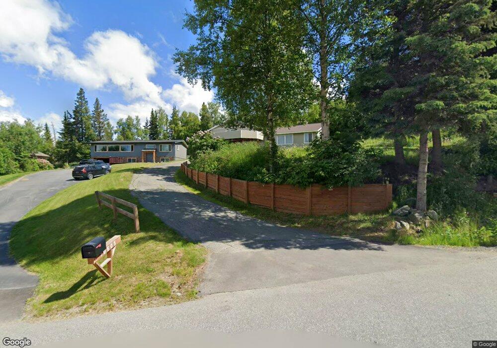
10615 Main Tree Dr Anchorage, AK 99507
Mid-Hillside NeighborhoodEstimated Value: $533,000 - $626,000
3
Beds
3
Baths
1,869
Sq Ft
$309/Sq Ft
Est. Value
About This Home
This home is located at 10615 Main Tree Dr, Anchorage, AK 99507 and is currently estimated at $577,449, approximately $308 per square foot. 10615 Main Tree Dr is a home located in Anchorage Municipality with nearby schools including O'Malley Elementary School, Hanshew Middle School, and Service High School.
Ownership History
Date
Name
Owned For
Owner Type
Purchase Details
Closed on
Apr 25, 2025
Sold by
Schubert Carolyn G
Bought by
Schubert Edward L and Schubert Evan L
Current Estimated Value
Purchase Details
Closed on
Aug 20, 1992
Sold by
Fedje Raymond Norman and Fedje Betty Thompson
Bought by
Oba Gail R and Aarons Charles
Home Financials for this Owner
Home Financials are based on the most recent Mortgage that was taken out on this home.
Original Mortgage
$160,650
Interest Rate
8.08%
Mortgage Type
New Conventional
Create a Home Valuation Report for This Property
The Home Valuation Report is an in-depth analysis detailing your home's value as well as a comparison with similar homes in the area
Home Values in the Area
Average Home Value in this Area
Purchase History
| Date | Buyer | Sale Price | Title Company |
|---|---|---|---|
| Schubert Edward L | -- | None Listed On Document | |
| Oba Gail R | -- | -- |
Source: Public Records
Mortgage History
| Date | Status | Borrower | Loan Amount |
|---|---|---|---|
| Previous Owner | Oba Gail R | $160,650 |
Source: Public Records
Tax History
| Year | Tax Paid | Tax Assessment Tax Assessment Total Assessment is a certain percentage of the fair market value that is determined by local assessors to be the total taxable value of land and additions on the property. | Land | Improvement |
|---|---|---|---|---|
| 2025 | $3,911 | $526,000 | $136,800 | $389,200 |
| 2024 | $3,911 | $486,000 | $130,100 | $355,900 |
| 2023 | $6,719 | $432,100 | $124,500 | $307,600 |
| 2022 | $3,576 | $427,800 | $124,400 | $303,400 |
| 2021 | $6,697 | $397,000 | $124,400 | $272,600 |
| 2020 | $4,994 | $386,100 | $124,400 | $261,700 |
| 2019 | $5,112 | $387,400 | $124,400 | $263,000 |
| 2018 | $5,110 | $387,500 | $141,600 | $245,900 |
| 2017 | $5,584 | $396,300 | $141,600 | $254,700 |
| 2016 | $4,632 | $406,500 | $141,600 | $264,900 |
| 2015 | $4,632 | $389,800 | $137,500 | $252,300 |
| 2014 | $4,632 | $367,300 | $123,500 | $243,800 |
Source: Public Records
Map
Nearby Homes
- 6815 Double Tree Ct
- 6770 Round Tree Dr
- 6324 Red Tree Cir
- 9850 Main Tree Dr
- 11100 Hideaway Trail
- 0 Rd
- 7509 Beacon Hill Dr
- 11601 Hillside Dr
- 5500 E 98th Ave
- L2 Totem Rd
- 5300 Shaun Cir
- 000 Valley View Dr
- L5 Panorama Dr
- L7 Panorama Dr
- L13 Panorama Dr
- L3 Panorama Dr
- L1 Panorama Dr
- L9 Panorama Dr
- L6 Panorama Dr
- L2 Panorama Dr
- 10605 Main Tree Dr
- 10625 Main Tree Dr
- 6707 Double Tree Ct
- 10525 Main Tree Dr
- 10600 Main Tree Dr
- 6706 Double Tree Ct
- 6717 Double Tree Ct
- 10515 Main Tree Dr
- 10705 Main Tree Dr
- 10704 Main Tree Dr
- 10524 Main Tree Dr
- 10621 Lone Tree Dr
- 10505 Main Tree Dr
- 6716 Double Tree Ct
- 6727 Double Tree Ct
- 10714 Main Tree Dr
- 10650 Lone Tree Dr
- 10601 Lone Tree Dr
- 10514 Main Tree Dr
- 10715 Main Tree Dr
Your Personal Tour Guide
Ask me questions while you tour the home.