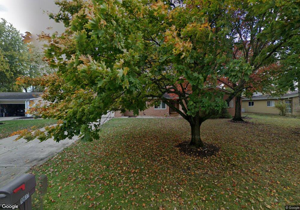
10617 King Coe Ln Strongsville, OH 44149
Estimated Value: $325,517 - $372,000
3
Beds
3
Baths
1,665
Sq Ft
$206/Sq Ft
Est. Value
About This Home
This home is located at 10617 King Coe Ln, Strongsville, OH 44149 and is currently estimated at $342,629, approximately $205 per square foot. 10617 King Coe Ln is a home located in Cuyahoga County with nearby schools including Strongsville High School and Sts Joseph & John Interparochial School.
Ownership History
Date
Name
Owned For
Owner Type
Purchase Details
Closed on
Nov 16, 2022
Sold by
Fizer Timothy S and Fizer Ray W
Bought by
Fizer Timothy S and Fizer Ray W
Current Estimated Value
Purchase Details
Closed on
Jun 20, 2007
Sold by
Jago Curtis L and Jago Rick
Bought by
Fizer Timothy S and Fizer Ray W
Home Financials for this Owner
Home Financials are based on the most recent Mortgage that was taken out on this home.
Original Mortgage
$116,000
Interest Rate
6.26%
Mortgage Type
Purchase Money Mortgage
Purchase Details
Closed on
Mar 27, 1998
Sold by
Estate Of James A Ross
Bought by
Ross Mary E
Purchase Details
Closed on
Jan 1, 1975
Bought by
Ross James A and Ross Mary
Create a Home Valuation Report for This Property
The Home Valuation Report is an in-depth analysis detailing your home's value as well as a comparison with similar homes in the area
Home Values in the Area
Average Home Value in this Area
Purchase History
| Date | Buyer | Sale Price | Title Company |
|---|---|---|---|
| Fizer Timothy S | -- | None Listed On Document | |
| Fizer Timothy S | $145,000 | Attorney | |
| Ross Mary E | -- | -- | |
| Ross James A | -- | -- |
Source: Public Records
Mortgage History
| Date | Status | Borrower | Loan Amount |
|---|---|---|---|
| Previous Owner | Fizer Timothy S | $116,000 |
Source: Public Records
Tax History Compared to Growth
Tax History
| Year | Tax Paid | Tax Assessment Tax Assessment Total Assessment is a certain percentage of the fair market value that is determined by local assessors to be the total taxable value of land and additions on the property. | Land | Improvement |
|---|---|---|---|---|
| 2024 | $4,686 | $97,475 | $22,260 | $75,215 |
| 2023 | $4,404 | $68,850 | $18,870 | $49,980 |
| 2022 | $4,373 | $68,850 | $18,870 | $49,980 |
| 2021 | $4,342 | $68,850 | $18,870 | $49,980 |
| 2020 | $4,307 | $60,410 | $16,560 | $43,860 |
| 2019 | $4,183 | $172,600 | $47,300 | $125,300 |
| 2018 | $3,806 | $60,410 | $16,560 | $43,860 |
| 2017 | $3,853 | $56,630 | $13,510 | $43,120 |
| 2016 | $3,822 | $56,630 | $13,510 | $43,120 |
| 2015 | $3,665 | $56,630 | $13,510 | $43,120 |
| 2014 | $3,665 | $53,520 | $13,130 | $40,390 |
Source: Public Records
Map
Nearby Homes
- 19240 Briarwood Ln
- 10986 Fawn Meadow Ln
- 11432 Pearl Rd
- 11179 Fawn Meadow Ln
- 11499 Pearl Rd Unit A106
- 19890 Idlewood Trail
- 19997 Idlewood Trail
- 20050 Idlewood Trail
- 20424 Scotch Pine Way
- 11650 River Moss Rd
- 18336 Falling Water Rd
- 12385 Corinth Ct
- 12539 Olympus Way
- 18433 Whitney Rd
- 9401 Pheasant Run Place
- 20684 Albion Rd
- 12647 Edgepark Cir
- 17945 Cliffside Dr
- 18248 Meadow Ln
- 12694 Ionia Ct
- 10665 King Coe Ln
- 10575 King Coe Ln
- 10567 King Coe Ln
- 10612 King Coe Ln
- 10660 King Coe Ln
- 10570 King Coe Ln
- 19162 Albion Rd
- 10702 King Coe Ln
- 10485 King Coe Ln
- 10526 King Coe Ln
- 10800 Pearl Rd Unit B4
- 10800 Pearl Rd Unit B7
- 10800 Pearl Rd Unit B5
- 10800 Pearl Rd Unit A-8
- 10800 Pearl Rd
- 10800 Pearl Rd Unit B6-B7
- 10800 Pearl Rd Unit B-4 & B-8
- 10750 Pearl Rd Unit E2
- 10750 Pearl Rd Unit E4
- 10750 Pearl Rd Unit 7 & 8