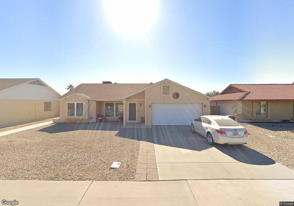
10617 W Griswold Rd Peoria, AZ 85345
Estimated Value: $292,265 - $385,000
--
Bed
2
Baths
1,380
Sq Ft
$254/Sq Ft
Est. Value
About This Home
This home is located at 10617 W Griswold Rd, Peoria, AZ 85345 and is currently estimated at $350,066, approximately $253 per square foot. 10617 W Griswold Rd is a home located in Maricopa County with nearby schools including Country Meadows Elementary School, Raymond S. Kellis, and Brighton Charter School.
Ownership History
Date
Name
Owned For
Owner Type
Purchase Details
Closed on
Aug 23, 2002
Sold by
Colvin Hector O
Bought by
Colvin Hector O and Colvin Jacquelin L
Current Estimated Value
Purchase Details
Closed on
Mar 28, 1997
Sold by
Lang Ted R and Lang Connie S
Bought by
Colvin Hector O
Home Financials for this Owner
Home Financials are based on the most recent Mortgage that was taken out on this home.
Original Mortgage
$85,327
Interest Rate
8.13%
Mortgage Type
FHA
Purchase Details
Closed on
Sep 22, 1995
Sold by
Kooy Paul J and Kooy Kathleen L
Bought by
Lang Ted R and Lang Connie S
Home Financials for this Owner
Home Financials are based on the most recent Mortgage that was taken out on this home.
Original Mortgage
$62,000
Interest Rate
7.59%
Mortgage Type
New Conventional
Create a Home Valuation Report for This Property
The Home Valuation Report is an in-depth analysis detailing your home's value as well as a comparison with similar homes in the area
Home Values in the Area
Average Home Value in this Area
Purchase History
| Date | Buyer | Sale Price | Title Company |
|---|---|---|---|
| Colvin Hector O | -- | -- | |
| Colvin Hector O | $85,900 | First American Title | |
| Lang Ted R | $78,000 | North American Title Agency |
Source: Public Records
Mortgage History
| Date | Status | Borrower | Loan Amount |
|---|---|---|---|
| Previous Owner | Colvin Hector O | $85,327 | |
| Previous Owner | Lang Ted R | $62,000 |
Source: Public Records
Tax History Compared to Growth
Tax History
| Year | Tax Paid | Tax Assessment Tax Assessment Total Assessment is a certain percentage of the fair market value that is determined by local assessors to be the total taxable value of land and additions on the property. | Land | Improvement |
|---|---|---|---|---|
| 2025 | $810 | $10,404 | -- | -- |
| 2024 | $798 | $9,909 | -- | -- |
| 2023 | $798 | $25,170 | $5,030 | $20,140 |
| 2022 | $781 | $19,550 | $3,910 | $15,640 |
| 2021 | $836 | $17,370 | $3,470 | $13,900 |
| 2020 | $844 | $16,230 | $3,240 | $12,990 |
| 2019 | $817 | $14,460 | $2,890 | $11,570 |
| 2018 | $790 | $12,970 | $2,590 | $10,380 |
| 2017 | $790 | $11,550 | $2,310 | $9,240 |
| 2016 | $782 | $10,560 | $2,110 | $8,450 |
| 2015 | $730 | $9,630 | $1,920 | $7,710 |
Source: Public Records
Map
Nearby Homes
- 8161 N 107th Ave Unit 109
- 8131 N 107th Ave Unit 74
- 8131 N 107th Ave Unit 66
- 8131 N 107th Ave Unit 82
- 10516 W Griswold Rd
- 8101 N 107th Ave Unit 23
- 10620 W Northern Ave Unit 5
- 8140 N 107th Ave Unit 125
- 8140 N 107th Ave Unit 287
- 10815 W Northern Ave Unit 102
- 10512 W Butler Dr
- 8435 N 104th Dr Unit 3
- 8582 N 107th Ln
- 11003 W Griswold Rd
- 8566 N 108th Ln
- 10603 W Ruth Ave
- 10512 W Ruth Ave
- 8800 N 107th Ave Unit 17
- 8800 N 107th Ave Unit 19
- 8800 N 107th Ave Unit 52
- 8161 N 107th Ave Unit 99
- 8161 N 107th Ave Unit 98
- 8161 N 107th Ave Unit 100
- 8161 N 107th Ave
- 8161 N 107th Ave Unit 103
- 8161 N 107th Ave Unit 102
- 8161 N 107th Ave Unit 108
- 8161 N 107th Ave Unit 106
- 8161 N 107th Ave Unit 119
- 8161 N 107th Ave Unit 114
- 8161 N 107th Ave Unit 118
- 8161 N 107th Ave Unit 112
- 8161 N 107th Ave Unit 110
- 8161 N 107th Ave Unit 107
- 8161 N 107th Ave Unit 105
- 8161 N 107th Ave Unit 116
- 8161 N 107th Ave Unit 101
- 8161 N 107th Ave Unit 115
- 8161 N 107th Ave Unit 120
- 8161 N 107th Ave Unit 117