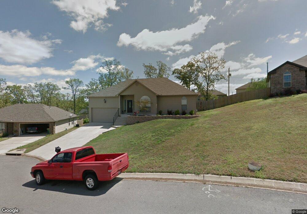
10619 Rockbrook Dr Sherwood, AR 72120
Estimated Value: $235,000 - $248,000
--
Bed
2
Baths
1,616
Sq Ft
$149/Sq Ft
Est. Value
About This Home
This home is located at 10619 Rockbrook Dr, Sherwood, AR 72120 and is currently estimated at $240,781, approximately $148 per square foot. 10619 Rockbrook Dr is a home located in Pulaski County with nearby schools including Sylvan Hills Elementary School, Sylvan Hills Middle School, and Sylvan Hills High School.
Ownership History
Date
Name
Owned For
Owner Type
Purchase Details
Closed on
May 27, 2016
Sold by
Adkins Avery A and Adkins Sandi K
Bought by
Stephens Tyler D and Gailey Blaine J
Current Estimated Value
Home Financials for this Owner
Home Financials are based on the most recent Mortgage that was taken out on this home.
Original Mortgage
$147,595
Outstanding Balance
$119,225
Interest Rate
4.12%
Mortgage Type
FHA
Estimated Equity
$121,556
Purchase Details
Closed on
Nov 1, 2013
Sold by
Meyer Sandi Kaye and Adkins Sandi K
Bought by
Adkins Avery A and Adkins Sandi K
Purchase Details
Closed on
Oct 23, 2009
Sold by
Metropolitan National Bank
Bought by
Meyer Sandi Kaye
Home Financials for this Owner
Home Financials are based on the most recent Mortgage that was taken out on this home.
Original Mortgage
$147,184
Interest Rate
5.03%
Mortgage Type
FHA
Purchase Details
Closed on
Aug 4, 2009
Sold by
Westglen Properties Llc and Knight Darvin
Bought by
Metropolitan National Bank
Create a Home Valuation Report for This Property
The Home Valuation Report is an in-depth analysis detailing your home's value as well as a comparison with similar homes in the area
Home Values in the Area
Average Home Value in this Area
Purchase History
| Date | Buyer | Sale Price | Title Company |
|---|---|---|---|
| Stephens Tyler D | $155,500 | United Abstract & Title Co | |
| Adkins Avery A | -- | Bankers Title | |
| Meyer Sandi Kaye | $150,000 | None Available | |
| Metropolitan National Bank | $110,000 | None Available |
Source: Public Records
Mortgage History
| Date | Status | Borrower | Loan Amount |
|---|---|---|---|
| Open | Stephens Tyler D | $147,595 | |
| Previous Owner | Meyer Sandi Kaye | $147,184 |
Source: Public Records
Tax History Compared to Growth
Tax History
| Year | Tax Paid | Tax Assessment Tax Assessment Total Assessment is a certain percentage of the fair market value that is determined by local assessors to be the total taxable value of land and additions on the property. | Land | Improvement |
|---|---|---|---|---|
| 2025 | $1,928 | $37,011 | $7,600 | $29,411 |
| 2024 | $1,790 | $37,011 | $7,600 | $29,411 |
| 2023 | $1,790 | $37,011 | $7,600 | $29,411 |
| 2022 | $1,822 | $37,011 | $7,600 | $29,411 |
| 2021 | $1,632 | $28,630 | $5,500 | $23,130 |
| 2020 | $1,625 | $28,630 | $5,500 | $23,130 |
| 2019 | $1,625 | $28,630 | $5,500 | $23,130 |
| 2018 | $1,625 | $28,630 | $5,500 | $23,130 |
| 2017 | $1,622 | $28,630 | $5,500 | $23,130 |
| 2016 | $1,555 | $29,850 | $5,600 | $24,250 |
| 2015 | $1,516 | $29,850 | $5,600 | $24,250 |
| 2014 | $1,516 | $29,850 | $5,600 | $24,250 |
Source: Public Records
Map
Nearby Homes
- 1909 Windridge Ct
- Lot 30 Hidden Creek Dr
- 10732 Rocky Creek Dr
- 10724 Rocky Creek Dr
- 2520 Austin Oaks Dr
- 519 Hillcrest Rd
- 10114 Hidden Cir
- 222 Gragson Ave
- 9833 Oak Heights Dr
- 109 Pamela Ln
- 4 Property Package
- 597 Valley Oak Dr
- 564 Valley Oak Dr
- 25 Acres Denton Rd
- 616 E Woodruff Ave
- 2117 Ingleside Dr
- 2032 Miramonte Dr
- 9909 Oakdale Rd
- 14 Pamela Ln
- 2949 Maelstrom Cir
- 10611 Rockbrook Dr
- 0 Rockbrook Dr Unit 16004253
- 0 Rockbrook Dr Unit 17016081
- 0 Rockbrook Dr Unit 18001021
- 10627 Rockbrook Dr
- 10590 Stoneridge Ct
- 10586 Stoneridge Ct
- 10594 Stoneridge Ct
- 10600 Stoneridge Ct
- 10604 Stoneridge Ct
- 10626 Rockbrook Dr
- 10610 Rockbrook Dr
- 10608 Stoneridge Ct
- 10582 Stoneridge Ct
- 10618 Rockbrook Dr
- 10602 Rockbrook Dr
- 10710 Windridge Dr
- 0 Stoneridge Ct
- 10587 Stoneridge Ct
- 209 Amber Oaks Dr