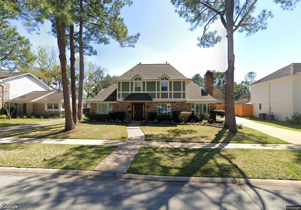
10619 Russett Dr Houston, TX 77042
Briar Forest NeighborhoodEstimated Value: $594,117 - $692,000
4
Beds
3
Baths
2,614
Sq Ft
$249/Sq Ft
Est. Value
About This Home
This home is located at 10619 Russett Dr, Houston, TX 77042 and is currently estimated at $651,279, approximately $249 per square foot. 10619 Russett Dr is a home located in Harris County with nearby schools including Walnut Bend Elementary School, Paul Revere Middle School, and Westside High School.
Ownership History
Date
Name
Owned For
Owner Type
Purchase Details
Closed on
Dec 16, 2022
Sold by
Aldrete Dagoberto and Aldrete Debra T
Bought by
Aldrete Dagoberto
Current Estimated Value
Purchase Details
Closed on
May 30, 2006
Sold by
Smilie Clay J and Smilie Kathleen A
Bought by
Aldrete Dagoberto and Aldrete Debra
Home Financials for this Owner
Home Financials are based on the most recent Mortgage that was taken out on this home.
Original Mortgage
$232,000
Interest Rate
6.5%
Mortgage Type
Fannie Mae Freddie Mac
Create a Home Valuation Report for This Property
The Home Valuation Report is an in-depth analysis detailing your home's value as well as a comparison with similar homes in the area
Home Values in the Area
Average Home Value in this Area
Purchase History
| Date | Buyer | Sale Price | Title Company |
|---|---|---|---|
| Aldrete Dagoberto | -- | None Listed On Document | |
| Aldrete Dagoberto | -- | Startex Title Company |
Source: Public Records
Mortgage History
| Date | Status | Borrower | Loan Amount |
|---|---|---|---|
| Previous Owner | Aldrete Dagoberto | $232,000 |
Source: Public Records
Tax History Compared to Growth
Tax History
| Year | Tax Paid | Tax Assessment Tax Assessment Total Assessment is a certain percentage of the fair market value that is determined by local assessors to be the total taxable value of land and additions on the property. | Land | Improvement |
|---|---|---|---|---|
| 2025 | $7,340 | $526,330 | $190,170 | $336,160 |
| 2024 | $7,340 | $516,519 | $190,170 | $326,349 |
| 2023 | $7,340 | $493,373 | $190,170 | $303,203 |
| 2022 | $8,908 | $493,373 | $190,170 | $303,203 |
| 2021 | $8,572 | $367,782 | $110,013 | $257,769 |
| 2020 | $8,816 | $364,061 | $110,013 | $254,048 |
| 2019 | $10,187 | $420,322 | $114,958 | $305,364 |
| 2018 | $7,143 | $365,964 | $123,611 | $242,353 |
| 2017 | $9,643 | $444,086 | $123,611 | $320,475 |
| 2016 | $8,766 | $444,086 | $123,611 | $320,475 |
| 2015 | $5,744 | $395,270 | $123,611 | $271,659 |
| 2014 | $5,744 | $361,740 | $123,611 | $238,129 |
Source: Public Records
Map
Nearby Homes
- 10703 Deerwood Rd
- 10607 Riverview Dr
- 10726 Riverview Dr
- 10710 Candlewood Dr
- 10718 Holly Springs Dr
- 706 Walnut Bend Ln
- 10827 Tupper Lake Dr
- 11003 Tupper Lake Dr
- 10903 Holly Springs Dr
- 102 Lakeside Oaks Dr
- 203 Cove Creek Ln
- 1003 Blue Willow Dr
- 106 Sibelius Ln
- 210 Big Hollow Ln
- 10623 Longmont Dr
- 10330 Briar Dr
- 10816 Briar Forest Dr Unit 33
- 10818 Briar Forest Dr Unit 34
- 1515 Sandy Springs Rd Unit 1808
- 1515 Sandy Springs Rd Unit 1102
- 10623 Russett Dr
- 10615 Russett Dr
- 10618 Cranbrook Rd
- 10622 Cranbrook Rd
- 10614 Cranbrook Rd
- 10611 Russett Dr
- 10627 Russett Dr
- 10626 Cranbrook Rd
- 10618 Russett Dr
- 10614 Russett Dr
- 10610 Cranbrook Rd
- 10622 Russett Dr
- 10610 Russett Dr
- 10607 Russett Dr
- 10703 Russett Dr
- 10702 Cranbrook Rd
- 10626 Russett Dr
- 10606 Cranbrook Rd
- 10606 Russett Dr
- 10623 Cranbrook Rd