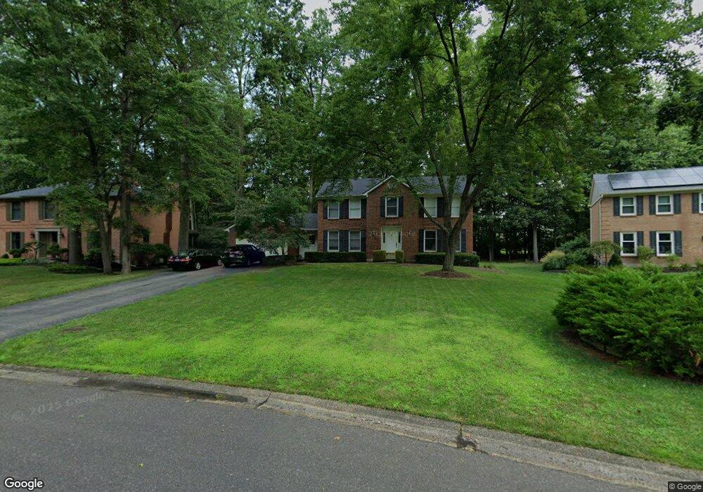
1062 Bridlepath Ln Loveland, OH 45140
Outer Loveland NeighborhoodEstimated Value: $475,803 - $517,000
4
Beds
3
Baths
2,506
Sq Ft
$201/Sq Ft
Est. Value
About This Home
This home is located at 1062 Bridlepath Ln, Loveland, OH 45140 and is currently estimated at $502,951, approximately $200 per square foot. 1062 Bridlepath Ln is a home located in Clermont County with nearby schools including Milford Senior High School, Milford Christian Academy, and St. Andrew - St. Elizabeth Ann Seton School.
Ownership History
Date
Name
Owned For
Owner Type
Purchase Details
Closed on
Jul 27, 2007
Sold by
Basselman Randall R and Basselman Angela J
Bought by
Meister Randy G and Meister Carol Ann
Current Estimated Value
Home Financials for this Owner
Home Financials are based on the most recent Mortgage that was taken out on this home.
Original Mortgage
$226,000
Interest Rate
6.73%
Mortgage Type
Purchase Money Mortgage
Purchase Details
Closed on
May 4, 1999
Sold by
Sanders Robert S
Bought by
Basselman Randall R and Basselman Angela J
Home Financials for this Owner
Home Financials are based on the most recent Mortgage that was taken out on this home.
Original Mortgage
$155,300
Interest Rate
7.05%
Mortgage Type
New Conventional
Purchase Details
Closed on
Oct 31, 1996
Sold by
Kerrigan Thomas D
Bought by
Sanders Robert S and Sanders Jennifer W
Home Financials for this Owner
Home Financials are based on the most recent Mortgage that was taken out on this home.
Original Mortgage
$152,000
Interest Rate
8.23%
Mortgage Type
Balloon
Create a Home Valuation Report for This Property
The Home Valuation Report is an in-depth analysis detailing your home's value as well as a comparison with similar homes in the area
Home Values in the Area
Average Home Value in this Area
Purchase History
| Date | Buyer | Sale Price | Title Company |
|---|---|---|---|
| Meister Randy G | $266,000 | Attorney | |
| Basselman Randall R | $194,300 | -- | |
| Sanders Robert S | $160,000 | -- |
Source: Public Records
Mortgage History
| Date | Status | Borrower | Loan Amount |
|---|---|---|---|
| Closed | Meister Randy G | $226,000 | |
| Previous Owner | Basselman Randall R | $155,300 | |
| Previous Owner | Sanders Robert S | $152,000 |
Source: Public Records
Tax History Compared to Growth
Tax History
| Year | Tax Paid | Tax Assessment Tax Assessment Total Assessment is a certain percentage of the fair market value that is determined by local assessors to be the total taxable value of land and additions on the property. | Land | Improvement |
|---|---|---|---|---|
| 2024 | $5,835 | $126,040 | $21,910 | $104,130 |
| 2023 | $5,894 | $126,040 | $21,910 | $104,130 |
| 2022 | $5,859 | $90,650 | $15,750 | $74,900 |
| 2021 | $5,586 | $90,650 | $15,750 | $74,900 |
| 2020 | $5,358 | $90,650 | $15,750 | $74,900 |
| 2019 | $5,889 | $94,890 | $17,960 | $76,930 |
| 2018 | $5,891 | $94,890 | $17,960 | $76,930 |
| 2017 | $5,593 | $94,890 | $17,960 | $76,930 |
| 2016 | $5,675 | $83,230 | $15,750 | $67,480 |
| 2015 | $5,218 | $83,230 | $15,750 | $67,480 |
| 2014 | $5,218 | $83,230 | $15,750 | $67,480 |
| 2013 | $4,498 | $69,580 | $17,500 | $52,080 |
Source: Public Records
Map
Nearby Homes
- 1513 Charleston Ln
- 1113 Clover Field Dr
- 6211 Cook Rd
- 6141 Brandywine Ct
- 6149 Century Farm Dr
- 6379 Derbyshire Ln
- 5933 Firm Stance Dr
- 6365 Ironwood Dr
- 1140 Weber Rd
- 2013 Weber Rd
- 1331 Harbor Cove
- 1803 Wheatfield Way
- 6661 Paxton Guinea Rd
- 6211 Spires Dr
- 1706 Cottontail Dr
- 899 Murle Ln
- 709 Middleton Way
- 6320 Ashford Dr
- 802 Andrea Dr
- 945 Paul Vista Dr
- 1064 Bridlepath Ln
- 1060 Bridlepath Ln
- 6329 S Devonshire Dr
- 1058 Bridlepath Ln
- 6331 S Devonshire Dr
- 1066 Bridlepath Ln
- 6327 S Devonshire Dr
- 1068 Bridlepath Ln
- 1069 Bridlepath Ln
- 6333 S Devonshire Dr
- 1056 Bridlepath Ln
- 6325 S Devonshire Dr
- 1070 Bridlepath Ln
- 1074 Tumbleweed Dr
- 6335 S Devonshire Dr
- 1071 Bridlepath Ln
- 6227 Tanglewood Dr
- 1054 Bridlepath Ln
- 1072 Bridlepath Ln
- 6323 S Devonshire Dr