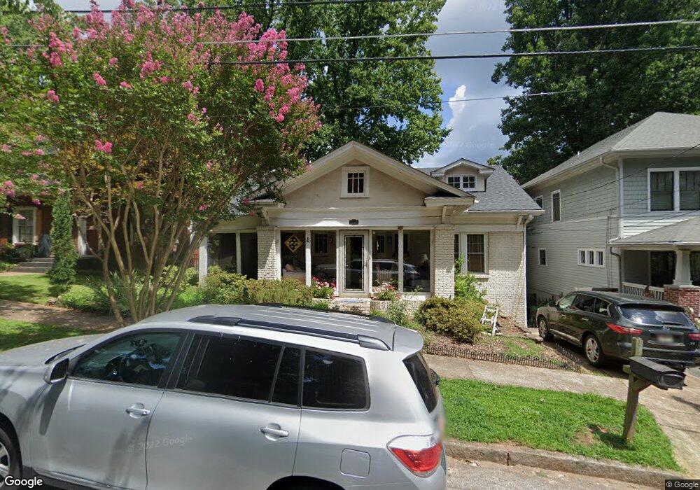
1062 High Point Dr NE Atlanta, GA 30306
Morningside NeighborhoodEstimated Value: $858,411 - $1,060,000
2
Beds
1
Bath
1,809
Sq Ft
$522/Sq Ft
Est. Value
About This Home
This home is located at 1062 High Point Dr NE, Atlanta, GA 30306 and is currently estimated at $944,353, approximately $522 per square foot. 1062 High Point Dr NE is a home located in Fulton County with nearby schools including Morningside Elementary School, Midtown High School, and Atlanta Montessori International School - Druid Hills.
Ownership History
Date
Name
Owned For
Owner Type
Purchase Details
Closed on
Jul 14, 2005
Sold by
Sehoyan Leon W
Bought by
Mccormack Paul and Mccormack Kai
Current Estimated Value
Home Financials for this Owner
Home Financials are based on the most recent Mortgage that was taken out on this home.
Original Mortgage
$359,650
Outstanding Balance
$185,310
Interest Rate
5.46%
Mortgage Type
New Conventional
Estimated Equity
$759,043
Purchase Details
Closed on
Aug 21, 1996
Sold by
Bips Virginia A
Bought by
Sehoyan Leon W
Create a Home Valuation Report for This Property
The Home Valuation Report is an in-depth analysis detailing your home's value as well as a comparison with similar homes in the area
Home Values in the Area
Average Home Value in this Area
Purchase History
| Date | Buyer | Sale Price | Title Company |
|---|---|---|---|
| Mccormack Paul | $534,900 | -- | |
| Sehoyan Leon W | $184,000 | -- |
Source: Public Records
Mortgage History
| Date | Status | Borrower | Loan Amount |
|---|---|---|---|
| Open | Mccormack Paul | $359,650 | |
| Closed | Sehoyan Leon W | $0 |
Source: Public Records
Tax History Compared to Growth
Tax History
| Year | Tax Paid | Tax Assessment Tax Assessment Total Assessment is a certain percentage of the fair market value that is determined by local assessors to be the total taxable value of land and additions on the property. | Land | Improvement |
|---|---|---|---|---|
| 2025 | $8,545 | $350,000 | $232,320 | $117,680 |
| 2023 | $14,998 | $362,280 | $232,320 | $129,960 |
| 2022 | $7,388 | $253,120 | $114,240 | $138,880 |
| 2021 | $7,129 | $245,720 | $110,920 | $134,800 |
| 2020 | $7,128 | $245,720 | $110,920 | $134,800 |
| 2019 | $485 | $208,480 | $68,600 | $139,880 |
| 2018 | $6,407 | $195,160 | $59,400 | $135,760 |
| 2017 | $6,129 | $179,240 | $65,880 | $113,360 |
| 2016 | $6,125 | $179,240 | $65,880 | $113,360 |
| 2015 | $6,609 | $179,240 | $65,880 | $113,360 |
| 2014 | $5,436 | $152,040 | $55,880 | $96,160 |
Source: Public Records
Map
Nearby Homes
- 1087 High Point Dr NE
- 1448 N Highland Ave NE
- 1031 Reeder Cir NE
- 1026 Reeder Cir NE
- 1485 Lanier Place NE
- 1144 Zimmer Dr NE
- 1154 Reeder Cir NE
- 1134 Spring Valley Ln NE
- 1366 Wessyngton Rd NE
- 1146 Cumberland Rd NE
- 1115 E Rock Springs Rd NE
- 1190 Cumberland Rd NE
- 935 Cumberland Rd NE
- 1281 Avalon Place NE
- 991 Courtenay Dr NE
- 1485 N Morningside Dr NE
- 1590 Johnson Rd NE
- 1251 Cumberland Rd NE
- 1258 Reeder Cir NE
- 1056 High Point Dr NE
- 0 High Point Dr NE Unit 8968803
- 0 High Point Dr NE Unit 7113974
- 0 High Point Dr NE Unit 7041262
- 0 High Point Dr NE Unit 8730164
- 0 High Point Dr NE Unit 8069612
- 0 High Point Dr NE Unit 7177382
- 0 High Point Dr NE Unit 7059259
- 0 High Point Dr NE Unit 8159882
- 0 High Point Dr NE Unit 3163758
- 0 High Point Dr NE Unit 8669632
- 0 High Point Dr NE Unit 8200104
- 0 High Point Dr NE Unit 3210867
- 0 High Point Dr NE Unit 7246429
- 0 High Point Dr NE Unit 8511324
- 0 High Point Dr NE Unit 8104021
- 0 High Point Dr NE Unit 7585906
- 0 High Point Dr NE Unit 7059600
- 0 High Point Dr NE Unit 3133928
- 0 High Point Dr NE