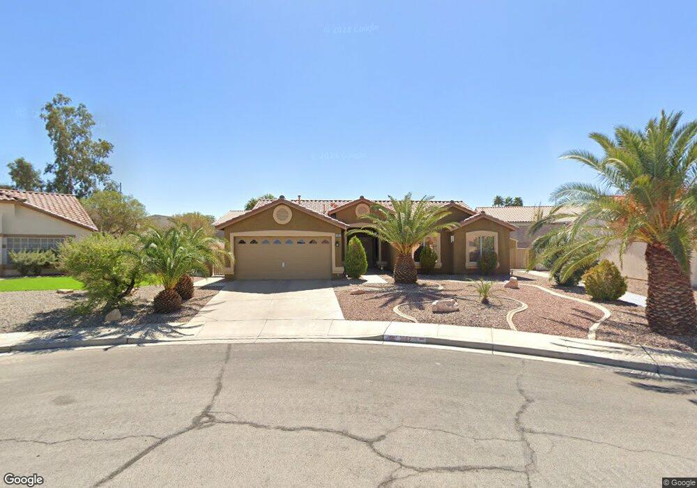
1062 Kennebunk Cir Henderson, NV 89015
River Mountain NeighborhoodEstimated Value: $459,382 - $463,000
About This Home
This home is located at 1062 Kennebunk Cir, Henderson, NV 89015 and is currently estimated at $461,096, approximately $276 per square foot. 1062 Kennebunk Cir is a home located in Clark County with nearby schools including Sue H. Morrow Elementary School, B Mahlon Brown Academy of International Studies, and Basic Academy of International Studies.
Ownership History
Purchase Details
Purchase Details
Home Financials for this Owner
Home Financials are based on the most recent Mortgage that was taken out on this home.Home Values in the Area
Average Home Value in this Area
Purchase History
We collect this data history from publicly available records. To have your information removed, we recommend requesting removal directly through your county’s website.
| Date | Buyer | Sale Price | Title Company |
|---|---|---|---|
| Jersey 27 Trust | -- | None Listed On Document | |
| Edwards Greg L | -- | First American Title Co |
Mortgage History
We collect this data history from publicly available records. To have your information removed, we recommend requesting removal directly through your county’s website.
| Date | Status | Borrower | Loan Amount |
|---|---|---|---|
| Previous Owner | Edwards Greg L | $100,000 |
Tax History
| Year | Tax Paid | Tax Assessment Tax Assessment Total Assessment is a certain percentage of the fair market value that is determined by local assessors to be the total taxable value of land and additions on the property. | Land | Improvement |
|---|---|---|---|---|
| 2026 | $1,905 | $106,646 | $38,150 | $68,496 |
| 2025 | $1,850 | $100,529 | $30,100 | $70,429 |
| 2024 | $1,796 | $100,529 | $30,100 | $70,429 |
| 2023 | $1,796 | $102,186 | $35,350 | $66,836 |
| 2022 | $1,744 | $91,737 | $30,450 | $61,287 |
| 2021 | $1,693 | $84,554 | $26,250 | $58,304 |
| 2020 | $1,641 | $82,433 | $24,500 | $57,933 |
| 2019 | $1,621 | $79,167 | $22,050 | $57,117 |
| 2018 | $1,547 | $72,708 | $17,500 | $55,208 |
| 2017 | $2,102 | $72,525 | $16,450 | $56,075 |
| 2016 | $1,449 | $66,464 | $9,800 | $56,664 |
| 2015 | $1,445 | $52,917 | $9,800 | $43,117 |
| 2014 | $1,403 | $48,161 | $8,400 | $39,761 |
Map
- 1073 Featherwood Ave
- 1031 Huckburn Ave
- 1016 Huckburn Ave
- 1100 Indiana Ct
- 1010 Huckburn Ave
- 705 Spotted Eagle St
- 713 Spotted Eagle St
- 736 Spotted Eagle St Unit 2
- 1018 Blue Lantern Dr
- 1008 Beaver Crest Terrace
- 698 S Racetrack Rd Unit 124
- 698 S Racetrack Rd Unit 413
- 698 S Racetrack Rd Unit 724
- 698 S Racetrack Rd Unit 1022
- 698 S Racetrack Rd Unit 823
- 698 S Racetrack Rd Unit 311
- 698 S Racetrack Rd Unit 1114
- 698 S Racetrack Rd Unit 1411
- 698 S Racetrack Rd Unit 713
- 998 Trackers Glen Ave
- 1046 Juniper Ridge Ave Unit house
- 1046 Juniper Ridge Ave
- 1044 Juniper Ridge Ave
- 1048 Juniper Ridge Ave
- 1064 Kennebunk Cir
- 1042 Juniper Ridge Ave
- 1060 Kennebunk Cir
- 1047 Juniper Ridge Ave
- 1066 Kennebunk Cir
- 1045 Juniper Ridge Ave
- 1049 Juniper Ridge Ave
- 1040 Juniper Ridge Ave
- 1043 Juniper Ridge Ave
- 1082 Blue Lantern Dr
- 1058 Kennebunk Cir
- 1084 Blue Lantern Dr
- 1080 Blue Lantern Dr Unit 2
- 1041 Juniper Ridge Ave
- 1038 Juniper Ridge Ave
- 1057 Kennebunk Cir
Ask me questions while you tour the home.