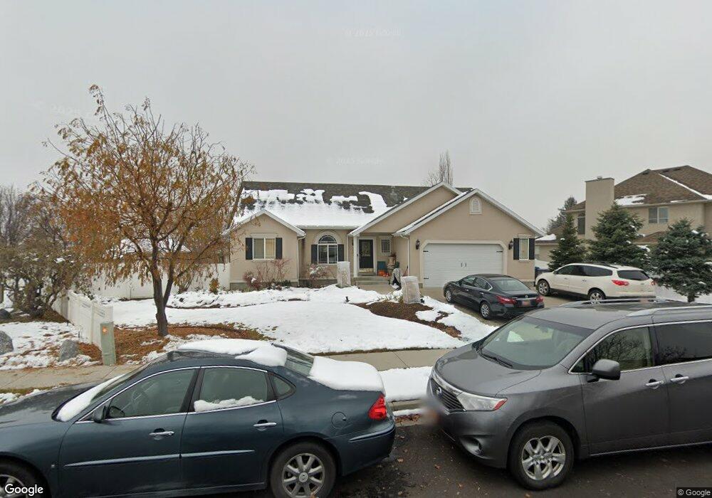
1062 Murdock Dr American Fork, UT 84003
Estimated Value: $777,000 - $798,000
7
Beds
4
Baths
4,250
Sq Ft
$185/Sq Ft
Est. Value
About This Home
This home is located at 1062 Murdock Dr, American Fork, UT 84003 and is currently estimated at $784,184, approximately $184 per square foot. 1062 Murdock Dr is a home located in Utah County with nearby schools including Deerfield Elementary School, Mountain Ridge Junior High School, and American Fork High School.
Ownership History
Date
Name
Owned For
Owner Type
Purchase Details
Closed on
Dec 21, 2023
Sold by
Anstead Kelly
Bought by
Anstead Stewart and Anstead Kelly
Current Estimated Value
Home Financials for this Owner
Home Financials are based on the most recent Mortgage that was taken out on this home.
Original Mortgage
$40,000
Outstanding Balance
$27,721
Interest Rate
7.76%
Mortgage Type
New Conventional
Estimated Equity
$756,463
Purchase Details
Closed on
Dec 11, 2023
Sold by
Anstead Stewart and Anstead Kelly
Bought by
Anstead Kelly
Home Financials for this Owner
Home Financials are based on the most recent Mortgage that was taken out on this home.
Original Mortgage
$40,000
Outstanding Balance
$27,721
Interest Rate
7.76%
Mortgage Type
New Conventional
Estimated Equity
$756,463
Purchase Details
Closed on
Feb 16, 2021
Sold by
Anstead Kelly
Bought by
Anstead Stewart and Anstead Kelly
Home Financials for this Owner
Home Financials are based on the most recent Mortgage that was taken out on this home.
Original Mortgage
$254,000
Interest Rate
2.65%
Mortgage Type
New Conventional
Purchase Details
Closed on
Mar 24, 2005
Sold by
Richardson Ronald E and Richardson Kowanda L
Bought by
Anstead Stewart
Home Financials for this Owner
Home Financials are based on the most recent Mortgage that was taken out on this home.
Original Mortgage
$236,250
Interest Rate
5.7%
Mortgage Type
Future Advance Clause Open End Mortgage
Purchase Details
Closed on
Mar 23, 2005
Sold by
Anstead Stewart
Bought by
Anstead Stewart and Anstead Kelly
Home Financials for this Owner
Home Financials are based on the most recent Mortgage that was taken out on this home.
Original Mortgage
$236,250
Interest Rate
5.7%
Mortgage Type
Future Advance Clause Open End Mortgage
Purchase Details
Closed on
Jul 17, 2001
Sold by
Tibbitts Mitch L and Tibbitts Jill A
Bought by
Richardson Ronald E and Richardson Kowanda L
Home Financials for this Owner
Home Financials are based on the most recent Mortgage that was taken out on this home.
Original Mortgage
$170,000
Interest Rate
7.21%
Purchase Details
Closed on
Dec 11, 1998
Sold by
Sundance Homes Inc
Bought by
Tibbitts Mitch L and Tibbitts Jill A
Home Financials for this Owner
Home Financials are based on the most recent Mortgage that was taken out on this home.
Original Mortgage
$205,560
Interest Rate
6.78%
Create a Home Valuation Report for This Property
The Home Valuation Report is an in-depth analysis detailing your home's value as well as a comparison with similar homes in the area
Home Values in the Area
Average Home Value in this Area
Purchase History
| Date | Buyer | Sale Price | Title Company |
|---|---|---|---|
| Anstead Stewart | -- | None Listed On Document | |
| Anstead Kelly | -- | None Listed On Document | |
| Anstead Stewart | -- | Accommodation | |
| Anstead Kelly | -- | First American Title Ins Co | |
| Anstead Stewart | -- | First American Title Agency | |
| Anstead Stewart | -- | Us Title Utah | |
| Richardson Ronald E | -- | Empire Land Title Company | |
| Tibbitts Mitch L | -- | Signature Title |
Source: Public Records
Mortgage History
| Date | Status | Borrower | Loan Amount |
|---|---|---|---|
| Open | Anstead Kelly | $40,000 | |
| Previous Owner | Anstead Kelly | $254,000 | |
| Previous Owner | Anstead Stewart | $236,250 | |
| Previous Owner | Richardson Ronald E | $170,000 | |
| Previous Owner | Tibbitts Mitch L | $205,560 |
Source: Public Records
Tax History Compared to Growth
Tax History
| Year | Tax Paid | Tax Assessment Tax Assessment Total Assessment is a certain percentage of the fair market value that is determined by local assessors to be the total taxable value of land and additions on the property. | Land | Improvement |
|---|---|---|---|---|
| 2025 | $3,270 | $367,895 | $256,500 | $412,400 |
| 2024 | $3,270 | $363,330 | $0 | $0 |
| 2023 | $3,161 | $372,350 | $0 | $0 |
| 2022 | $3,065 | $356,290 | $0 | $0 |
| 2021 | $2,692 | $488,800 | $179,600 | $309,200 |
| 2020 | $2,617 | $460,800 | $166,300 | $294,500 |
| 2019 | $2,466 | $449,200 | $154,700 | $294,500 |
| 2018 | $2,314 | $403,000 | $146,900 | $256,100 |
| 2017 | $2,188 | $205,645 | $0 | $0 |
| 2016 | $2,325 | $203,005 | $0 | $0 |
| 2015 | $2,224 | $184,305 | $0 | $0 |
| 2014 | $2,029 | $165,880 | $0 | $0 |
Source: Public Records
Map
Nearby Homes
- 1172 Murdock Dr
- 9587 N 4500 W
- 9681 N Peach Ct
- 4441 W Bridgestone Dr
- 248 N Deerfield Ln
- 4631 W Harvey Blvd
- 1243 N 1270 E
- 1162 E 1180 N
- 1089 N 950 E
- 1058 N 930 E Unit 64
- 1059 N 930 E
- 1053 N 930 E Unit 73
- The McKenzie Plan at Autumn Crest
- The Christine Plan at Autumn Crest
- The Avery Plan at Autumn Crest
- The Madison Plan at Autumn Crest
- The Roosevelt Plan at Autumn Crest
- The Annie Plan at Autumn Crest
- The Michelle Plan at Autumn Crest
- 9748 N Caldwell Place
- 1041 E 1420 N
- 1468 N 1020 E
- 1108 Murdock Dr
- 1108 Murdock Dr Unit 11
- 1446 N 1020 E
- 1446 N 1020 E Unit 8
- 1384 N 1100 E
- 1083 Murdock Dr
- 1111 Murdock Dr Unit 9
- 1451 N 1020 E
- 1126 Murdock Dr Unit 12
- 1126 Murdock Dr
- 1111 Murdock Dr
- 1035 Murdock Dr
- 1036 E 1420 N
- 1123 E 1350 N
- 1376 N 1100 E
- 1479 N 1020 E
- 1479 N 1020 E Unit 1
- 1433 N 1020 E