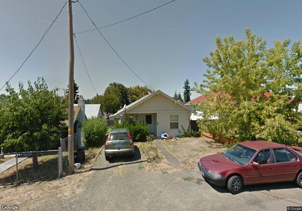
1062 NE Post St Roseburg, OR 97470
West Avenue NeighborhoodEstimated Value: $227,000 - $324,000
3
Beds
2
Baths
1,984
Sq Ft
$132/Sq Ft
Est. Value
About This Home
This home is located at 1062 NE Post St, Roseburg, OR 97470 and is currently estimated at $262,727, approximately $132 per square foot. 1062 NE Post St is a home located in Douglas County with nearby schools including Fir Grove Elementary School, Joseph Lane Middle School, and Roseburg High School.
Ownership History
Date
Name
Owned For
Owner Type
Purchase Details
Closed on
Jun 18, 2019
Sold by
Mcmanus Sylvia Jo
Bought by
Standridge Randy W and Standridge Kathy
Current Estimated Value
Home Financials for this Owner
Home Financials are based on the most recent Mortgage that was taken out on this home.
Original Mortgage
$10,000,000
Outstanding Balance
$8,792,445
Interest Rate
4.1%
Mortgage Type
Unknown
Estimated Equity
-$8,529,718
Purchase Details
Closed on
Sep 7, 2012
Sold by
Mcmanus Sylvia Jo
Bought by
Mcmanus Sylvia Jo and The Sylvia Jo Mcmanus Family Trust
Create a Home Valuation Report for This Property
The Home Valuation Report is an in-depth analysis detailing your home's value as well as a comparison with similar homes in the area
Home Values in the Area
Average Home Value in this Area
Purchase History
| Date | Buyer | Sale Price | Title Company |
|---|---|---|---|
| Standridge Randy W | $160,000 | Amerititle | |
| Mcmanus Sylvia Jo | -- | None Available |
Source: Public Records
Mortgage History
| Date | Status | Borrower | Loan Amount |
|---|---|---|---|
| Open | Standridge Randy W | $10,000,000 |
Source: Public Records
Tax History Compared to Growth
Tax History
| Year | Tax Paid | Tax Assessment Tax Assessment Total Assessment is a certain percentage of the fair market value that is determined by local assessors to be the total taxable value of land and additions on the property. | Land | Improvement |
|---|---|---|---|---|
| 2024 | $1,910 | $130,228 | -- | -- |
| 2023 | $1,854 | $126,435 | $0 | $0 |
| 2022 | $1,800 | $122,753 | $0 | $0 |
| 2021 | $1,748 | $119,178 | $0 | $0 |
| 2020 | $1,740 | $115,707 | $0 | $0 |
| 2019 | $1,702 | $112,337 | $0 | $0 |
| 2018 | $1,659 | $109,066 | $0 | $0 |
| 2017 | $1,610 | $105,890 | $0 | $0 |
| 2016 | $1,556 | $102,806 | $0 | $0 |
| 2015 | $1,523 | $99,812 | $0 | $0 |
| 2014 | $1,480 | $96,905 | $0 | $0 |
| 2013 | -- | $94,083 | $0 | $0 |
Source: Public Records
Map
Nearby Homes
- 866 NE Walnut St
- 1111 NE Crescent Alley
- 1119 NE Crescent Alley
- 0 NW Highland St
- 0 NE Crescent St
- 1246 NW Hicks St
- 797 NE Garden Valley Blvd
- 1248 NW Ellan St
- 916 NE Malheur Ave
- 1229 NW Munson Ct
- 693 NE Winchester St
- 885 NE Sunset St Unit 22
- 885 NE Sunset St Unit 26
- 598 NE Winchester St
- 1025 NE Klamath Ave
- 650 NE Polk St
- 1157 NE Malheur Ave
- 1219 NE Junker Ave
- 1218 NE Klamath Ave
- 1448 NE Rocky Ridge Dr
- 1054 NE Post St
- 1057 NE Walnut St
- 1067 NE Walnut St
- 1047 NE Walnut St
- 1032 NE Post St
- 1043 NE Post St
- 1037 NE Walnut St
- 1063 NE Post St
- 1049 NE Post St
- 1073 NE Post St
- 1012 NE Post St
- 1027 NE Walnut St
- 1017 NE Walnut St
- 1064 NE Alder St
- 1117 NE Walnut St
- 1117 Walnut St
- 466 NE Chestnut Ave
- 1066 NE Walnut St
- 1076 NE Walnut St
- 0 Walnut St