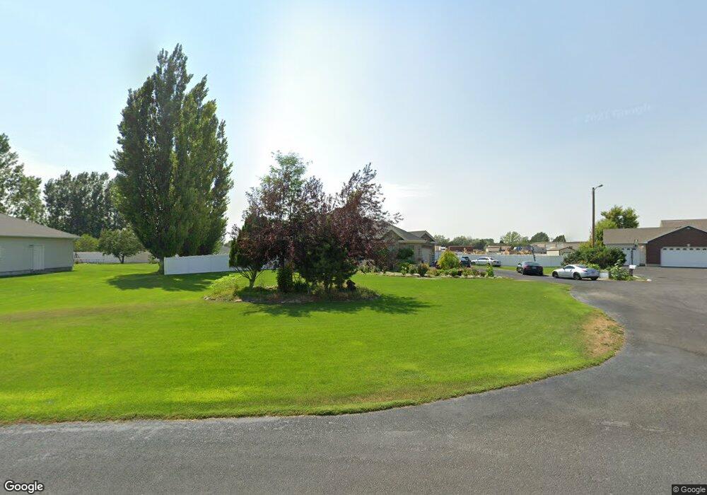
1062 Rimrock Canyon Shelley, ID 83274
Estimated Value: $521,000 - $641,000
3
Beds
3
Baths
3,670
Sq Ft
$160/Sq Ft
Est. Value
About This Home
This home is located at 1062 Rimrock Canyon, Shelley, ID 83274 and is currently estimated at $587,218, approximately $160 per square foot. 1062 Rimrock Canyon is a home located in Bingham County with nearby schools including Riverview Elementary School.
Ownership History
Date
Name
Owned For
Owner Type
Purchase Details
Closed on
Jun 21, 2006
Sold by
Lambert M Travis and Lambert Alicia A
Bought by
Cowley Lisa and Cowley Mark W
Current Estimated Value
Home Financials for this Owner
Home Financials are based on the most recent Mortgage that was taken out on this home.
Original Mortgage
$268,500
Outstanding Balance
$157,856
Interest Rate
6.57%
Mortgage Type
New Conventional
Estimated Equity
$429,362
Create a Home Valuation Report for This Property
The Home Valuation Report is an in-depth analysis detailing your home's value as well as a comparison with similar homes in the area
Home Values in the Area
Average Home Value in this Area
Purchase History
| Date | Buyer | Sale Price | Title Company |
|---|---|---|---|
| Cowley Lisa | -- | -- |
Source: Public Records
Mortgage History
| Date | Status | Borrower | Loan Amount |
|---|---|---|---|
| Open | Cowley Lisa | $268,500 |
Source: Public Records
Tax History Compared to Growth
Tax History
| Year | Tax Paid | Tax Assessment Tax Assessment Total Assessment is a certain percentage of the fair market value that is determined by local assessors to be the total taxable value of land and additions on the property. | Land | Improvement |
|---|---|---|---|---|
| 2025 | $3,139 | $555,600 | $70,000 | $485,600 |
| 2024 | $3,139 | $496,950 | $43,750 | $453,200 |
| 2023 | $3,000 | $496,950 | $43,750 | $453,200 |
| 2022 | $5,640 | $455,750 | $43,750 | $412,000 |
| 2021 | $3,820 | $364,600 | $35,000 | $329,600 |
| 2020 | $3,748 | $327,650 | $0 | $0 |
| 2019 | $3,932 | $327,650 | $0 | $0 |
| 2018 | $3,262 | $271,510 | $22,860 | $248,650 |
| 2017 | $3,236 | $271,510 | $22,860 | $248,650 |
| 2016 | $3,225 | $271,510 | $0 | $0 |
| 2015 | $3,415 | $271,510 | $0 | $0 |
| 2014 | $3,415 | $271,510 | $22,860 | $248,650 |
Source: Public Records
Map
Nearby Homes
- TBD 1200 N
- 631 Holley St
- L6 B6 E Meadow Walk Dr
- L7 B6 E Meadow Walk Dr
- 757 E 1200 N
- L5 B6 E Meadow Walk Dr
- L1 B6 E Meadow Mist Ave
- L11 B4 E Meadow Mist Ave
- 393 W Pine St
- Kensington Plan at Sunset Vista
- Canyon Plan at Sunset Vista
- Brantwood Plan at Sunset Vista
- Xavier Plan at Sunset Vista
- Edgeworth Plan at Sunset Vista
- Clearpoint Plan at Sunset Vista
- Ashland Plan at Sunset Vista
- Denford Plan at Sunset Vista
- Northfield Plan at Sunset Vista
- Ravenstone Plan at Sunset Vista
- 285 Moonlight Dr
- 1060 Rimrock Canyon Dr
- 1060 Rimrock Canyon
- 1066 Rimrock Canyon
- 1066 Rimrock Canyon Dr
- 1030 Rimrock Canyon
- 1055 Rimrock Canyon
- 1035 Rimrock Canyon
- 1065 Rimrock Canyon
- 1067 Rimrock Canyon
- 1068 Rimrock Canyon
- 1068 Rimrock Canyon Dr
- 1005 Rimrock Canyon Dr
- 1005 Rimrock Canyon
- 1111 October Cove
- 1091 October Cove
- 1010 Rimrock Canyon
- 1060 W Fir St
- 1035 October Cove
- 1030 W Fir St
- 1101 October Cove
