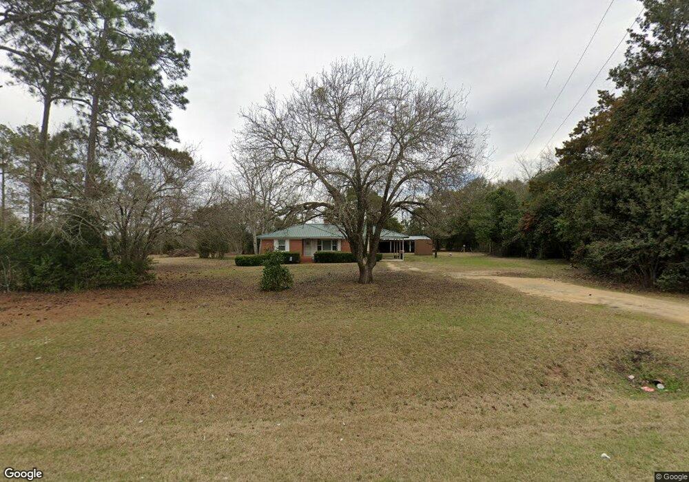
1062 State Route 128 Rd Oglethorpe, GA 31068
Estimated Value: $57,000 - $110,000
Studio
1
Bath
1,193
Sq Ft
$70/Sq Ft
Est. Value
About This Home
This home is located at 1062 State Route 128 Rd, Oglethorpe, GA 31068 and is currently estimated at $83,556, approximately $70 per square foot. 1062 State Route 128 Rd is a home with nearby schools including Macon County Elementary School, Macon County Middle School, and Macon County High School.
Ownership History
Date
Name
Owned For
Owner Type
Purchase Details
Closed on
Jan 18, 2023
Sold by
Beard Deborah
Bought by
Dreifort David W and Dreifort Denise D
Current Estimated Value
Purchase Details
Closed on
Jul 19, 2004
Sold by
Spillers Lynwood Robert and Spillers Amanda L
Bought by
Beard Deborah
Purchase Details
Closed on
Jan 30, 2003
Sold by
Johnson Lucille C
Bought by
Spillers Lynwood Robert
Purchase Details
Closed on
Aug 27, 2001
Sold by
Johnson Harry W
Bought by
Johnson Lucille C
Purchase Details
Closed on
Jul 17, 1998
Sold by
Lucille C
Bought by
Johnson Harry W
Purchase Details
Closed on
Mar 31, 1995
Sold by
Odom Coreane L
Bought by
Odom The Rev Rex L
Purchase Details
Closed on
Aug 11, 1978
Sold by
Odom Clemon
Bought by
Odom Coreane L
Purchase Details
Closed on
Jan 1, 1959
Bought by
Odom Clemon
Create a Home Valuation Report for This Property
The Home Valuation Report is an in-depth analysis detailing your home's value as well as a comparison with similar homes in the area
Purchase History
| Date | Buyer | Sale Price | Title Company |
|---|---|---|---|
| Dreifort David W | $50,000 | -- | |
| Beard Deborah | $60,000 | -- | |
| Spillers Lynwood Robert | $56,000 | -- | |
| Johnson Lucille C | -- | -- | |
| Johnson Harry W | $56,000 | -- | |
| Odom The Rev Rex L | -- | -- | |
| Odom Coreane L | -- | -- | |
| Odom Clemon | -- | -- |
Source: Public Records
Tax History
| Year | Tax Paid | Tax Assessment Tax Assessment Total Assessment is a certain percentage of the fair market value that is determined by local assessors to be the total taxable value of land and additions on the property. | Land | Improvement |
|---|---|---|---|---|
| 2025 | $959 | $34,653 | $3,000 | $31,653 |
| 2024 | $562 | $34,653 | $3,000 | $31,653 |
| 2023 | $917 | $34,663 | $3,000 | $31,663 |
| 2022 | $682 | $26,307 | $3,000 | $23,307 |
| 2021 | $557 | $19,207 | $2,400 | $16,807 |
| 2020 | $499 | $19,207 | $2,400 | $16,807 |
| 2019 | $557 | $19,207 | $2,400 | $16,807 |
| 2018 | $500 | $19,207 | $2,400 | $16,807 |
| 2017 | $504 | $19,207 | $2,400 | $16,807 |
| 2016 | $504 | $19,207 | $2,400 | $16,807 |
| 2015 | -- | $20,610 | $2,400 | $18,211 |
| 2014 | -- | $20,611 | $2,400 | $18,211 |
| 2013 | -- | $20,610 | $2,400 | $18,210 |
Source: Public Records
Map
Nearby Homes
- 204 Jordan St
- 311 Overlook Dr
- 311 Macon St
- 702 Overlook Dr
- 706 Overlook Dr
- 707 Overlook Dr
- 703 Overlook Dr
- 705 Overlook Dr
- 704 Overlook Dr
- 311 Hillcrest Dr
- 313 Hillcrest Dr
- 310 Sumter St
- 0 Hillcrest Dr Unit 261714
- 303 Christopher Cir
- 301 Christopher Cir
- 312 Christopher Cir
- 102 June Dr
- 1220 Georgia 49
- 562 W Anderson St
- 100 Minor Ave
- 960 State Route 128 Rd
- 910 State Route 128 Rd
- 1370 State Route 128 Rd
- 747 State Route 128 Rd
- 1402 State Route 128 Rd
- 1405 State Route 128 Rd
- 1464 State Route 128 Rd
- 1457 Georgia 128
- 1529 State Route 128 Rd
- 366 Pond Church Rd
- 2460 Ga Highway 90 W
- 2365 Ga Highway 90 W
- 1653 State Route 128 Rd
- 2361 Ga Highway 90 W
- 2275 Ga Highway 90 W
- 2755 Ga Highway 90 W
- 2245 Ga Highway 90 W
- 2701 Ga Highway 90 W
- 1717 State Route 128 Rd
- 428 Georgia 128
Your Personal Tour Guide
Ask me questions while you tour the home.