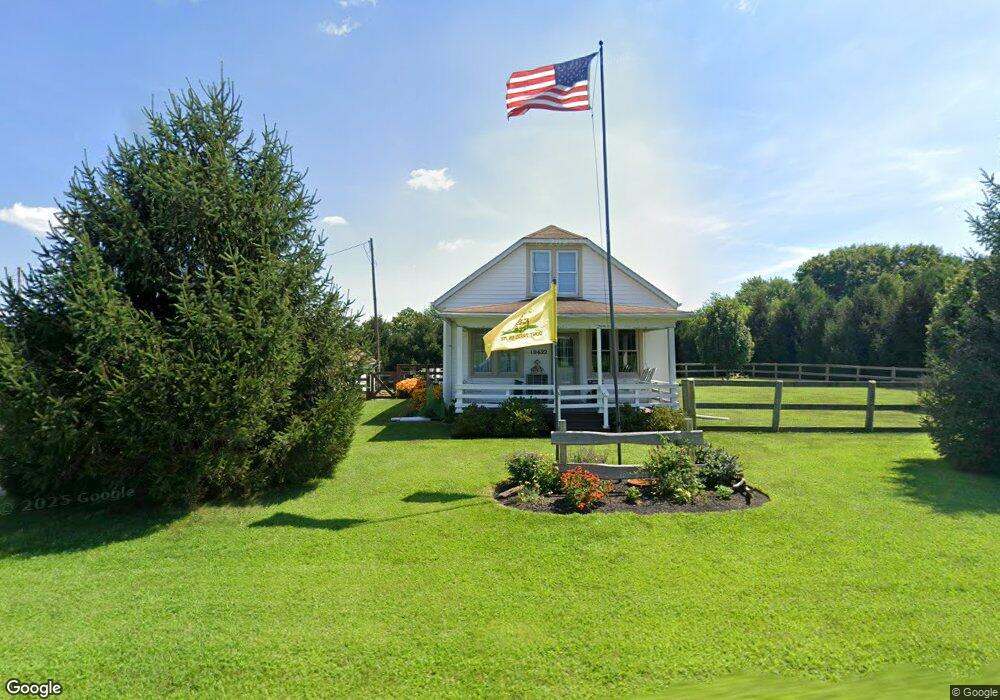
10622 Wheat Rd New Park, PA 17352
Estimated Value: $213,947 - $290,000
3
Beds
1
Bath
982
Sq Ft
$253/Sq Ft
Est. Value
About This Home
This home is located at 10622 Wheat Rd, New Park, PA 17352 and is currently estimated at $248,737, approximately $253 per square foot. 10622 Wheat Rd is a home located in York County with nearby schools including South Eastern Intermediate School, South Eastern Middle School, and Kennard-Dale High School.
Ownership History
Date
Name
Owned For
Owner Type
Purchase Details
Closed on
Dec 6, 2002
Sold by
Ogden William Blaine
Bought by
Lutz William
Current Estimated Value
Home Financials for this Owner
Home Financials are based on the most recent Mortgage that was taken out on this home.
Original Mortgage
$99,400
Outstanding Balance
$43,004
Interest Rate
6.34%
Mortgage Type
Purchase Money Mortgage
Estimated Equity
$205,733
Purchase Details
Closed on
Nov 5, 1997
Bought by
Ogden William Blaine
Create a Home Valuation Report for This Property
The Home Valuation Report is an in-depth analysis detailing your home's value as well as a comparison with similar homes in the area
Home Values in the Area
Average Home Value in this Area
Purchase History
| Date | Buyer | Sale Price | Title Company |
|---|---|---|---|
| Lutz William | $102,500 | -- | |
| Ogden William Blaine | $87,500 | -- |
Source: Public Records
Mortgage History
| Date | Status | Borrower | Loan Amount |
|---|---|---|---|
| Open | Lutz William | $99,400 |
Source: Public Records
Tax History Compared to Growth
Tax History
| Year | Tax Paid | Tax Assessment Tax Assessment Total Assessment is a certain percentage of the fair market value that is determined by local assessors to be the total taxable value of land and additions on the property. | Land | Improvement |
|---|---|---|---|---|
| 2025 | $3,458 | $114,700 | $55,000 | $59,700 |
| 2024 | $3,441 | $114,700 | $55,000 | $59,700 |
| 2023 | $3,441 | $114,700 | $55,000 | $59,700 |
| 2022 | $3,441 | $114,700 | $55,000 | $59,700 |
| 2021 | $3,314 | $114,700 | $55,000 | $59,700 |
| 2020 | $3,314 | $114,700 | $55,000 | $59,700 |
| 2019 | $3,302 | $114,700 | $55,000 | $59,700 |
| 2018 | $3,302 | $114,700 | $55,000 | $59,700 |
| 2017 | $3,295 | $114,700 | $55,000 | $59,700 |
| 2016 | $0 | $114,700 | $55,000 | $59,700 |
| 2015 | -- | $114,700 | $55,000 | $59,700 |
| 2014 | -- | $114,700 | $55,000 | $59,700 |
Source: Public Records
Map
Nearby Homes
- 9377 Hickory Rd
- 15792 Cross Mill Rd
- 14292 Kilgore Rd
- 370 High Rock Rd
- 18183 Piedmont Rd
- 18010 Dave Anne Cir
- 387 Garvine Mill Rd
- 14754 Lowe Rd
- 140 Lantern Ln
- 14639 Hyson School Rd
- 2131 Channel Rd
- 10 Black Oak Ct
- 200 Patterson Dr Unit 52
- 180 Patterson Dr Unit 50
- 170 Patterson Dr Unit 49
- 119 Edie Cir
- 160 Patterson Dr Unit 48
- 150 Patterson Dr Unit 47
- 515 Log House Rd Unit 119
- 2 S Main St
- 10662 Wheat Rd
- 10584 Wheat Rd
- 10558 Wheat Rd
- 10538 Wheat Rd
- 10762 Wheat Rd
- 10413 Wheat Rd
- 16905 Gun Club Rd
- 16969 Gun Club Rd
- 10908 Wheat Rd
- 16925 Gun Club Rd
- 10344 Wheat Rd
- 16885 Gun Club Rd
- 16794 Gun Club Rd
- 10234 Wheat Rd
- 17378 Maize Rd
- 10521 Blue Ball Rd
- 10555 Blue Ball Rd
- 10401 Blue Ball Rd
- 10363 Blue Ball Rd
- 10046 Manifold School Rd