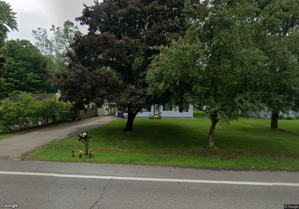
10628 Oakland Dr Portage, MI 49024
Estimated Value: $174,000 - $200,707
--
Bed
--
Bath
984
Sq Ft
$185/Sq Ft
Est. Value
About This Home
This home is located at 10628 Oakland Dr, Portage, MI 49024 and is currently estimated at $181,677, approximately $184 per square foot. 10628 Oakland Dr is a home located in Kalamazoo County with nearby schools including Moorsbridge Elementary School, Portage Central Middle School, and Portage Central High School.
Ownership History
Date
Name
Owned For
Owner Type
Purchase Details
Closed on
Oct 24, 2024
Sold by
Urness Brenda and Visscher Diana
Bought by
Roblyer Denton
Current Estimated Value
Home Financials for this Owner
Home Financials are based on the most recent Mortgage that was taken out on this home.
Original Mortgage
$121,550
Outstanding Balance
$120,235
Interest Rate
6.2%
Mortgage Type
New Conventional
Estimated Equity
$61,442
Purchase Details
Closed on
Jun 23, 2008
Sold by
Deryke Marjorie M and Deryke William A
Bought by
Deryke Marjorie M and Visscher Diana
Create a Home Valuation Report for This Property
The Home Valuation Report is an in-depth analysis detailing your home's value as well as a comparison with similar homes in the area
Home Values in the Area
Average Home Value in this Area
Purchase History
| Date | Buyer | Sale Price | Title Company |
|---|---|---|---|
| Roblyer Denton | $170,000 | None Listed On Document | |
| Deryke Marjorie M | -- | None Available |
Source: Public Records
Mortgage History
| Date | Status | Borrower | Loan Amount |
|---|---|---|---|
| Open | Roblyer Denton | $121,550 |
Source: Public Records
Tax History Compared to Growth
Tax History
| Year | Tax Paid | Tax Assessment Tax Assessment Total Assessment is a certain percentage of the fair market value that is determined by local assessors to be the total taxable value of land and additions on the property. | Land | Improvement |
|---|---|---|---|---|
| 2025 | $1,866 | $84,900 | $0 | $0 |
| 2024 | $2,373 | $75,400 | $0 | $0 |
| 2023 | $2,219 | $60,000 | $0 | $0 |
| 2022 | $2,310 | $56,700 | $0 | $0 |
| 2021 | $1,605 | $50,300 | $0 | $0 |
| 2020 | $1,570 | $43,900 | $0 | $0 |
| 2019 | $141 | $39,300 | $0 | $0 |
| 2018 | $0 | $37,200 | $0 | $0 |
| 2017 | $0 | $34,200 | $0 | $0 |
| 2016 | -- | $35,400 | $0 | $0 |
| 2015 | -- | $33,900 | $0 | $0 |
| 2014 | -- | $32,900 | $0 | $0 |
Source: Public Records
Map
Nearby Homes
- 1817 Alder Ave
- 10381 Schrier Ln
- 10382 Pennridge Dr
- 2633 Rolling Hill Ave
- Integrity 1800 Plan at Pennridge Trail North
- Integrity 2085 Plan at Pennridge Trail North
- Integrity 1910 Plan at Pennridge Trail North
- 10197 Pennridge Dr
- 10187 Pennridge Dr
- 10118 Pennridge Dr
- 10077 Kearns Ct
- 10025 Kearns Ct
- 10565 Pierport Dr
- 10029 Kearns Ct
- 10025 Shuman St
- 10631 Gracie Ln Unit 6
- 821 Janelle Ct
- 775 Chloe Jane Ave
- 10613 Sharon Lee Ln
- 739 Chloe Jane Ave
- 10632 Oakland Dr
- 10626 Oakland Dr
- 10648 Oakland Dr
- 10631 Schuur St
- 10639 Schuur St
- 10623 Schuur St
- 10616 Oakland Dr
- 10647 Schuur St
- 10716 Oakland Dr
- 10615 Schuur St
- 10707 Schuur St
- 10689 Oakland Dr
- 10697 Oakland Dr
- 10607 Schuur St
- 10673 Oakland Dr
- 10714 Oakland Dr
- 2214 Holly Ave
- 10606 Oakland Dr
- 10713 Schuur St
- 2213 Mapleview Ave