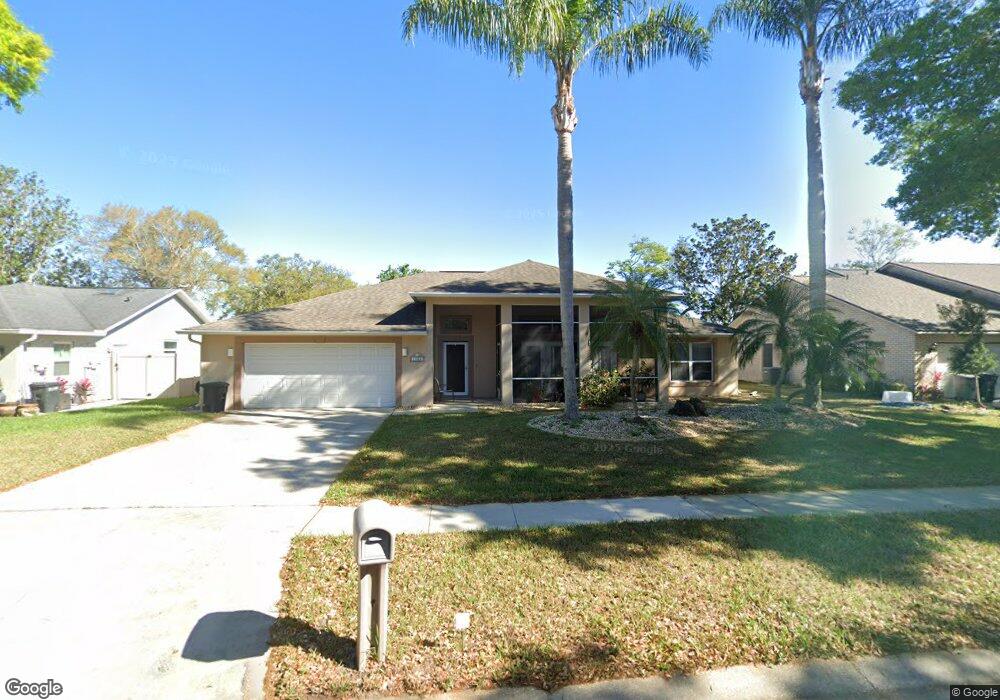
1063 Azalea Pointe Dr Port Orange, FL 32129
Port Orange West NeighborhoodEstimated Value: $341,406 - $396,000
3
Beds
2
Baths
2,032
Sq Ft
$184/Sq Ft
Est. Value
About This Home
This home is located at 1063 Azalea Pointe Dr, Port Orange, FL 32129 and is currently estimated at $374,852, approximately $184 per square foot. 1063 Azalea Pointe Dr is a home located in Volusia County with nearby schools including Sugar Mill Elementary School, Atlantic High School, and Silver Sands Middle School.
Ownership History
Date
Name
Owned For
Owner Type
Purchase Details
Closed on
Feb 9, 2001
Sold by
Cooper Gina M
Bought by
Home Depot Us A Inc
Current Estimated Value
Purchase Details
Closed on
Jun 10, 1999
Sold by
Korach Bennett Ira and Korach Toni Lynne
Bought by
Cooper Gina M
Home Financials for this Owner
Home Financials are based on the most recent Mortgage that was taken out on this home.
Original Mortgage
$96,000
Interest Rate
6.94%
Purchase Details
Closed on
Aug 6, 1993
Sold by
Johnson Group Inc
Bought by
Korach Bennett Ira and Korach Toni Lynne
Home Financials for this Owner
Home Financials are based on the most recent Mortgage that was taken out on this home.
Original Mortgage
$65,000
Interest Rate
7.34%
Purchase Details
Closed on
May 15, 1993
Bought by
Cooper Gina M
Create a Home Valuation Report for This Property
The Home Valuation Report is an in-depth analysis detailing your home's value as well as a comparison with similar homes in the area
Home Values in the Area
Average Home Value in this Area
Purchase History
| Date | Buyer | Sale Price | Title Company |
|---|---|---|---|
| Home Depot Us A Inc | -- | -- | |
| Cooper Gina M | $120,000 | -- | |
| Korach Bennett Ira | $119,900 | -- | |
| Cooper Gina M | $75,000 | -- |
Source: Public Records
Mortgage History
| Date | Status | Borrower | Loan Amount |
|---|---|---|---|
| Previous Owner | Cooper Gina M | $96,000 | |
| Previous Owner | Korach Bennett Ira | $65,000 |
Source: Public Records
Tax History Compared to Growth
Tax History
| Year | Tax Paid | Tax Assessment Tax Assessment Total Assessment is a certain percentage of the fair market value that is determined by local assessors to be the total taxable value of land and additions on the property. | Land | Improvement |
|---|---|---|---|---|
| 2025 | $5,016 | $318,126 | $72,192 | $245,934 |
| 2024 | $5,016 | $319,062 | $72,192 | $246,870 |
| 2023 | $5,016 | $291,588 | $67,200 | $224,388 |
| 2022 | $4,642 | $275,880 | $37,248 | $238,632 |
| 2021 | $4,341 | $225,980 | $25,728 | $200,252 |
| 2020 | $4,186 | $221,146 | $24,960 | $196,186 |
| 2019 | $3,778 | $199,827 | $19,968 | $179,859 |
| 2018 | $3,759 | $197,049 | $16,896 | $180,153 |
| 2017 | $3,547 | $181,982 | $16,960 | $165,022 |
| 2016 | $3,292 | $159,198 | $0 | $0 |
| 2015 | $3,298 | $153,312 | $0 | $0 |
| 2014 | $3,176 | $148,762 | $0 | $0 |
Source: Public Records
Map
Nearby Homes
- 1077 Willow Wood Dr
- 1086 Donnell Dr
- 1075 Horizon View Blvd
- 1300 Harms Way
- 1118 Kane Dr
- 1132 Loblolly Ln
- 1106 Blueberry Dr
- 4041 S Waterbridge Cir
- 4039 N Waterbridge Cir
- 993 Appleview Way
- 4029 N Waterbridge Cir
- 5912 Plainview Dr
- 1213 Jeffery Dr
- 1245 Thomas Dr
- 803 Black Duck Dr
- 4015 N Waterbridge Cir
- 3929 Oak Crest Cir
- 1736 Dunlawton Ave
- 800 Black Duck Dr
- 3830 Bourbon St
- 1065 Azalea Pointe Dr
- 1061 Azalea Pointe Dr
- 1068 Wexford Way
- 1066 Wexford Way
- 1070 Wexford Way
- 1062 Azalea Pointe Dr
- 1067 Azalea Pointe Dr
- 1059 Azalea Pointe Dr
- 1064 Wexford Way
- 1060 Azalea Pointe Dr
- 1064 Azalea Pointe Dr
- 1072 Wexford Way
- 1058 Azalea Pointe Dr
- 1057 Azalea Pointe Dr
- 1062 Wexford Way
- 1066 Azalea Pointe Dr
- 1071 Wexford Way
- 1069 Azalea Pointe Dr
- 1056 Azalea Pointe Dr
- 1073 Wexford Way