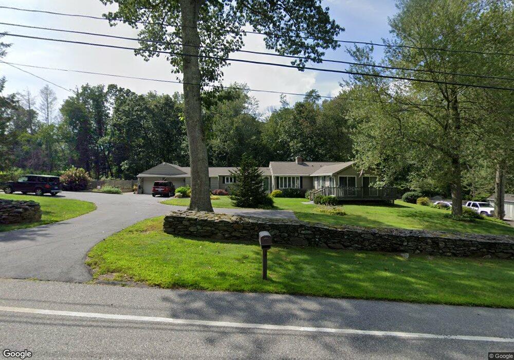
1063 Bread and Milk St Coventry, CT 06238
Estimated Value: $414,000 - $514,000
4
Beds
3
Baths
1,791
Sq Ft
$250/Sq Ft
Est. Value
About This Home
This home is located at 1063 Bread and Milk St, Coventry, CT 06238 and is currently estimated at $447,537, approximately $249 per square foot. 1063 Bread and Milk St is a home with nearby schools including Coventry Grammar School, George Hersey Robertson School, and Capt. Nathan Hale School.
Ownership History
Date
Name
Owned For
Owner Type
Purchase Details
Closed on
Jun 15, 1977
Bought by
Decinque Lewis W
Current Estimated Value
Create a Home Valuation Report for This Property
The Home Valuation Report is an in-depth analysis detailing your home's value as well as a comparison with similar homes in the area
Home Values in the Area
Average Home Value in this Area
Purchase History
| Date | Buyer | Sale Price | Title Company |
|---|---|---|---|
| Decinque Lewis W | -- | -- |
Source: Public Records
Mortgage History
| Date | Status | Borrower | Loan Amount |
|---|---|---|---|
| Closed | Decinque Lewis W | $160,000 | |
| Closed | Decinque Lewis W | $110,000 | |
| Closed | Decinque Lewis W | $90,000 | |
| Closed | Decinque Lewis W | $60,000 |
Source: Public Records
Tax History Compared to Growth
Tax History
| Year | Tax Paid | Tax Assessment Tax Assessment Total Assessment is a certain percentage of the fair market value that is determined by local assessors to be the total taxable value of land and additions on the property. | Land | Improvement |
|---|---|---|---|---|
| 2025 | $6,358 | $267,600 | $58,400 | $209,200 |
| 2024 | $6,122 | $183,800 | $51,400 | $132,400 |
| 2023 | $5,834 | $183,800 | $51,400 | $132,400 |
| 2022 | $5,725 | $183,800 | $51,400 | $132,400 |
| 2021 | $5,725 | $183,800 | $51,400 | $132,400 |
| 2020 | $5,729 | $183,800 | $51,400 | $132,400 |
| 2019 | $5,918 | $183,800 | $51,400 | $132,400 |
| 2018 | $5,361 | $166,500 | $51,400 | $115,100 |
| 2017 | $5,328 | $166,500 | $51,400 | $115,100 |
| 2016 | $5,195 | $166,500 | $51,400 | $115,100 |
| 2015 | $5,195 | $166,500 | $51,400 | $115,100 |
| 2014 | $5,182 | $182,000 | $64,100 | $117,900 |
Source: Public Records
Map
Nearby Homes
- 16 Julia Rd
- 93 Dockerel Rd
- 28 Columbine Rd
- 64 Columbine Rd
- 15 Elm Rd
- 70 Branden Way
- 101 Dockerel Rd
- 109 Timber Trail
- 65 Bolton Branch Rd
- 7 Laurelwood Ln Unit Lot 15
- 12 Laurelwood Ln Unit lot 8
- 39 Josephine Way
- 5 Laurelwood Ln Unit lot 16
- 38 Josephine Way
- 395 Grant Hill Rd Unit Lot21
- 32 Josephine Way
- 395 Grant Hill (Mill Race Drive) Lot #21 Rd
- 26 Josephine Way
- 54 Wolf Hill (Lot#49) Rd
- 37 Wolf Hill Rd Unit Lot 40
- 0 Dunn Rd
- Lot 1 Dunn Rd
- Lot 3 Dunn Rd
- LOT 5 Dunn Rd
- 1045 Bread and Milk St
- 10 Dunn Rd
- 31 Dunn Rd
- 1404 Cedar Swamp Rd
- 48 Heather Ln
- 28 Heather Ln
- 535 Mile Hill Rd
- 52 Heather Ln
- 1028 Bread and Milk St Unit B
- 1028 Bread and Milk St
- 1028 Bread and Milk St Unit 2
- 1028 Bread and Milk St Unit 1
- 47 Heather Ln
- 60 Dunn Rd
- 520 Mile Hill Rd
- 73 Dunn Rd