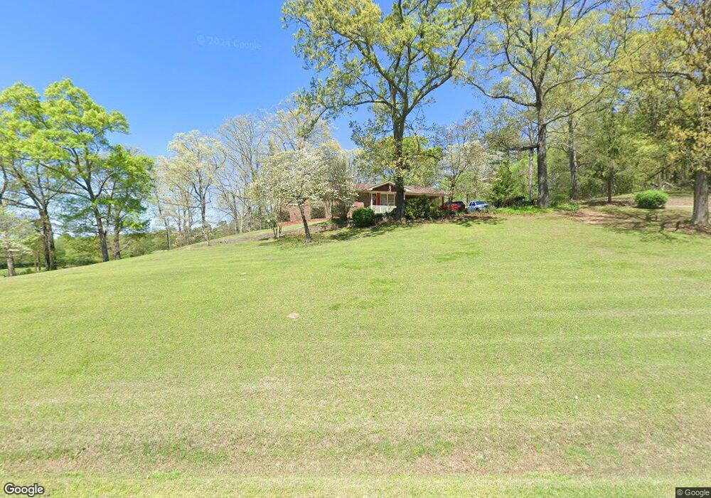
1063 Brock Rd Rockmart, GA 30153
Estimated Value: $303,000 - $361,000
3
Beds
2
Baths
2,161
Sq Ft
$154/Sq Ft
Est. Value
About This Home
This home is located at 1063 Brock Rd, Rockmart, GA 30153 and is currently estimated at $332,462, approximately $153 per square foot. 1063 Brock Rd is a home located in Polk County with nearby schools including Rockmart Middle School.
Ownership History
Date
Name
Owned For
Owner Type
Purchase Details
Closed on
Jul 18, 2007
Sold by
Welch Edna Lennell
Bought by
Oliver Joel D and Oliver Justin E
Current Estimated Value
Purchase Details
Closed on
Jun 26, 2007
Sold by
Not Provided
Bought by
Cook Stephanie
Purchase Details
Closed on
Apr 30, 1980
Sold by
Welch Carl E
Bought by
Welch Edna Lennell
Purchase Details
Closed on
Oct 23, 1971
Sold by
Gurley Jerrell O
Bought by
Welch Carl E
Purchase Details
Closed on
Nov 28, 1962
Sold by
Gurley R L
Bought by
Gurley Jerrell O
Purchase Details
Closed on
Feb 25, 1941
Bought by
Gurley R L
Create a Home Valuation Report for This Property
The Home Valuation Report is an in-depth analysis detailing your home's value as well as a comparison with similar homes in the area
Home Values in the Area
Average Home Value in this Area
Purchase History
| Date | Buyer | Sale Price | Title Company |
|---|---|---|---|
| Oliver Joel D | -- | -- | |
| Cook Stephanie | $182,900 | -- | |
| Welch Edna Lennell | -- | -- | |
| Welch Carl E | -- | -- | |
| Gurley Jerrell O | -- | -- | |
| Gurley R L | -- | -- |
Source: Public Records
Tax History Compared to Growth
Tax History
| Year | Tax Paid | Tax Assessment Tax Assessment Total Assessment is a certain percentage of the fair market value that is determined by local assessors to be the total taxable value of land and additions on the property. | Land | Improvement |
|---|---|---|---|---|
| 2024 | $2,088 | $99,891 | $9,405 | $90,486 |
| 2023 | $1,743 | $73,467 | $9,405 | $64,062 |
| 2022 | $1,529 | $64,436 | $6,270 | $58,166 |
| 2021 | $1,548 | $64,376 | $6,270 | $58,106 |
| 2020 | $1,551 | $64,376 | $6,270 | $58,106 |
| 2019 | $1,479 | $55,084 | $6,270 | $48,814 |
| 2018 | $1,487 | $53,982 | $6,270 | $47,712 |
| 2017 | $1,469 | $53,982 | $6,270 | $47,712 |
| 2016 | $1,535 | $56,401 | $8,689 | $47,712 |
| 2015 | $1,543 | $56,528 | $8,689 | $47,839 |
| 2014 | $1,554 | $56,528 | $8,689 | $47,839 |
Source: Public Records
Map
Nearby Homes
- 8 White River Rd
- 71 Caseys Ridge Rd
- 209 Eastwood Path
- 0 Carlton Dr Unit 25352782
- 135 Oak Hollow Way
- 11 Jenna Dr
- 1 Carlton Dr
- 19 Williams St
- 7667 Georgia 101
- 100 Hixville Rd
- 0 Nathan Dean Bypass Unit 10434274
- 19 Walnut St
- 1 E 4th St
- 163 Portland Cir
- 54 Taylorsville Rd
- 66 Elm St
- 456 Clearwater St
- 58 Elm St
- 2470 Nathan Dean Pkwy
- 825 Wilson St
- 1023 Brock Rd
- 1005 Brock Rd
- 1028 Brock Rd
- 738 White River Rd
- 737 White River Rd
- 992 Brock Rd
- 959 Brock Rd
- 959 Brock Rd
- 711 White River Rd
- 688 White River Rd
- 685 White River Rd
- 948 Brock Rd
- 684 White River Rd
- 919 Brock Rd
- 914 White River Rd
- 914 White River Rd
- 1068 Brock Rd
- 960 White River Rd
- 638 White River Rd
- 605 White River Rd