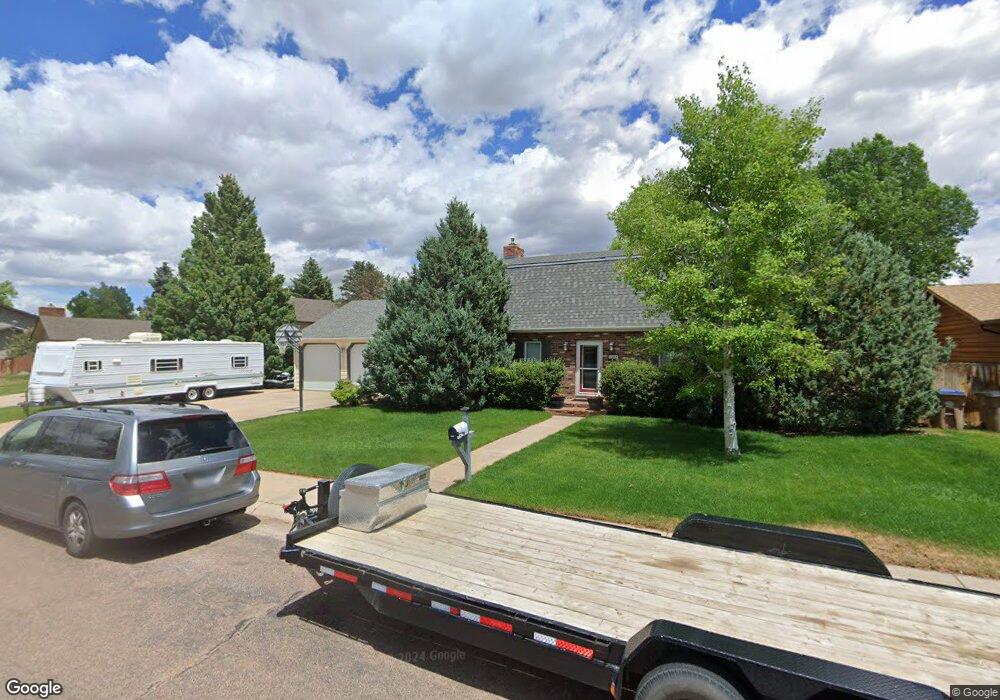
1063 Frontera Dr Laramie, WY 82072
Estimated Value: $516,000 - $569,000
4
Beds
3
Baths
2,604
Sq Ft
$208/Sq Ft
Est. Value
About This Home
This home is located at 1063 Frontera Dr, Laramie, WY 82072 and is currently estimated at $542,562, approximately $208 per square foot. 1063 Frontera Dr is a home located in Albany County with nearby schools including Indian Paintbrush Elementary School, Laramie Middle School, and Laramie High School.
Ownership History
Date
Name
Owned For
Owner Type
Purchase Details
Closed on
Sep 16, 2009
Sold by
Harris Phillip B and Harris Paula L
Bought by
Lockard Chester L and Lockard Roberta C
Current Estimated Value
Home Financials for this Owner
Home Financials are based on the most recent Mortgage that was taken out on this home.
Original Mortgage
$244,000
Outstanding Balance
$159,656
Interest Rate
5.2%
Mortgage Type
New Conventional
Estimated Equity
$382,906
Create a Home Valuation Report for This Property
The Home Valuation Report is an in-depth analysis detailing your home's value as well as a comparison with similar homes in the area
Home Values in the Area
Average Home Value in this Area
Purchase History
| Date | Buyer | Sale Price | Title Company |
|---|---|---|---|
| Lockard Chester L | -- | -- |
Source: Public Records
Mortgage History
| Date | Status | Borrower | Loan Amount |
|---|---|---|---|
| Open | Lockard Chester L | $244,000 |
Source: Public Records
Tax History Compared to Growth
Tax History
| Year | Tax Paid | Tax Assessment Tax Assessment Total Assessment is a certain percentage of the fair market value that is determined by local assessors to be the total taxable value of land and additions on the property. | Land | Improvement |
|---|---|---|---|---|
| 2025 | $3,297 | $35,223 | $5,660 | $29,563 |
| 2024 | $3,297 | $45,159 | $7,257 | $37,902 |
| 2023 | $3,245 | $44,455 | $7,257 | $37,198 |
| 2022 | $2,802 | $38,381 | $7,257 | $31,124 |
| 2021 | $2,534 | $34,715 | $5,637 | $29,078 |
| 2020 | $2,477 | $33,937 | $5,637 | $28,300 |
| 2019 | $2,254 | $30,876 | $5,637 | $25,239 |
| 2018 | $2,093 | $28,665 | $5,487 | $23,178 |
| 2017 | $2,063 | $28,257 | $5,487 | $22,770 |
| 2016 | $2,037 | $27,899 | $5,487 | $22,412 |
| 2015 | $1,971 | $27,000 | $6,215 | $20,785 |
| 2014 | $1,981 | $27,132 | $0 | $0 |
Source: Public Records
Map
Nearby Homes
- 1071 Duna Dr
- 3734 Reynolds St
- 1062 Bonita Dr
- TBD Hayford Ave
- 1651 Fox Ridge Rd
- 1772 Eaglecrest Ct
- 4106 Kiowa Dr
- 1050 N Indian Hills Dr
- 2919 Plains St
- 4341 E Crow Dr
- 2611 Reynolds St Unit A
- 2719 Nighthawk Dr
- 4421 Shoshone Dr
- 4324 Pueblo Dr
- 1766 N 23rd St
- 2122 E Curtis St
- 1554 Henry Dr
- 2130 Edward Dr
- 417 Stetson Ct
- 1150 N 18th St
- 1067 Frontera Dr
- 1059 Frontera Dr
- 1062 Granito Dr
- 1058 Granito Dr
- 1066 Granito Dr
- 1062 Frontera Dr
- 1058 Frontera Dr
- 1066 Frontera Dr
- 1071 Frontera Dr
- 1054 Granito Dr
- 1072 Granito Dr
- 3601 Grays Gable Rd
- 1054 Frontera Dr
- 1072 Frontera Dr
- 1050 Granito Dr
- 1067 Granito Dr
- 1067 Empinado Dr
- 3505 Grays Gable Rd
- 1055 Granito Dr
- 1071 Granito Dr